
VoyageursVoyageurs camping
Camping Permits Campground
161 sites. See Recreation.gov.
Compiled by National Park News from NPS and Recreation.gov records
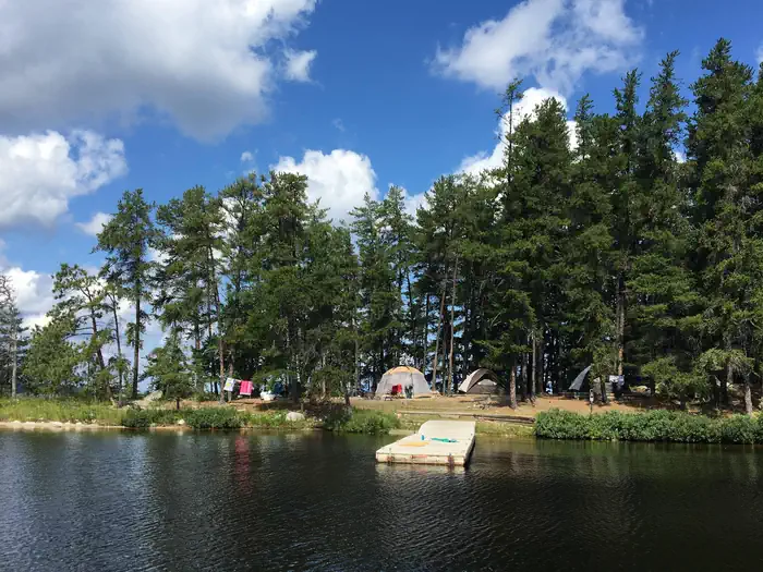
Voyageurs · Photo: David & Keri New
Sold out for your dates? Get a $5 alert when a site that fits opens
- Sites
- 161 listed on Recreation.gov
- Fee
- Not published
- Season
- See Recreation.gov
- Reservations
- Recreation.gov
- RVs and trailers
- Not published
- Hookups
- None listed
- Dump station
- Not published
- Pets
- Allowed at 10 sites
- Accessible sites
- 6
- Elevation
- 1,115 ft
- Cell signal (carrier maps)
- AT&T 5G · Verizon 5G · T-Mobile 5G
- Recreation.gov rating
- 4.4 of 5 (948 reviews)
- Phone
- (218) 283-6600
Book Camping Permits Campground on Recreation.gov ↗ Campground map (PDF) ↗
Campfires: no current NPS alert for Voyageurs mentions fire restrictions. Rules and bans can still apply. Official conditions ↗
From NPS alerts read 2026-11-20.
How cold does it get at night at Camping Permits Campground?
Typical overnight lows at about 1,115 ft: May 38°F, Jun 48°F, Jul 52°F, Aug 50°F, Sep 42°F, Oct 31°F. Estimated from NOAA’s 1991–2020 climate normals at Intl Falls Intl AP, 5 km away, adjusted for elevation; canyon and valley floors can run colder.
Is there cell service at Camping Permits Campground?
Carriers report outdoor coverage at the campground: AT&T 5G · Verizon 5G · T-Mobile 5G. That’s the carriers’ own coverage map as filed with the FCC (as of 2026-06-30); trees, canyon walls and crowds can still weaken it.
Are dogs allowed at Camping Permits Campground?
10 of 161 sites list pets as allowed on Recreation.gov. Pets must be leashed; check the park’s pet rules for trails.
Booking and season
When Camping Permits Campground opens
On Recreation.gov today: bookable through May 6, 2027 (checked Nov 10, 2026). Summer booking dates
Get the exact opening day for your dates in the trip planner.
Live availability
Open sites at Camping Permits Campground for your dates
Enter your dates and what you camp in. We check every site for every night of your stay and list the ones that fit and are open.
Nothing open for your dates? Other places to stay near Voyageurs
Affiliate link: we may earn a commission, at no extra cost to you. How this works
Campsite alert · $5
Watch Camping Permits Campground for a campsite that fits
Choose your tent or rig, how many nights you need, and the range of dates you could arrive. We email when we find one site that fits and is open every night. One payment covers this campground and arrival range.
Getting around
Drive times from Camping Permits Campground
Visitor centers
- 23 min Rainy Lake Visitor Center (10.8 mi)
- 43 min Kabetogama Lake Visitor Center (29.5 mi)
- 1 hr 2 min Ash River Visitor Center (40.3 mi)
- 2 hr 19 min Crane Lake Visitor Center (82.8 mi)
Driving time with no traffic, routed on OpenStreetMap roads (OSRM); places from NPS records. Some park roads are shuttle-only in season or closed in winter; check the park before you go.
Sun, moon and dark skies
Sunrise, sunset and stargazing at Camping Permits Campground
Darkest nights coming up (new moon): Dec 9, Jan 7, Feb 6, Mar 8. Plan stargazing within a few days of these; around a full moon (Nov 24, Dec 24, Jan 22, Feb 21) the stars wash out.
| Month | Jan | Feb | Mar | Apr | May | Jun | Jul | Aug | Sep | Oct | Nov | Dec |
|---|---|---|---|---|---|---|---|---|---|---|---|---|
| Sunrise | 8:00a | 7:22a | 7:29a | 6:24a | 5:33a | 5:10a | 5:26a | 6:05a | 6:48a | 7:31a | 7:20a | 7:58a |
| Sunset | 4:43p | 5:32p | 7:17p | 8:02p | 8:45p | 9:16p | 9:12p | 8:31p | 7:29p | 6:26p | 4:35p | 4:18p |
| Daylight | 8.7h | 10.2h | 11.8h | 13.6h | 15.2h | 16.1h | 15.8h | 14.4h | 12.7h | 10.9h | 9.3h | 8.3h |
Calculated for the campground’s location on the 15th of each month, in park time; within a few minutes. Canyon walls and ridges can hide the sun earlier or later than this.
Weather by month
How warm and cold it gets at Camping Permits Campground
Typical daily high and overnight low for each month at the campground’s elevation (about 1,115 ft). Pack for the low: nights are often much colder than the day suggests.
| Month | Jan | Feb | Mar | Apr | May | Jun | Jul | Aug | Sep | Oct | Nov | Dec |
|---|---|---|---|---|---|---|---|---|---|---|---|---|
| Typical high | 16° | 22° | 36° | 50° | 64° | 74° | 78° | 76° | 67° | 51° | 35° | 21° |
| Typical low | -6° | -2° | 12° | 26° | 38° | 48° | 52° | 50° | 42° | 31° | 18° | 3° |
Estimate: NOAA 1991–2020 climate normals (°F) from station Intl Falls Intl AP, 5 km away, shifted +0.2°F for the elevation difference. Lows at or below freezing are marked. Check the forecast before you go.
About
About Camping Permits Campground
** PLEASE READ IMPORTANT INFORMATION BELOW TO UNDERSTAND HOW TO CAMP AT VOYAGEURS NATIONAL PARK ** All frontcountry and backcountry campsites require travel by private watercraft or water taxi to access. Click on any campsite name when searching sites to view boating distances and a link to photos. You can type in a specific campsite number or campsite/lake name when searching site availability. Voyageurs National Park has 143 frontcountry, 14 backcountry, and 2 primitive campsites for visitors wanting an authentic Northwoods camping experience. PRIMITIVE CAMPSITES (Red Pine & Blueberry Ridge) are the only campsites that are located on the mainland and DO NOT require a boat to access. They a
Facilities: Voyageurs National Park has three visitor centers, which offer area information, exhibits, a park movie, bookstore, Junior Ranger programs, boat ramps, hiking trials and more. All visitor centers are open daily in the summer, and re open limited hours in the fall, winter, and spring. Raniy Lake Visitor Center (218) 286-5258 Kabetogama Lake Visitor Center (218) 875-2111 Ash River Visitor Center (218) 374-3221
Setting: Voyageurs National Park is a land and water environment of great beauty, exceptional natural and cultural resources, and abundant recreational opportunities. Located in the lake-country of northern Minnesota, the park protects 218,054 acres (88,243 ha) that include roughly 134,000 acres (54,227 ha) of forest, 84,000 acres (33,993 ha) of water, 655-miles (1,054 km) of undeveloped shoreline, and hun
Boat Dock · Campfire Rings · Drinking Water (hand pump) · Picnic Tables · Tent Pads · Vault Toilets · Waterfront Sites
Which site to book
Best Camping Permits Campground sites for what you need
Picked only from what each site’s Recreation.gov listing says. Tap a site to see its photos, map and open dates on Recreation.gov.
Tents (tent-only and walk-in) 161 sites
- Site Agnes Lake B1 · Backcountry
- Site Alder Creek R1 · Rainy Lake
- Site Anderson Bay West R90 · Rainy Lake
- Site Arden Island R4 · Rainy Lake
- Site Aspen Bench N57 · Namakan Lake
Accessible sites 6 sites
- Site Convergence N73 · Namakan Lake
- Site Kabetogama Lake Group K54 · Kabetogama Lake
- Site Rainy Lake Group R74 · Rainy Lake
- Site Saginaw Bay West R104 · Rainy Lake
- Site Sunrise Point R26 · Rainy Lake
From the 161 individual sites Recreation.gov lists for Camping Permits Campground, retrieved Nov 7, 2026. Lengths and features are as listed; check the site’s own page for slope, driveway shape and current notes. Filter every site
Every site
Camping Permits Campground campsites
Loops: Backcountry, Rainy Lake, Namakan Lake, Kabetogama Lake, Sand Point Lake, Primitive.
| Site | Loop | Type | RV/trailer | Electric | Water & sewer | Pull-through | Shade | Pets | Accessible |
|---|---|---|---|---|---|---|---|---|---|
| Brown Lake B3 | Backcountry | Hike To | — | — | — | — | — | — | — |
| Shelland Island R106 | Rainy Lake | Boat In | — | — | — | — | — | — | — |
| Namakan Entrance N26 | Namakan Lake | Boat In | — | — | — | — | — | — | — |
| Round Bear Island K29 | Kabetogama Lake | Boat In | — | — | — | — | — | — | — |
| Norway Island S14 | Sand Point Lake | Boat In | — | — | — | — | — | — | — |
| Lost Bay Island K17 | Kabetogama Lake | Boat In | — | — | — | — | — | — | — |
| Sphunge Island West K53 | Kabetogama Lake | Boat In | — | — | — | — | — | — | — |
| Ryan Lake B18 | Backcountry | Hike To | — | — | — | — | — | — | — |
| War Club Lake B17 | Backcountry | Hike To | — | — | — | — | — | — | — |
| Dryweed Island R11 | Rainy Lake | Boat In | — | — | — | — | — | — | — |
| Mcmanus Island West N18 | Namakan Lake | Boat In | — | — | — | — | — | — | — |
| King Williams Narrows S11 A | Sand Point Lake | Boat In | — | — | — | — | — | — | — |
| Steakhouse Point N42 | Namakan Lake | Boat In | — | — | — | — | — | — | — |
| Ek Lake B6 | Backcountry | Hike To | — | — | — | — | — | — | — |
| Kabetogama Lake Group K54 | Kabetogama Lake | Boat In | — | — | — | — | — | — | Yes |
| King Pin S10 | Sand Point Lake | Boat In | — | — | — | — | — | — | — |
| Rock Shelf R72 | Rainy Lake | Boat In | — | — | — | — | — | — | — |
| Partridge Point S28 | Sand Point Lake | Boat In | — | — | — | — | — | — | — |
| Northland K24 | Kabetogama Lake | Boat In | — | — | — | — | — | — | — |
| Windbreak Point N45 | Namakan Lake | Boat In | — | — | — | — | — | — | — |
| Windmill Rock View R56 | Rainy Lake | Boat In | — | — | — | — | — | — | — |
| Lyle Mine Island R93 | Rainy Lake | Boat In | — | — | — | — | — | — | — |
| Blueberry Ridge H2 | Primitive | Hike To | — | — | — | — | — | — | — |
| Little Finlander Island R18 | Rainy Lake | Boat In | — | — | — | — | — | — | — |
| Maple Point K21 | Kabetogama Lake | Boat In | — | — | — | — | — | — | — |
| Voyageur Narrows N41 | Namakan Lake | Boat In | — | — | — | — | — | — | Yes |
| Williams Island South N44 | Namakan Lake | Boat In | — | — | — | — | — | — | — |
| Marrs Point East K55 | Kabetogama Lake | Boat In | — | — | — | — | — | Yes | — |
| Stoneburner Island S18 | Sand Point Lake | Boat In | — | — | — | — | — | — | — |
| Sphunge Island East K31 | Kabetogama Lake | Boat In | — | — | — | — | — | — | — |
| Shelter Bay K30 | Kabetogama Lake | Boat In | — | — | — | — | — | — | — |
| Catamaran N15 | Namakan Lake | Boat In | — | — | — | — | — | — | — |
| Cruiser Lake B5 | Backcountry | Hike To | — | — | — | — | — | — | — |
| Kettle Portage N16 | Namakan Lake | Boat In | — | — | — | — | — | — | — |
| Swansons Bay S24 | Sand Point Lake | Boat In | — | — | — | — | — | — | — |
| Eks Bay K8 | Kabetogama Lake | Boat In | — | — | — | — | — | — | — |
| Hanson R14 | Rainy Lake | Boat In | — | — | — | — | — | — | — |
| Cranberry Creek R95 | Rainy Lake | Boat In | — | — | — | — | — | — | — |
| Cutover Island South K6 | Kabetogama Lake | Boat In | — | — | — | — | — | — | — |
| Alder Creek R1 | Rainy Lake | Boat In | — | — | — | — | — | Yes | — |
| Eagle View K7 | Kabetogama Lake | Boat In | — | — | — | — | — | — | — |
| King Williams Narrows S11 C | Sand Point Lake | Boat In | — | — | — | — | — | — | — |
| Quarter Line Lake B14 | Backcountry | Hike To | — | — | — | — | — | — | — |
| Nelson Island R102 | Rainy Lake | Boat In | — | — | — | — | — | — | — |
| Pine Point K45 | Kabetogama Lake | Boat In | — | — | — | — | — | — | — |
| La Bontys Point K14 | Kabetogama Lake | Boat In | — | — | — | — | — | — | — |
| Saginaw Bay R22 | Rainy Lake | Boat In | — | — | — | — | — | — | — |
| Tango Channel R101 | Rainy Lake | Boat In | — | — | — | — | — | — | — |
| Your Island N49 | Namakan Lake | Boat In | — | — | — | — | — | — | — |
| Houseboat Island West S9 | Sand Point Lake | Boat In | — | — | — | — | — | — | — |
| Little Shoepack Lake | Backcountry | Hike To | — | — | — | — | — | — | — |
| Ingersoll Cove S30 | Sand Point Lake | Boat In | — | — | — | — | — | — | — |
| Nuthatch R21 | Rainy Lake | Boat In | — | — | — | — | — | — | — |
| Convergence N73 | Namakan Lake | Boat In | — | — | — | — | — | Yes | Yes |
| Sheen Point N38 | Namakan Lake | Boat In | — | — | — | — | — | — | — |
| Mukooda Lake - Bass S12 A | Sand Point Lake | Boat In | — | — | — | — | — | — | — |
| Sand Point S29 | Sand Point Lake | Boat In | — | — | — | — | — | — | — |
| Browns Bay S1 | Sand Point Lake | Boat In | — | — | — | — | — | — | — |
| Leach Bay N3 | Namakan Lake | Boat In | — | — | — | — | — | — | — |
| Namakan Island South N63 | Namakan Lake | Boat In | — | — | — | — | — | — | — |
| Wolf Island S19 | Sand Point Lake | Boat In | — | — | — | — | — | — | — |
| Krantz Point R62 | Rainy Lake | Boat In | — | — | — | — | — | — | — |
| Red Pine H1 | Primitive | Hike To | — | — | — | — | — | — | — |
| Birch Cove Island N1 | Namakan Lake | Boat In | — | — | — | — | — | — | — |
| Wood Duck Island K36 | Kabetogama Lake | Boat In | — | — | — | — | — | — | — |
| Namakan Island East N27 | Namakan Lake | Boat In | — | — | — | — | — | — | — |
| Finlander Island R59 | Rainy Lake | Boat In | — | — | — | — | — | — | — |
| Whites Point R47 | Rainy Lake | Boat In | — | — | — | — | — | — | — |
| Logging Camp R19 | Rainy Lake | Boat In | — | — | — | — | — | — | — |
| Dryweed Island North R73 | Rainy Lake | Boat In | — | — | — | — | — | — | — |
| Loon Cove R71 | Rainy Lake | Boat In | — | — | — | — | — | — | — |
| Granite Cliff North S6 | Sand Point Lake | Boat In | — | — | — | — | — | — | — |
| Torry Fish Camp N43 | Namakan Lake | Boat In | — | — | — | — | — | — | — |
| Virgin Island South R27 | Rainy Lake | Boat In | — | — | — | — | — | — | — |
| Shoepack B8 & Little Shoepack Lakes B19 | Backcountry | Hike To | — | — | — | — | — | — | — |
| Browns Bay View S3 | Sand Point Lake | Boat In | — | — | — | — | — | — | — |
| Peary Lake B13 | Backcountry | Hike To | — | — | — | — | — | — | — |
| Burnt Island S4 | Sand Point Lake | Boat In | — | — | — | — | — | — | — |
| Hitchcock Island R105 | Rainy Lake | Boat In | — | — | — | — | — | — | — |
| Mukooda Lake - Trout S12 C | Sand Point Lake | Boat In | — | — | — | — | — | — | — |
| Jensen Bay S27 | Sand Point Lake | Boat In | — | — | — | — | — | — | — |
| My Island West N25 | Namakan Lake | Boat In | — | — | — | — | — | — | — |
| Arden Island R4 | Rainy Lake | Boat In | — | — | — | — | — | — | — |
| Sexton Island N62 | Namakan Lake | Boat In | — | — | — | — | — | — | — |
| Rainbow Island N33 | Namakan Lake | Boat In | — | — | — | — | — | — | — |
| Mica Island N20 | Namakan Lake | Boat In | — | — | — | — | — | — | — |
| Diamond Island South R10 | Rainy Lake | Boat In | — | — | — | — | — | — | — |
| Pat Smith Island N30 | Namakan Lake | Boat In | — | — | — | — | — | — | — |
| Kawawia Island R16 | Rainy Lake | Boat In | — | — | — | — | — | — | — |
| Quill Lake B15 | Backcountry | Hike To | — | — | — | — | — | — | — |
| Hammer Bay South N59 | Namakan Lake | Boat In | — | — | — | — | — | — | — |
| Windigo K35 | Kabetogama Lake | Boat In | — | — | — | — | — | — | — |
| Channel View R100 | Rainy Lake | Boat In | — | — | — | — | — | — | — |
| Mio Beach R64 | Rainy Lake | Boat In | — | — | — | — | — | — | — |
| Stones Point R67 | Rainy Lake | Boat In | — | — | — | — | — | — | — |
| Anderson Bay West R90 | Rainy Lake | Boat In | — | — | — | — | — | Yes | — |
| Feldt Channel S5 | Sand Point Lake | Boat In | — | — | — | — | — | — | — |
| Rusty Island N35 | Namakan Lake | Boat In | — | — | — | — | — | — | — |
| Fish Camp Island R13 | Rainy Lake | Boat In | — | — | — | — | — | — | — |
| Beaver Lodge R54 | Rainy Lake | Boat In | — | — | — | — | — | Yes | — |
| C. Vic Linsten K5 | Kabetogama Lake | Boat In | — | — | — | — | — | Yes | — |
| Namakan Island Northeast N55 | Namakan Lake | Boat In | — | — | — | — | — | — | — |
| Pike Bay N31 | Namakan Lake | Boat In | — | — | — | — | — | — | — |
| Three Sisters Island R77 | Rainy Lake | Boat In | — | — | — | — | — | Yes | — |
| Lost Bay (Kab) K16 | Kabetogama Lake | Boat In | — | — | — | — | — | — | — |
| Rainy Lake Group R74 | Rainy Lake | Boat In | — | — | — | — | — | — | Yes |
| Williams Island North N61 | Namakan Lake | Boat In | — | — | — | — | — | — | — |
| Aspen Bench N57 | Namakan Lake | Boat In | — | — | — | — | — | — | — |
| Hoist Bay N12 | Namakan Lake | Boat In | — | — | — | — | — | — | — |
| King Williams Narrows S11 D | Sand Point Lake | Boat In | — | — | — | — | — | — | — |
| Makinen Point R53 | Rainy Lake | Boat In | — | — | — | — | — | — | — |
| Camel Back Island K3 | Kabetogama Lake | Boat In | — | — | — | — | — | — | — |
| Sandbar Point N37 | Namakan Lake | Boat In | — | — | — | — | — | — | — |
| Namakan Island West N28 | Namakan Lake | Boat In | — | — | — | — | — | — | — |
| Echo Island K41 | Kabetogama Lake | Boat In | — | — | — | — | — | Yes | — |
| Wolf Pack Island East N48 | Namakan Lake | Boat In | — | — | — | — | — | — | — |
| Blueberry Island West R92 | Rainy Lake | Boat In | — | — | — | — | — | — | — |
| Locator Lake B9 | Backcountry | Hike To | — | — | — | — | — | — | — |
| Oslo Lake B12 | Backcountry | Hike To | — | — | — | — | — | — | — |
| Wolf Pack Island West N46 | Namakan Lake | Boat In | — | — | — | — | — | — | — |
| North Mitchell Island N58 | Namakan Lake | Boat In | — | — | — | — | — | — | — |
| My Island South N24 | Namakan Lake | Boat In | — | — | — | — | — | — | — |
| Mukooda Lake - Crappie S12 B | Sand Point Lake | Boat In | — | — | — | — | — | — | — |
| Grassy Islands South K9 | Kabetogama Lake | Boat In | — | — | — | — | — | — | — |
| Harrison Bay R61 | Rainy Lake | Boat In | — | — | — | — | — | — | — |
| Sunrise Point R26 | Rainy Lake | Boat In | — | — | — | — | — | — | Yes |
| Fox Farm K50 | Kabetogama Lake | Boat In | — | — | — | — | — | — | — |
| Sugarbush Island K34 | Kabetogama Lake | Boat In | — | — | — | — | — | — | — |
| South Island S17 | Sand Point Lake | Boat In | — | — | — | — | — | — | — |
| Johnson Bay N13 | Namakan Lake | Boat In | — | — | — | — | — | — | — |
| North Island West S13 | Sand Point Lake | Boat In | — | — | — | — | — | — | — |
| Jorgens Lake B7 | Backcountry | Hike To | — | — | — | — | — | — | — |
| Loon Bay R63 | Rainy Lake | Boat In | — | — | — | — | — | — | — |
| Pine Island View R103 | Rainy Lake | Boat In | — | — | — | — | — | — | — |
| Reuter Creek R65 | Rainy Lake | Boat In | — | — | — | — | — | — | — |
| King Williams Narrows S11 E | Sand Point Lake | Boat In | — | — | — | — | — | — | — |
| Agnes Lake B1 | Backcountry | Hike To | — | — | — | — | — | — | — |
| Granite Cliff South S7 | Sand Point Lake | Boat In | — | — | — | — | — | Yes | — |
| Lost Bay (Rainy) R20 | Rainy Lake | Boat In | — | — | — | — | — | — | — |
| Moxie Island K22 | Kabetogama Lake | Boat In | — | — | — | — | — | — | — |
| Dove Bay West R111 | Rainy Lake | Boat In | — | — | — | — | — | — | — |
| Bald Rock K1 | Kabetogama Lake | Boat In | — | — | — | — | — | Yes | — |
| Peterson Point K25 | Kabetogama Lake | Boat In | — | — | — | — | — | — | — |
| Happy Landing K11 | Kabetogama Lake | Boat In | — | — | — | — | — | — | — |
| Hammer Bay Point N69 | Namakan Lake | Boat In | — | — | — | — | — | — | — |
| Old Dutch Bay N29 | Namakan Lake | Boat In | — | — | — | — | — | — | — |
| Breakwater Cove R6 | Rainy Lake | Boat In | — | — | — | — | — | — | — |
| Lost Lake K19 | Kabetogama Lake | Boat In | — | — | — | — | — | — | — |
| Soboleski Bay South R49 | Rainy Lake | Boat In | — | — | — | — | — | — | — |
| Loiten Lake B11 | Backcountry | Hike To | — | — | — | — | — | — | — |
| Jack Pine Bench R55 | Rainy Lake | Boat In | — | — | — | — | — | — | — |
| King Williams Narrows S11 B | Sand Point Lake | Boat In | — | — | — | — | — | — | — |
| Fox Island N10 | Namakan Lake | Boat In | — | — | — | — | — | — | — |
| Kempton Entrance East R91 | Rainy Lake | Boat In | — | — | — | — | — | — | — |
| Day Marker 23 N5 | Namakan Lake | Boat In | — | — | — | — | — | — | — |
| Junction Bay N14 | Namakan Lake | Boat In | — | — | — | — | — | — | — |
| Grassy Bay South S23 | Sand Point Lake | Boat In | — | — | — | — | — | — | — |
| Reef Island S15 | Sand Point Lake | Boat In | — | — | — | — | — | — | — |
| Depthfinder Island N7 | Namakan Lake | Boat In | — | — | — | — | — | — | — |
| Big Island R5 | Rainy Lake | Boat In | — | — | — | — | — | — | — |
| Saginaw Bay West R104 | Rainy Lake | Boat In | — | — | — | — | — | — | Yes |
Each site as Recreation.gov lists it (2 site types), retrieved Nov 7, 2026. Lengths are the maximum RV or trailer the site lists; confirm on the booking page.
If it’s full
Other campgrounds
In Voyageurs
- Frontcountry boat-in campsites See dates
- Backcountry campsites 14 sites · See dates
- Primitive Kab-Ash Trail sites 2 sites · All year
Near Voyageurs
- Echo Lake (Minn) ↗ 6.4 mi from Crane Lake Visitor Center · USDA Forest Service · RVs to 45 ft
- Jeanette Lake ↗ 12.7 mi from Crane Lake Visitor Center · USDA Forest Service · RVs to 35 ft
Season, fees, reservations and campground inventory from the NPS campground record, checked Nov 7, 2026; individual site details from Recreation.gov, retrieved Nov 7, 2026. Things change; confirm on the official pages before you go.