Black Canyon of the GunnisonTrail guides
Warner Point Trail
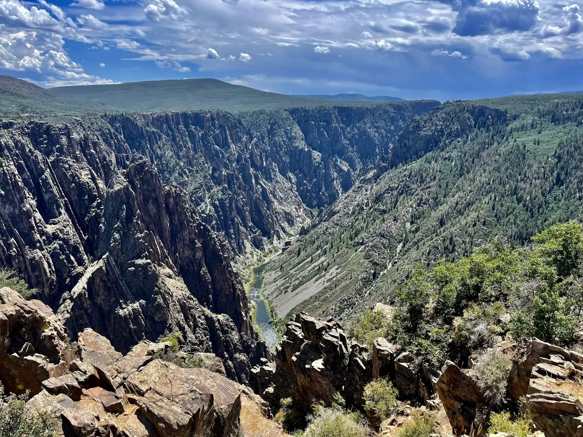
Warner Point Trail provides views of various mountain ranges, the Black Canyon, and the Gunnison River. Nature trail guides are available at High Point Overlook or the South Rim Visitor Center.
Black Canyon of the Gunnison · Photo: David & Keri New
- 0.8 mi one wayDistance
- StrenuousDifficulty
The numbers, with sources
Distance: 0.8 miles one way Source
Gain: The NPS doesn’t publish the elevation gain. Source
Time: No official duration confirmed for this exact route. Source
Difficulty: Moderately strenuous; steep in places Source
Trailhead: This trail starts from the High Point parking area, located at the end of the South Rim Drive. Source
Route type: out-and-back Source
Built from official sources (checked Nov 3, 2026). Confirm current conditions with the park.
Recreation.gov permits, entrances & campgrounds
Recreation.gov (RIDB). Booking records date not published. NPS guidance above takes precedence. A listing doesn’t mean you need a permit or that there’s space on your dates.
Nearby campground records
Within 10 straight-line miles of the trailhead. Distances are straight-line from map coordinates, not driving distances.
- Black Canyon Of The Gunnison South Rim Campground: approximately 3.6 miles straight line. RIDB coordinates · Mapped route source
- East Portal Campground: approximately 6.1 miles straight line. RIDB coordinates · Mapped route source
- Black Canyon Of The Gunnison North Rim Campground: approximately 2.6 miles straight line. RIDB coordinates · Mapped route source
Park campground options (3)
These records belong to the park’s NPS recreation area. We haven’t checked how close these are to the trail, when they open or whether sites are free; check the map and the booking page.
Black Canyon Of The Gunnison South Rim Campground — Campground; RIDB reservable: yes. Season: not published in structured RIDB data. Recreation.gov (RIDB) source · Booking details
NPS reservation guidance: All sites in all loops must be reserved through Recreation.gov. Only loop B is open in winter. NOTE: Due to wildfire damage, limited sites (non-electric only) are currently available. NPS source
East Portal Campground — Campground; RIDB reservable: no. Season: not published in structured RIDB data. Recreation.gov (RIDB) source
NPS reservation guidance: Reservations are not accepted for East Portal Campground. All sites are first-come first-served. Payment MUST be submitted online using the Scan & Pay feature on the Recreation.gov mobile app. There is no cell service or connectivity on site. Download the Recreation.gov app before entering the park to arrive prepared. NPS source
Black Canyon Of The Gunnison North Rim Campground — Campground; RIDB reservable: yes. Season: not published in structured RIDB data. Recreation.gov (RIDB) source · Booking details
Route, junction by junction
Trailhead → Selected destination or loop
NPS describes shady benches among mountain mahogany, serviceberry, pinyon and juniper. The views include the San Juan and West Elk mountains, and the destination looks into the Black Canyon toward the Gunnison River. These are distant views from the trail, not permission to descend toward the river. Source
No elevation profile: we only draw one from a mapped route we can verify. Route source
In-depth guide
Compiled from linked sources, checked Nov 2, 2026. Each paragraph links to its source.
Is this hike for you?
Warner Point is a nature trail on the South Rim that ends with a look down into the Black Canyon and the Gunnison River. It’s 0.8 mile one way (1.25 km). The NPS rates it moderately strenuous and says it’s steep in places, and it doesn’t give a hiking time or an elevation gain. Don’t let the short distance fool you. Source
The trail
There are shady benches along the way among mountain mahogany, serviceberry, pinyon pine and juniper. To the south you can see the San Juan Mountain Range, Uncompahgre Valley and Bostwick Park; to the north, the West Elk Mountains. Pick up a trail guide at High Point Overlook or the South Rim Visitor Center if you want to learn what you’re looking at. The views of the river are from the rim; the trail doesn’t go down to it. Source
Getting to the trailhead
The trail starts at the High Point parking area at the end of South Rim Drive. You come back the same way. Source
Water and food
Water systems throughout the park are shut off for the winter season, October to April (per an NPS alert as of November 3, 2026). Bring your own drinking water. Source · Source 2
The NPS doesn’t list water or restrooms on the trail at any time of year, so carry what you need for the round trip. Source
Kids, strollers and wheelchairs
The trail is unpaved, steep in places and not wheelchair accessible. The NPS doesn’t give a minimum age. Source
Dogs, permits and fees
Pets aren’t allowed on this trail. You don’t need a reservation. Stay on the trail and leave what you find. Source
Check the NPS fees page for the park entrance fee; we haven’t confirmed the current price. Source
Before you go
The NPS doesn’t give a season for this trail. Check the park’s current alerts and the forecast, and look at the signs at the trailhead. If the group is slower than expected, turn back early and stay together. Source
There’s no elevation profile yet: the NPS trail map line comes from its trail data and USGS 3DEP terrain, but we haven’t verified complete measurements for this route. Source
Sources & planning limits
Reviewed 2026-11-03. Check current conditions for your trip dates.
- NPS alert, November 3, 2026: water systems throughout the park are shut off for the winter season, October to April. Bring your own drinking water. Source
- There’s no elevation profile yet: we haven’t verified complete measurements for this route. Source
- Park information changes. Check access, services and reservations for your travel date. Source
Getting there and back
This trail starts from the High Point parking area, located at the end of the South Rim Drive. Source
Return: Come back the way described above. Return along the same trail unless a separate transport plan has been confirmed. Source
Water
No complete route-specific drinking-water or restroom schedule confirmed. Carry water for the whole hike. Source
Hazards
This unpaved trail is steep in places and not wheelchair accessible. Source
Season
Use current official conditions; activity season labels are not a guarantee of access. Source
Current trail conditions require a trip-date check. Source
Gear & rules
Follow current signs and closures, and treat any side trip as a separate decision. Source
Filling a gap in your kit? Compare these packing essentials on Amazon. Choose gear for your route, conditions and the park’s guidance.
As an Amazon Associate we earn from qualifying purchases. How this works
Pets are not allowed on this trail. Source
Questions
Which route do these figures describe?
0.8 miles one way Warner Point is a South Rim viewpoint trail beginning at High Point, at the end of South Rim Drive. Its published distance is 0.8 mile one way. Leave time for the walk back too. The NPS doesn’t give a time or a total climb. Source
Is the trail open right now?
No. NPS details as of Nov 3, 2026. Confirm current conditions and closures with NPS. Source
Is there a measured elevation profile?
Official NPS trail geometry sampled with USGS 3DEP terrain; no mileage or gain scaling. NPS publishes 0.80 mi one way; the traced line measures 0.77 mi. The difference is unresolved. Source
Alternatives
The NPS says nature-trail guides are available at High Point or the South Rim Visitor Center. Use the guide to slow the walk down if desired, rather than turning the distance into a fixed walking speed. The dirt trail is steep in places and explicitly not wheelchair accessible; pets are prohibited. Source
Camp near Warner Point Trail
Closest campgrounds by drive time to Warner Point Trail Trailhead:
- 16 min South Rim (6.2 mi, in the park)
- 32 min East Portal Campground ↗ (12.7 mi, National Park Service)
- 48 min Cimarron Campground (CO) ↗ (25.1 mi, National Park Service)
- 1 hr 25 min Lake Fork Campground ↗ (45.9 mi, National Park Service)
- 1 hr 42 min Big Cimarron ↗ (42 mi, USDA Forest Service)
Driving time with no traffic (OSRM, OpenStreetMap roads). Some park roads are shuttle-only in season. All camping near Black Canyon of the Gunnison
More Black Canyon of the Gunnison trail guides
- Oak Flat Loop Trail1.6 mi · Strenuous