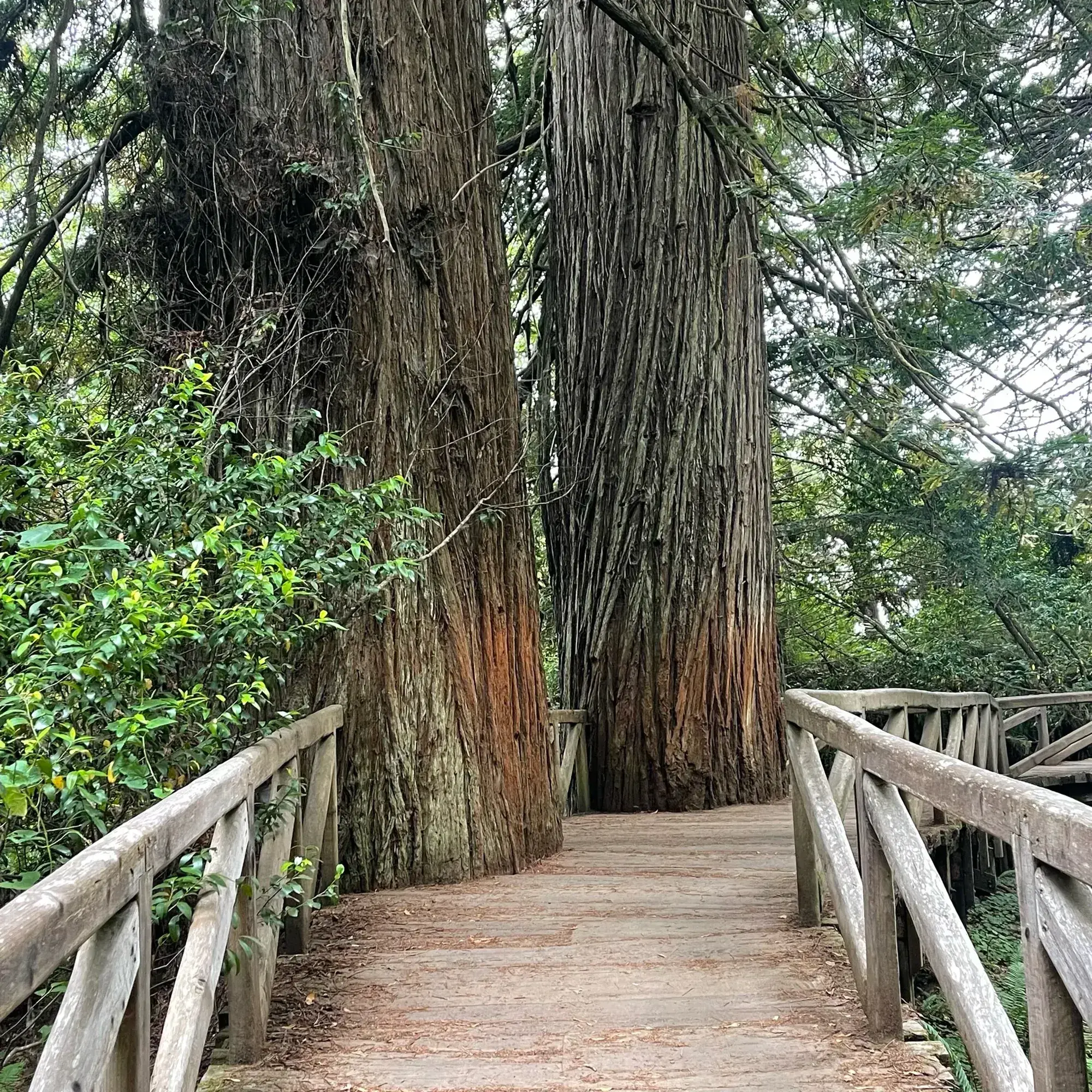
Tall Trees Grove
The Tall Trees Grove sits on the alluvial floodplain of Redwood Creek, where NPS says many redwoods exceed 350 feet. The hike is a 4.5-mile round trip with 1,600 feet of total elevation change: the trail descends 800 feet to the creek, so the climbing comes on the way back. NPS calls it moderately strenuous, gives 3 to 6 hours, and says the trail has switchbacks and grades over 10 percent. The grove’s Libby Tree held the world height title until its top died back in 1994; NPS notes that the tallest tree in the world is not in this grove.
Redwood · Photo: David & Keri New
- 4.5 miDistance
- 1,600 ftElevation gain
- 3–6 hrTime
- StrenuousDifficulty
The numbers, with sources
Distance: 4.5 miles round trip (NPS; its metric figure, 6.5 km, doesn’t match). Source
Gain: 1,600 feet total elevation change; the trail descends 800 feet to Redwood Creek. Source
Time: 3-6 hours (NPS activity duration). Source
Difficulty: Moderately strenuous (NPS; one of the more strenuous hikes in the parks). Source
Trailhead: Tall Trees trailhead, at the end of a gated road with 7 miles of dirt; directions come with the free online permit. Source
Route type: Round trip from the Tall Trees trailhead (NPS: backcountry hike) Source
Built from official sources (checked Nov 15, 2026). Confirm current conditions with the park.
Recreation.gov permits, entrances & campgrounds
Recreation.gov (RIDB). Booking records date not published. NPS guidance above takes precedence. A listing doesn’t mean you need a permit or that there’s space on your dates.
Park campground options (3)
These records belong to the park’s NPS recreation area. We haven’t checked how close these are to the trail, when they open or whether sites are free; check the map and the booking page.
Gold Bluffs Beach Campground - Prairie Creek Redwoods State Park — Campground; RIDB reservable: no. Season: not published in structured RIDB data. Recreation.gov (RIDB) source · Booking details
NPS reservation guidance: Reservations can be made through the California State Parks at Reserve California (1-800-444-7275). NPS source
Mill Creek Campground - Del Norte Coast Redwoods State Park — Campground; RIDB reservable: no. Season: not published in structured RIDB data. Recreation.gov (RIDB) source · Booking details
NPS reservation guidance: Reservations can be made through the California State Parks at Reserve California www.reservecalifornia.com/ or 1-800-444-7275 (8am-6pm PST). NPS source
Jedediah Smith Campground - Jedediah Smith Redwoods State Park — Campground; RIDB reservable: no. Season: not published in structured RIDB data. Recreation.gov (RIDB) source · Booking details
NPS reservation guidance: Reservations can be made through the California State Parks at Reserve California (1-800-444-7275). NPS source
Route, junction by junction
Route selection → Described destination
The Tall Trees Grove sits on the alluvial floodplain of Redwood Creek, where NPS says many redwoods exceed 350 feet. The hike is a 4.5-mile round trip with 1,600 feet of total elevation change: the trail descends 800 feet to the creek, so the climbing comes on the way back. NPS calls it moderately strenuous, gives 3 to 6 hours, and says the trail has switchbacks and grades over 10 percent. The grove’s Libby Tree held the world height title until its top died back in 1994; NPS notes that the tallest tree in the world is not in this grove. Source
No elevation profile yet:
No elevation profile yet: we haven’t verified a complete line for this route. No partial line, invented connector, scaled mileage or flat profile is substituted. Source
In-depth guide
Compiled from linked sources, checked Nov 15, 2026. Each paragraph links to its source.
Is this hike for you?
Tall Trees Grove sits on the alluvial floodplain of Redwood Creek, where plenty of water, good soil and shelter from winter winds have grown many redwoods taller than 350 feet (106 meters). The hike is 4.5 miles round trip with a total elevation change of 1,600 feet (487 m). The trail drops 800 feet to the creek, so the climbing comes on the way back. The NPS calls it moderately strenuous and gives 3 to 6 hours. It gets a lot of attention online, but it isn’t for the faint of heart or anyone short on time. Source
A 1963 National Geographic Magazine article on the grove helped push for the creation of Redwood National Park. The tallest tree in the world isn’t here. The grove’s Libby Tree, or “Tall Tree”, held the title until 1994, when its top died back and it dropped to the 34th tallest tree on the planet. Source
You need a permit
You need a free Tall Trees permit, which you apply for online. Only 50 parties a day get one, and permits are issued up to 24 hours ahead. The NPS says they’re no longer issued in person at its visitor centers. Rangers give you directions with the permit, and there’s a locked gate at the top of the access road to limit traffic. Source
The NPS page contradicts itself here: another part of it says to pick up the permit and the gate combination from rangers at a park visitor center, and a fee note says permits are issued at visitor centers on the day of the trip. Confirm how you’ll get the gate combination when you apply. Source
Getting to the trailhead
Allow a 1-hour drive from the nearest visitor center, including 7 miles of dirt road. The road is narrow and winding, and the small lot can’t take RVs over 21 feet or vehicles towing trailers. Don’t rely on digital maps to find the gate; the NPS says map accuracy and coverage are poor there. The trailhead has two vault toilets, a shelter and information panels. Source
The trail
This isn’t an ADA trail. It has switchbacks and grades over 10%, and it’s four to six feet wide, with gravel and wood surfaces and the odd tree root. Source
What to bring
Bring food, water, sturdy shoes, raingear and a flashlight. Pets aren’t allowed; service animals are welcome. Source
What we couldn’t confirm
The NPS gives the distance as 4.5 miles (6.5km), but 4.5 miles is about 7.2 km, so we go by the miles. It doesn’t give leg times or say when the lot fills. Source
There’s no elevation profile yet: the Tall Trees Trail is on the NPS trail maps, but we haven’t verified a complete line for this hike. Source
We didn’t find a complete matching route on OpenStreetMap either. Source
Sources & planning limits
Reviewed 2026-11-15. Check current conditions for your trip dates.
- The NPS page lists “4.5-mile (6.5km)”, but 4.5 miles is about 7.2 km. It also says permits are online only, while other notes say to get the permit and gate combination from rangers at a visitor center, or on the day of the trip. Source
- We haven’t confirmed leg times, when the lot fills or any services not described above. Source
- There’s no elevation profile yet: we haven’t verified a complete, continuous line for this hike. Source
Getting there and back
Tall Trees trailhead, at the end of a gated road with 7 miles of dirt; directions come with the free online permit. Source
Return: Use the return described in the official route account. Don’t count on a shuttle, boat, flight or pickup unless you have confirmed it yourself. Source
Water
The NPS doesn’t publish a full list of water and restrooms along this route. Use only the facilities explicitly identified in the NPS account; confirm current operations. Source
Hazards
You need a free Tall Trees permit before you go. NPS limits them to 50 parties a day and issues them online up to 24 hours ahead; rangers give directions with the permit, and a locked gate at the top of the access road manages traffic (see the source conflict on where permits and the gate combination are handed out). Allow a 1-hour drive from the nearest visitor center, including 7 miles of dirt road. The road is narrow and winding, and the small lot does not take RVs over 21 feet or vehicles towing trailers. NPS advises against relying on digital maps to find the gate. Bring food, water, sturdy shoes, raingear and a flashlight. Pets are not permitted; service animals are welcome. The trailhead has two vault toilets, a shelter and information panels. Source
Season
This page can’t tell you current access. Check NPS conditions before departure. Source
Check current conditions and seasonal access with the park before you go. Check the park before departure. Source
Gear & rules
Respect current closures, signs and barriers. A mapped path is not proof that travel is permitted. Source
Filling a gap in your kit? Compare these packing essentials on Amazon. Choose gear for your route, conditions and the park’s guidance.
As an Amazon Associate we earn from qualifying purchases. How this works
The NPS doesn’t publish a pet rule for this exact route; confirm with the park before bringing an animal. Source
Questions
Which hike is this?
The Tall Trees Grove sits on the alluvial floodplain of Redwood Creek, where NPS says many redwoods exceed 350 feet. The hike is a 4.5-mile round trip with 1,600 feet of total elevation change: the trail descends 800 feet to the creek, so the climbing comes on the way back. NPS calls it moderately strenuous, gives 3 to 6 hours, and says the trail has switchbacks and grades over 10 percent. The grove’s Libby Tree held the world height title until its top died back in 1994; NPS notes that the tallest tree in the world is not in this grove. 4.5 miles round trip (NPS; its metric figure, 6.5 km, doesn’t match). Source
Is a measured elevation profile available?
No elevation profile yet: we haven’t verified a complete line for this route. No partial line, invented connector, scaled mileage or flat profile is substituted. Source
Alternatives
Alternative-route distances and durations are unavailable unless separately described in the source. Side trails aren’t included. Source
Camp near Tall Trees Grove
Closest campgrounds by drive time to Tall Trees Trailhead:
- 2 hr 16 min Panther Flat Campground ↗ (74.4 mi, USDA Forest Service)
- 2 hr 18 min Grassy Flat Campground ↗ (76.5 mi, USDA Forest Service)
- 2 hr 22 min Patrick Creek Campground ↗ (79.6 mi, USDA Forest Service)
- 2 hr 26 min Pearch Creek Campground ↗ (50.3 mi, USDA Forest Service)
- 2 hr 34 min Fish Lake Campground ↗ (47.8 mi, USDA Forest Service)
Driving time with no traffic (OSRM, OpenStreetMap roads). Some park roads are shuttle-only in season. All camping near Redwood National and State Parks
More Redwood trail guides
- Fern Canyon Loop1 mi · Easy