Theodore RooseveltTrail guides
Petrified Forest Trail: Short Out-and-Back
Choose either petrified-wood section as a short out-and-back destination. The full 10.4-mile loop is a separate commitment, not a shortcut connecting the two short walks.
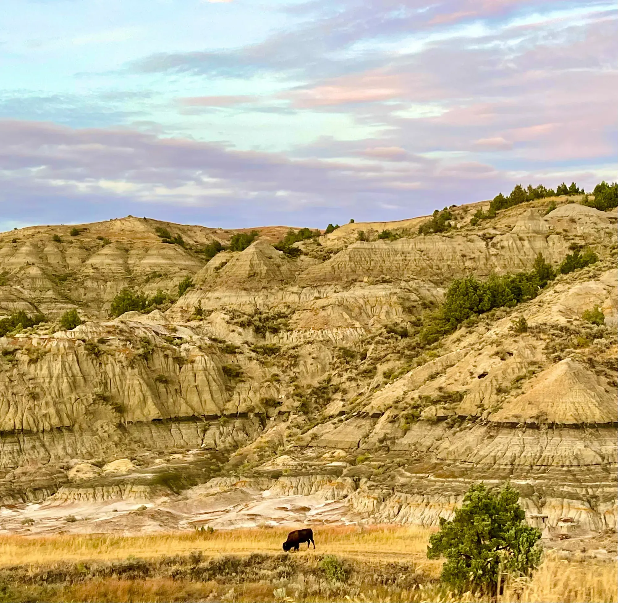
Theodore Roosevelt · Photo: David & Keri New
- 3 miDistance
- 2–10 hrTime
The numbers, with sources
Distance: 3 miles round trip to either section; full loop is 10.4 miles Source
Gain: Not stated for the selected short route in the NPS listing Source
Time: The NPS gives 2–10 hours, which covers everything from short walks to the full loop. There’s no separate time for the short hike Source
Difficulty: The hike to the petrified forest is on an unpaved trail which may occasionally have uneven ground or loose stone. Trail surfaces are not maintained. Proper footwear is recommended. There is little to no shade available on this trail; hikers should dress for the weather and wear sun protection. Hikers are advised to carry at least one liter of water per person, per hour, especially in the hot summer months. During the summer, ticks, flies, and other biting insects may be present along the trail. It is illegal to remove any resource from the park. Leave any fossils, rocks, or other objects where you find them for other visitors to enjoy. Source
Trailhead: Follow the updated approved route from I-94 Exit 10 toward Camels Hump Lake and the marked posts. The full road directions are in the route description. Source
Route type: out-and-back Source
Built from official sources (checked Nov 3, 2026). Confirm current conditions with the park.
Recreation.gov permits, entrances & campgrounds
Recreation.gov (RIDB). Booking records date not published. NPS guidance above takes precedence. A listing doesn’t mean you need a permit or that there’s space on your dates.
Park campground options (5)
These records belong to the park’s NPS recreation area. We haven’t checked how close these are to the trail, when they open or whether sites are free; check the map and the booking page.
Juniper Campground (ND) — Campground; RIDB reservable: yes. Season: not published in structured RIDB data. Recreation.gov (RIDB) source · Booking details
NPS reservation guidance: Beginning May 1, 2026 all sites are by reservation at recreation.gov Group site reservations begin each season on the first business day in March at 8:00 am MST. The park cannot take reservations - they must all be made through recreation.gov. Click RESERVATIONS below or call recreation.gov at 1 (877) 444-6777. NPS source
Cottonwood Campground (ND) — Campground; RIDB reservable: yes. Season: not published in structured RIDB data. Recreation.gov (RIDB) source · Booking details
NPS reservation guidance: Beginning May 1, 2026 all sites are by reservation at recreation.gov Group site reservations begin each season on the first business day in March at 8:00 am MST. The park cannot take reservations - they must all be made through recreation.gov. Click RESERVATIONS below or call recreation.gov at 1 (877) 444-6777. NPS source
Cottonwood Group Site (ND) — Campground; RIDB reservable: yes. Season: not published in structured RIDB data. Recreation.gov (RIDB) source · Booking details
Juniper Campground Group Site (ND) — Campground; RIDB reservable: yes. Season: not published in structured RIDB data. Recreation.gov (RIDB) source · Booking details
Roundup Group Horse Camp — Campground; RIDB reservable: yes. Season: not published in structured RIDB data. Recreation.gov (RIDB) source · Booking details
NPS reservation guidance: This site is available by reservation only. Reservations can be made starting March 1st at 8:00am MST and must be made at least 5 days in advance. Maximum length of stay is 5 nights. NPS source
Route, junction by junction
Selected start → Selected destination
Choose either petrified-wood section as a short out-and-back destination. The full 10.4-mile loop is a separate commitment, not a shortcut connecting the two short walks. Source
No elevation profile yet:
No elevation profile yet: we haven’t verified complete measurements for this route. Source
In-depth guide
Compiled from linked sources, checked Nov 2, 2026. Each paragraph links to its source.
Is this hike for you?
The Petrified Forest Trail climbs out of the badlands onto a wide prairie, where it splits. Each branch drops into a valley full of petrified stumps, and both are about 1.5 miles from the parking area, so either one is a 3-mile out-and-back hike. You can also keep going past the petrified wood to finish the 10.4 mile loop or connect to other trails; bring extra water and supplies if you do. The NPS gives a time of 2–10 hours, which covers everything from the short hike to the full loop, and doesn’t publish an elevation gain. Theodore Roosevelt National Park has the third highest concentration of petrified wood in the United States. Source
The trail
This is a remote, unpaved backcountry trail with steep slopes, uneven footing and ground that can be unstable. Wear proper footwear. Weather can make it unstable or slippery, so ask a ranger about current conditions. Source
It’s illegal to remove anything from a national park. Leave fossils, stones and everything else where you find them. Source
Getting to the trailhead
The directions changed, and the NPS asks you to use its approved legal route. From I-94, take Exit 10 toward Camels Hump Lake and follow the marked posts. Turn right onto CR -11, then take an immediate right and go 3.7 miles. Turn right onto 30th St SW for 3.5 miles, then left onto Wannagan Creek Rd at Durham Ranch (there’s a Watch for Children sign) for 3.2 miles. Turn right onto 730 (no sign) for 4.4 miles, then left for 1 mile to the trailhead. The trail starts at the lift gate behind the trailhead sign. From Medora the drive takes about 50 minutes on dirt and gravel roads. Source
Permits, fees and dogs
You don’t need a reservation for this hike. Pets aren’t allowed; service animals are, on a leash no longer than 6 feet. Source
The park entrance fee is $30.00 per private vehicle and covers everyone in it for 7 days. Source
Before you go
Check the park’s current alerts and the forecast, carry a map, and decide which section you’re hiking to before you start. The NPS doesn’t publish an elevation profile we could verify for this trail, so there’s no chart here. Source · Source 2
Sources & planning limits
Reviewed 2026-11-03. Check current conditions for your trip dates.
- We haven’t confirmed access, transport or services for your trip date. Check with the NPS and any transport provider. Source
- Park information changes. Check access, services and reservations for your travel date. Source
- The NPS doesn’t say whether this hike suits kids or people with limited mobility. Read its accessibility notes before you pick it. Source
- There’s no elevation profile yet: we haven’t verified complete measurements for this route. Source
Getting there and back
Follow the updated approved route from I-94 Exit 10 toward Camels Hump Lake and the marked posts. The full road directions are in the route description. Source
Return: Complete the return arrangement described for this route. NPS places both sections approximately 1.5 miles from the parking area and describes a three-mile return walk to either one. It also publishes updated legal road access; older directions should not replace that instruction. Source
Water
Additional water and supplies are recommended for this longer hike. Source
Hazards
Season
Weather conditions may cause unstable or slippery conditions. Check with a ranger for current conditions. Source
Weather conditions may cause unstable or slippery conditions. Check with a ranger for current conditions. Source
Gear & rules
The NPS activity marks pets permitted: false. Source
Filling a gap in your kit? Compare these packing essentials on Amazon. Choose gear for your route, conditions and the park’s guidance.
As an Amazon Associate we earn from qualifying purchases. How this works
Questions
Which hike is this?
Choose either petrified-wood section as a short out-and-back destination. The full 10.4-mile loop is a separate commitment, not a shortcut connecting the two short walks. Source
Are the published figures fully consistent?
NPS places both sections approximately 1.5 miles from the parking area and describes a three-mile return walk to either one. It also publishes updated legal road access; older directions should not replace that instruction. Source
Is there an elevation profile?
Elevation profile omitted: The source permits either petrified-wood section as a short destination. The inspected loop and South Petrified Forest geometry has not been tied to a verified complete short out-and-back variant and its updated legal trailhead approach. Source
Alternatives
More Theodore Roosevelt trail guides
- Wind Canyon Trail0.3 mi · Easy