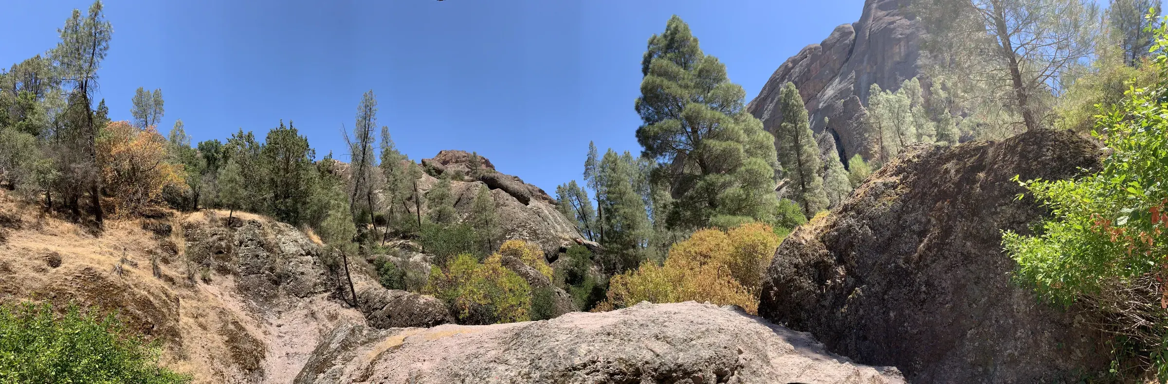
Pinnacles · Photo: David & Keri New
- 6.7 miDistance
- 1,425 ftElevation gain
- 4–5 hrTime
- StrenuousDifficulty
The numbers, with sources
Distance: Approximately 6.7-mile loop Source
Gain: NPS labels 1,425 feet as the maximum grade. The total climb isn’t confirmed. Source
Time: 4–5 hours Source
Difficulty: Strenuous Source
Trailhead: Accesible from Pinnacles East Entrance, drive approximately 4 miles along East Entrance Road to Bear Gulch Day Use Area. Trailhead starts near the Bear Gulch Nature Center. Start at Moses Spring Trailhead toward High Peaks Trail to Blue Oak returning on Sycamore Trail. For a shorter hike, take Condor Gulch Trail instead of Blue Oak Trail to Bench and Sycamore trails. Source
Route type: loop Source
Built from official sources (checked Nov 3, 2026). Confirm current conditions with the park.
Recreation.gov permits, entrances & campgrounds
Recreation.gov (RIDB). Booking records date not published. NPS guidance above takes precedence. A listing doesn’t mean you need a permit or that there’s space on your dates.
Park campground options (1)
These records belong to the park’s NPS recreation area. We haven’t checked how close these are to the trail, when they open or whether sites are free; check the map and the booking page.
PINNACLES CAMPGROUND — Campground; RIDB reservable: yes. Season: not published in structured RIDB data. Recreation.gov (RIDB) source · Booking details
NPS reservation guidance: Tent and RV sites can be reserved up to 6 months in advance, and group sites can be reserved up to 12 months in advance. To reserve a site please call the National Recreation Reservation Service at (877) 444-6777 or make reservations through Recreation.gov. For more information, please call the Pinnacles Campground Store at (831) 200-1722 or visit their website at visitpinnacles.com NPS source
Route, junction by junction
Trailhead → Selected destination or loop
NPS describes climbing into the High Peaks, descending the ridge through grasses and spring wildflowers, and returning beneath sycamore, buckeye and oak. The activity’s accessibility field labels 1,425 feet as maximum grade, which is not a grade unit. We flag that number instead of calling it the total climb. Source
No elevation profile yet:
No elevation profile yet: we haven’t verified complete measurements for this route. Source
In-depth guide
Compiled from linked sources, checked Nov 2, 2026. Each paragraph links to its source.
Is this hike for you?
High Peaks to Bear Gulch is a strenuous loop of about 6.7 miles on the east side of the park. The NPS allows 4–5 hours. Most of it has no shade, and in summer the High Peaks run 10 degrees hotter than the parking areas. The NPS recommends it for ages 10 and older; minors must be with a parent or guardian. Source
The trail
Start at the Moses Spring Trailhead near the Bear Gulch Nature Center and take the High Peaks Trail up into the High Peaks. Descend along the ridge through grassy meadows (wildflowers in spring) on the Blue Oak Trail, then return to the Bear Gulch Day Use Area on the Bench and Sycamore Trail, in the shade of sycamore, buckeye and oak. For a shorter loop, take the Condor Gulch Trail instead of Blue Oak (different mileage). If parking is tight at Bear Gulch, the NPS suggests going counter-clockwise, starting with Blue Oak and ending with Sycamore. Source
The trail is about 2 - 4 feet wide, dirt and rock, with a maximum grade the NPS lists as 1,425 feet. The NPS doesn’t give a total elevation gain. Wear sturdy, non-slip shoes with ankle support; the rocks can be slick. Source
A cave on the route needs a flashlight, and has low ceilings, slippery rocks and uneven footing. It’s open seasonally and may close for short periods in winter because of flooding, so don’t assume it’s open just because the loop is. Source
Getting to the trailhead
From the Pinnacles East Entrance, drive about 4 miles along East Entrance Road to the Bear Gulch Day Use Area. Weekends, holidays and nice-weather days (especially in spring) are very busy, with long lines and delays between 10:00 am and 3:00 pm. If you’re hiking the High Peaks, the park recommends arriving before 8:00 am, and parking may fill earlier. Campground access may be held up when all incoming traffic is stopped. Source · Source 2 · Source 3
Heat and water
There’s no water on any trail, only in developed areas. Carry at least a liter for every hour of hiking, plus an electrolyte drink and salty snacks. In summer don’t hike during the hottest part of the day (10AM-4PM); heat and dehydration can be fatal. Wear light, loose clothing, sunscreen, a hat and sunglasses. In winter, wear warm and waterproof clothing. Source
Safety
If you get hurt you’re a long way from medical help, and cell phones may not work. Tell someone your plan, bring a map, and turn back if you need to. Watch where you put your hands and feet: poison oak, stinging nettle and rattlesnakes are all here. Source
Rules, permits and fees
Don’t feed, approach or hunt wildlife, don’t fly drones, and leave plants, rocks and other features where they are; they’re protected by federal law. Stay on the trail to prevent erosion. Service animals are permitted; the NPS doesn’t give a full pet rule for this trail, so check before bringing a dog. Source
The NPS says this hike doesn’t need a reservation. Check the park’s entrance fee and any camping or other reservations for your date. Source · Source 2 · Source 3
Before you go
Check park alerts and the forecast before you leave. There’s no elevation profile yet: we haven’t verified complete measurements for this route. Source · Source 2
Sources & planning limits
Reviewed 2026-11-03. Check current conditions for your trip dates.
- Check permit, reservation and fee rules for your travel date. Source
- Check access and services with the NPS for your travel date. Source
- NPS alert, November 3, 2026: heavy traffic on weekends, holidays and nice-weather days, especially in spring. Expect long lines between 10:00 am and 3:00 pm; to hike the High Peaks, Condor Gulch, Balconies or Moses Spring Trail, arrive before 8:00 am. Check current alerts before you go. Source
- No elevation profile yet: we haven’t verified complete measurements for this route. Source
- NPS details are as of the date shown. Confirm access, services and reservations for your travel date. Source
Getting there and back
Accesible from Pinnacles East Entrance, drive approximately 4 miles along East Entrance Road to Bear Gulch Day Use Area. Trailhead starts near the Bear Gulch Nature Center. Start at Moses Spring Trailhead toward High Peaks Trail to Blue Oak returning on Sycamore Trail. For a shorter hike, take Condor Gulch Trail instead of Blue Oak Trail to Bench and Sycamore trails. Source
Return: Come back the way described above. Complete the chosen loop to the original start. Source
Water
Drinking water is only available in developed areas-there is no water along any of the trails. Carry at least a liter of water for every hour of hiking. Stay hydrated with plain water and an electrolyte drink replacement. Source
Hazards
Difficulty: Strenuous Distance: Approx. 6.7 mile loop Trail width: Approx. 2 - 4 feet Maximum grade: 1,425 feet Surface Composition: dirt, rock Exposure: Mostly no shade, shade along Sycamore Trail In summer, expect temperatures in the High Peaks and Chalone Peaks to be 10 degrees hotter than parking areas. Avoid hiking during the hottest parts of the day. Flashlight required in cave; Watch for low ceilings, slippery rocks, and uneven footing. Cave is open seasonally; Cave may be closed for short periods in winter due to flooding. *Service animals permitted Source
Season
In summer, expect temperatures in the High Peaks to be 10 degrees hotter than parking areas. Avoid hiking during the hottest parts of the day. There is no shade on trail. Bring plenty of water, salty snacks, a hat, and sunscreen. Source
In summer, expect temperatures in the High Peaks to be 10 degrees hotter than parking areas. Avoid hiking during the hottest parts of the day. There is no shade on trail. Bring plenty of water, salty snacks, a hat, and sunscreen. Source
Gear & rules
Follow current signs and closures, and treat any side trip as a separate decision. Source
Filling a gap in your kit? Compare these packing essentials on Amazon. Choose gear for your route, conditions and the park’s guidance.
As an Amazon Associate we earn from qualifying purchases. How this works
The NPS doesn’t publish a pet rule for this exact route. Confirm the applicable rule before bringing an animal. Source
Questions
Which route do these figures describe?
About a 6.7-mile loop. This roughly 6.7-mile High Peaks to Bear Gulch loop is a strenuous east-side hike. Its connected trail names matter: start near Bear Gulch, use High Peaks and Blue Oak, and return on Bench and Sycamore. The Condor Gulch alternative changes the loop and is not the same mileage. Source
Is the trail open right now?
No. NPS details as of Nov 3, 2026. Confirm current conditions and closures with NPS. Source
Is there a measured elevation profile?
No elevation profile yet: we haven’t verified a complete line for this route. Source
Alternatives
The NPS page includes cave cautions, but cave access is seasonal and you need a flashlight. Do not assume a cave is open because the larger trail circuit is described year-round. NPS warns that High Peaks can be hotter than the parking areas and that drinking water is available only in developed areas. Source
More Pinnacles trail guides
- Moses Spring to Rim Trail Loop2.2 mi · Moderate