Boulders and pines below steep rock walls on the west side of Pinnacles National Park

California

Pinnacles National Park Guide

The volcanic spires, talus caves and condor country of California’s Gabilan Range. The east and west entrances don’t connect by road, so pick your side before you set off.

By David & Keri New, who have visited 63 of the 64 U.S. national parksUpdated

Park 7 of our 63Visited Jul 2020

Your trip planner

Add Pinnacles to a trip

Choose a saved trip or start a new draft for this park.

Saves this park and its trail guides on this device. Alerts and conditions are as of when you save; live maps and bookings need a connection.

Photo: David & Keri New

NPS alertsAs of 6:03 AM ET, Nov 20

Fire Danger LOW

  • Heavy Traffic and High Visitation Alert
Booking morning · Tuesday, December 1 · About 8 a.m. ET observed June 2027 dates open at Pinnacles Campground. Get a free reminder →

Plan your first trip to Pinnacles

2 days is our starting point.

Spend day one on the east side at Bear Gulch and day two on the west side at Balconies and Prewett Point. Add the High Peaks as a separate early start if your group is comfortable with the exposed, strenuous route.

Open the 3-day itineraryPinnacles cave status

Starts a new draft and keeps your saved trips. Set a custom duration in the full planner.

How many days?

1 day
  1. East entrance · Bear Gulch Cave and Reservoir

For a few hours on the east side, walk the Moses Spring to Rim Trail loop from Bear Gulch, which NPS lists at 1 to 2 hours. The lower Bear Gulch Cave is open and the upper cave is closed. On busy days, arrive before 8 AM.

National Park Service guidancePinnacles cave statusNPS operating dates and hours

Open this day plan
2 days · our pick
  1. East entrance · Bear Gulch Cave and Reservoir
  2. West entrance · Balconies and Prewett Point
Open this day plan
Compare all trip lengths
Optional add-on

Stay after dark for night sky viewing, best near a new moon. NPS suggests Bacon Ranch or Peaks View on the east side, or the Chaparral Parking Area on the west, where the gate closes at 8 PM.

National Park Service guidanceNPS operating dates and hours

If plans change

If Bear Gulch Cave is closed, use the open surface route via Moses Spring and the Rim Trail for the reservoir if trail conditions allow. If Balconies Cave is closed, make Prewett Point the short west-side trip while that trail is open.

Pinnacles cave statusOpen the 2-day itineraryCurrent park conditions

Check what’s open

Where to base yourself

Soledad for Balconies, Hollister or King City for Bear Gulch

Compare the Inn at the Pinnacles near Soledad for a west-side start or Keefer’s Inn in King City for the southern approach to the east entrance. Hollister is a practical east-side base when arriving from the Bay Area.

Lodging and gateway townsNPS directionsInn at the Pinnacles visitor informationPinnacles Recreation Company trip planning

Compare stays and access

Before you book

Choose your entrance and overnight base before reserving. Book an east-side campground site or tent cabin separately if you want to sleep inside the park. Verify cave access and west gate hours for your dates.

NPS lodging informationNPS operating dates and hoursPinnacles cave status

Getting there and getting around

Route to the entrance for your trailhead. There is no drive through the park. Check the east-side shuttle and parking before a weekend Bear Gulch trip, and allow a separate drive outside the park if you switch sides.

NPS directionsNPS operating dates and hoursGetting to the park

Our visit

Park 7 of our 63

Where Pinnacles ranks in our 63

July 2020

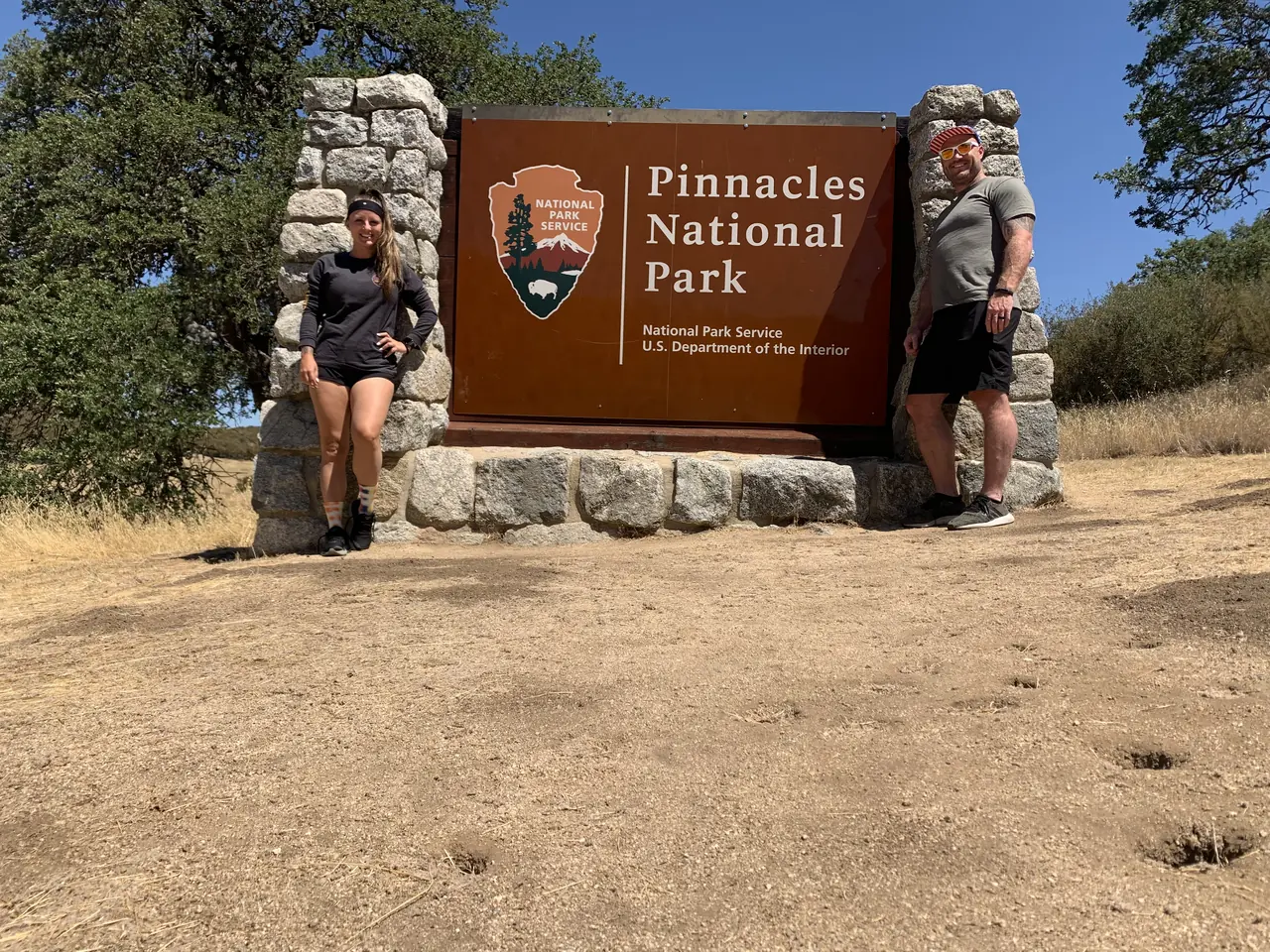
David and Keri at the Pinnacles entrance sign
We were hereJul 9, 2020
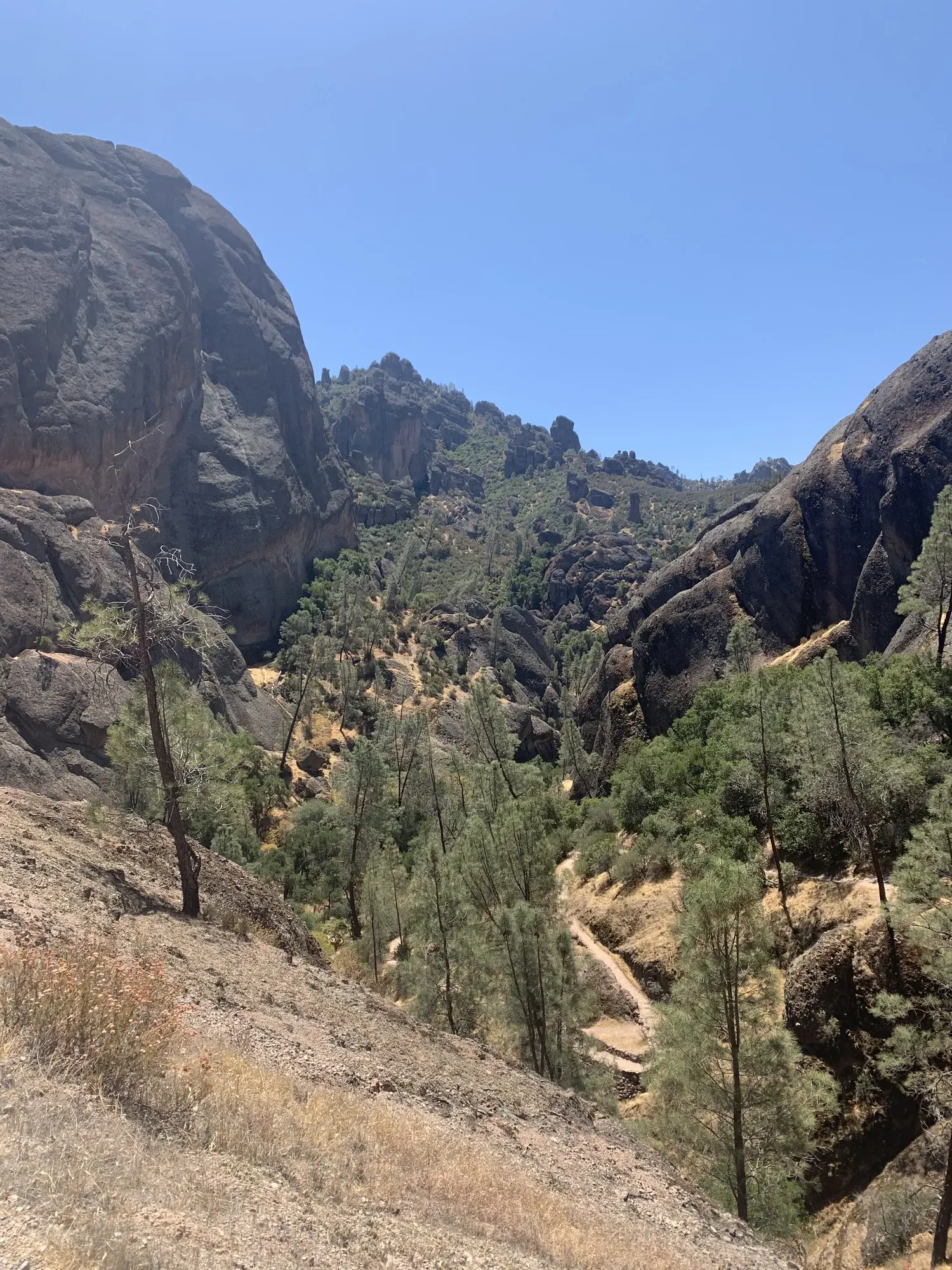
Dark volcanic rock walls and spires above a pine-dotted canyon in Pinnacles National Park
Looking into the rocky canyon on the west side of Pinnacles. · Jul 9, 2020

Why it’s on our list

Pinnacles is a unique park featuring towering volcanic rock formations, fascinating caves, and the opportunity to spot endangered California condors soaring overhead. The hiking can be surprisingly adventurous, particularly around the High Peaks and talus caves. While we enjoyed the unusual scenery, the park doesn’t offer quite the same variety or grand landscapes as many others on our list.

Our favorite moment

Hiking the valley trails below the spires. Bear Gulch Cave was closed when we visited, and we were disappointed to miss it.

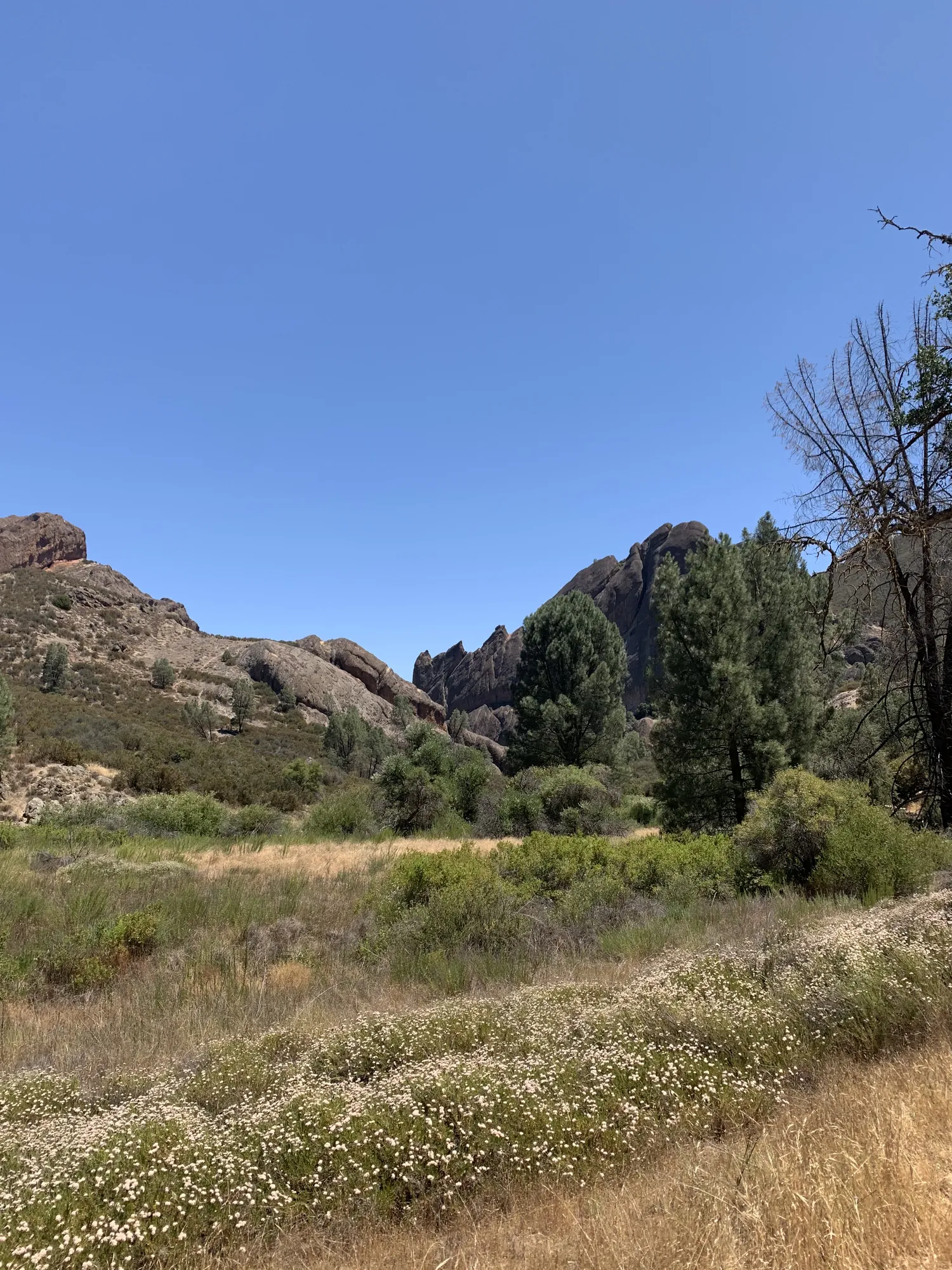
White wildflowers and dry grass in a meadow below rocky outcrops in Pinnacles National Park
White wildflowers among the dry grass on the west side of Pinnacles. · Jul 9, 2020
See all 5 photos and videos
When we went
July 2020

Photos by David & Keri New.

Firsthand · David & Keri New

What we’d tell a friend about Pinnacles

Pinnacles is what’s left of an ancient volcano that the San Andreas Fault carried well north of where it erupted. That leaves jagged spires, talus caves and condors in the middle of California ranch country. It’s a small park, and you can see a lot of it in a day.

  • Jul 9, 2020 · Day trip

Our one tip

Pick a side before you go, because the east and west entrances don’t connect by road, and the east side has the campground and more trails. Bring a flashlight for the talus caves and check that they’re open, since parts close seasonally for bats.
What we’d do differently

Come in March or April instead. It’s cooler then, and the hills are green and full of wildflowers.

With one more day

The west side. We’d go around and hike the Balconies Cliffs and Balconies Cave loop.

Was it a good time to go?

July is the slow season here, and we learned why. It was hot, and the grass was already dry and gold under clear skies. Start early and carry plenty of water.

In town

You won’t find much right outside the gates. Old San Juan Bautista and its mission make a good stop on the way in from the north, and the Santa Lucia Highlands wineries near Soledad are close to the west side.

Entry and best time to visit

Entry

No entry reservation required

You still need an entrance pass: $30 per vehicle, good for 7 days.

Fees and permits

Best time

March, April

March-April lead for flowers and hiking. October-November are good alternatives. Avoid midsummer heat. Check bat closures and spring parking.

Month by month

Live conditions and planning tools →

What’s different now

Official update, not firsthand

Bear Gulch Cave’s entire passage usually closes mid-May through mid-July for Townsend’s big-eared bat pupping; the Upper Cave is rarely open. Balconies Cave can close for flooding or rockfall. Check current cave status before you go. Last verified · nps.gov

Itineraries

How many days in Pinnacles?

  • 1 day

    1. Day 1 East entrance · Bear Gulch Cave and Reservoir
    Full 1-day plan
  • 2 daysOur pick

    1. Day 1 East entrance · Bear Gulch Cave and Reservoir
    2. Day 2 West entrance · Balconies and Prewett Point
    Full 2-day plan
  • 3 days

    1. Day 1 East entrance · Bear Gulch Cave and Reservoir
    2. Day 2 West entrance · Balconies and Prewett Point
    3. Day 3 East entrance · Condor Gulch and the High Peaks
    Full 3-day plan

Pinnacles itinerary: every day stop by stop, with sources

Compare the 1-, 2- and 3-day plans, day by day →

Map

Where things are in Pinnacles

3 visitor centers and 1 campground on a map you can zoom and drag. Map data loads from OpenStreetMap when you tap.

Pinnacles’ east and west entrance roads (no road through): schematic, not to scale HollisterEast EntranceOld PinnaclesBear GulchKing CitySoledadWest Entrance
Schematic, not to scale

3 visitor centers

Locations from the NPS visitor-center listing, checked Nov 13, 2026. Hours and what each one has

1 campground

Locations from Recreation.gov, checked Nov 7, 2026. Compare the campgrounds

Official NPS maps for Pinnacles (opens in a new tab) ↗

Trails

10 hikes, shortest first

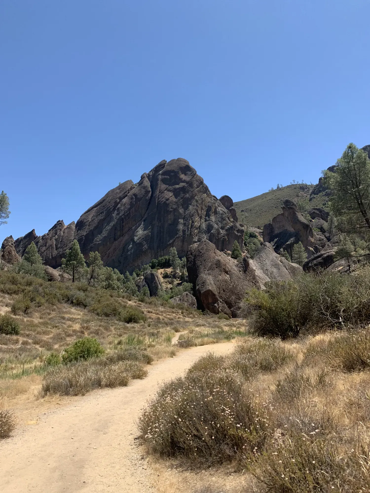
A dry dirt trail leads toward jagged volcanic rock spires under a blue sky in Pinnacles National Park
A dry dirt trail leads toward jagged volcanic rock spires under a blue sky · Jul 2020
  1. Prewett Point Trail (west side)0.9 mi round trip · 70 ft gain · Easy

    0.9 mi

    Details for Prewett Point Trail (west side)

    Wheelchair-accessible overlook trail from the West Visitor Contact Station, with benches. No shade.

    About 30-60 minutes
    Start: West Visitor Contact Station Parking Area, reached from Highway 101 via Highway 146/Chaparral Road.

    Last verified · nps.gov
  2. Condor Gulch Trail1.7 mi one way (1 mi to viewpoint) · 1,100 ft gain · Strenuous; moderate to the viewpoint

    1.7 mi

    Details for Condor Gulch Trail

    Quick views of the High Peaks and a good spot for condors. No shade.

    One way (point to point) · About 60-90 minutes
    Start: Condor Gulch Trailhead near Bear Gulch Nature Center, reached by East Entrance Road.

    Last verified · nps.gov
  3. Moses Spring - Rim Trail Loop2.2 mi loop · 500 ft gain · Moderate

    2.2 mi

    Details for Moses Spring - Rim Trail Loop

    Passes through Bear Gulch Cave (flashlight required) to the reservoir and back along the rim. Starts at Moses Spring Trailhead.

    Loop · About 1-2 hours
    Start: Moses Spring Trailhead; follow East Entrance Road to Bear Gulch and Moses Spring Parking Area.

    Last verified · nps.gov
  4. Bench Trail to Sycamore Trail2.3 mi one way · 300-350 ft gain · Moderate

    2.3 mi

    Details for Bench Trail to Sycamore Trail

    Follows Chalone and Bear creeks from the campground to Bear Gulch, with seasonal small waterfalls.

    One way (point to point) · About 1-2 hours one way
    Start: Bench Trailhead at the end of Pinnacles Campground, reached by East Entrance Road from CA 25.

    Last verified · nps.gov
  5. Balconies Cliffs - Balconies Cave Loop (west side)2.4 mi loop · 200 ft gain · Moderate

    2.4 mi

    Details for Balconies Cliffs - Balconies Cave Loop (west side)

    Scramble through talus cave passages (flashlight required) and return over the cliffs.

    Loop · About 1-2 hours
    Start: Balconies Trailhead via the connector from Chaparral Parking Area on Highway 146/Chaparral Road.

    Last verified · nps.gov
  6. Juniper Canyon - High Peaks (west side)4.3 mi round trip · 1,215 ft gain · Strenuous

    4.3 mi

    Details for Juniper Canyon - High Peaks (west side)

    Steep switchbacks from Chaparral Parking Area to the Steep and Narrow section; return on the Tunnel Trail.

    Loop · About 2-3 hours
    Start: Chaparral Parking Area; enter from the west on Highway 146/Chaparral Road.

    Last verified · nps.gov
  7. Condor Gulch - High Peaks Loop5.3 mi loop · 1,300-1,500 ft gain · Strenuous

    5.3 mi

    Details for Condor Gulch - High Peaks Loop

    Includes the Steep and Narrow section through the rock formations. No shade.

    Loop · About 3-5 hours
    Start: Bear Gulch Day Use Area, reached by East Entrance Road.

    Last verified · nps.gov
  8. Old Pinnacles Trail to Balconies Cave (east side)5.4 mi round trip · 350 ft gain · Moderate

    5.4 mi

    Details for Old Pinnacles Trail to Balconies Cave (east side)

    Sunny route past Machete Ridge, with six seasonal creek crossings.

    Lollipop loop · About 3-4 hours
    Start: Old Pinnacles Parking Area; enter on East Entrance Road and bear right at the fork.

    Last verified · nps.gov
  9. High Peaks - Bear Gulch Loop6.7 mi loop · 1,425 ft gain · Strenuous

    6.7 mi

    Details for High Peaks - Bear Gulch Loop

    Climb into the High Peaks, then come down through spring wildflower meadows and shady Sycamore Trail. Allow 4-5 hours.

    Loop · About 4-5 hours
    Start: Moses Spring Trailhead near Bear Gulch Nature Center, reached by East Entrance Road.

    Last verified · nps.gov
  10. North Chalone Peak9 mi round trip · 2,040 ft gain · Strenuous

    9 mi

    Details for North Chalone Peak

    Climbs from the reservoir to the park’s highest point; the last mile is on a dirt road. No shade.

    Out and back · About 3-5 hours
    Start: North Chalone Trail at Bear Gulch Reservoir; park at Bear Gulch Day Use Area via East Entrance Road.

    Last verified · nps.gov

Distances, gains and difficulty as NPS publishes them; the bar shows the published distance, dashed where a longer option exists.

Camping

Camping in Pinnacles

  • PinnaclesSee dates · $43–$59 a night · RVs to 90 ft, trailers to 45 ft

Camping in and near Pinnacles: the campground, every site, nearby campgrounds and open sites for your dates

Fees, permits & rules

Pinnacles entrance fee: $30 per vehicle, plus permits and when to book

Last verified · nps.gov All Pinnacles fees, permits and booking deadlines →

Rules and changes for 2026

  1. No through road

    No road connects the East and West entrances; the shortest link is via Hwy 101. GPS may send you to the wrong side, so use the NPS coordinates.

    Last verified · Directions (NPS)
  2. Cave status

    Bear Gulch and Balconies caves can close for Townsend’s big-eared bats, flooding, rockfall or vandalism. Bear Gulch’s upper cave closes for long periods. You need a flashlight in both. Check the cave status page before you go.

    Last verified · Status of the Caves (NPS)
  3. Fires

    Check the park’s current fire danger and restrictions before lighting a fire. Use designated areas when fires are allowed. Fireworks are always banned.

    Last verified · Current Conditions (NPS)
1 more rule
  1. Climbing closures

    Some cliffs and crags close or carry advisories from January to July to protect nesting falcons and other raptors.

    Last verified · Current Conditions (NPS)

Crowds by month

Historical recreation visits · 2021–2025 · as of Nov 3, 2026. Visits count entries, not unique people, parking spaces or trail crowding.

Average monthly recreation visits, 2021–2025
Jan23,508
Feb26,157
Mar37,688
Apr38,961
May37,145
Jun30,380
Jul28,047
Aug21,800
Sep19,821
Oct21,236
Nov24,668
Dec23,066

Busiest by average count: Apr. Quietest: Sep. Each bar is that month’s average visits across 5 years; unusual years and reported zeros are included. Past visits can’t tell you the best time of day to arrive.

Every month’s visits and NOAA weather, with the counts for each year →

NPS Visitor Use Statistics: monthly report · NPS monthly data · checked Nov 3, 2026; latest included year 2025.

How this page is made. The section “What we’d tell a friend” is ours. Our recorded visits to Pinnacles include July 2020.Planning information, including any fees, permits, closures, weather and crowd figures shown here, is compiled from the National Park Service, Recreation.gov and other public sources, and each fact shows the date we last checked it. If something is wrong, tell us and we’ll log the fix on our corrections page.

Sources & corrections

The core guide research was last verified Nov 20, 2026 against the linked National Park Service and Recreation.gov pages. Live conditions and separately sourced facts show their own dates. Park rules change; confirm before you go.

Report a correction · Corrections log

Photos: David & Keri New.

Where sources disagree (4)
  • Condor Gulch - High Peaks: the trails page says 1,300 ft of elevation gain. The NPS things-to-do page says 1,500 ft max grade.
  • Bench-Sycamore: the trails page says 300 ft of elevation gain. The things-to-do page says 350 ft.
  • Campground pool: the NPS camping page says it’s typically open mid-April to the end of September. Recreation.gov says Apr 1-Oct 31, weather permitting. Check with the campground (831-200-1722).
  • Special use permits: the NPS permits page says applications should arrive at least 90 days ahead (two days for First Amendment activities), but its own processing-time section says 30 days (five days for First Amendment, six months for large groups). We show the first figures; confirm with the park.