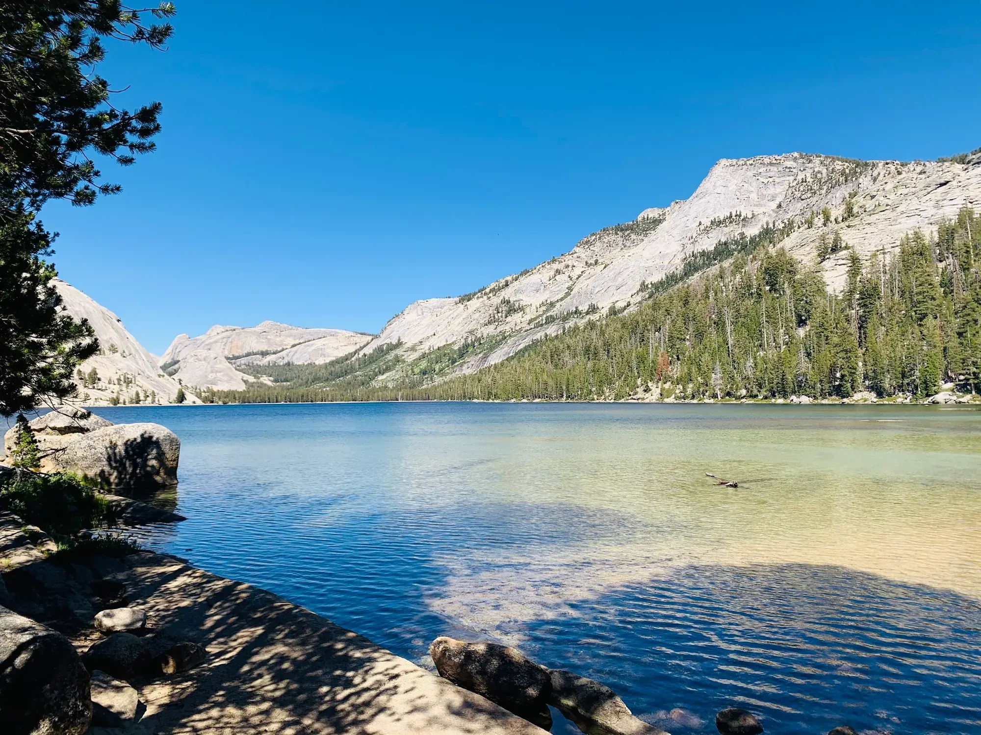
Half Dome
The route climbs from Yosemite Valley past Vernal and Nevada Falls toward Half Dome. The final cable ascent requires a permit when the cables are up.
Permit required
Yosemite · Photo: David & Keri New
- 14–16.4 miDistance
- 4,800 ftElevation gain
- 10–12 hrTime
- StrenuousDifficulty
The numbers, with sources
Distance: 14–16.4 mi round trip, depending on route. Source
Gain: 4,800 ft. Source
Time: Most hikers take 10–12 hours; some take longer. Source
Difficulty: Strenuous. Source
Trailhead: Happy Isles, shuttle stop 16. Source
Route type: out-and-back Source
Built from official sources (checked Nov 3, 2026). Confirm current conditions with the park.
Recreation.gov permits, entrances & campgrounds
Recreation.gov (RIDB). Booking records date not published. NPS guidance above takes precedence. A listing doesn’t mean you need a permit or that there’s space on your dates.
Nearby campground records
Within 10 straight-line miles of the trailhead. Distances are straight-line from map coordinates, not driving distances.
- Yosemite Creek Campground: approximately 6.9 miles straight line. RIDB coordinates · Mapped route source
- Porcupine Flat Campground: approximately 5.3 miles straight line. RIDB coordinates · Mapped route source
- Bridalveil Creek Campground: approximately 5.9 miles straight line. RIDB coordinates · Mapped route source
- North Pines Campground: approximately 0.8 miles straight line. RIDB coordinates · Mapped route source
- Tamarack Flat Campground: approximately 9.8 miles straight line. RIDB coordinates · Mapped route source
- Camp 4: approximately 2.6 miles straight line. RIDB coordinates · Mapped route source
- Lower Pines Campground: approximately 0.8 miles straight line. RIDB coordinates · Mapped route source
- Upper Pines Campground: approximately 0.4 miles straight line. RIDB coordinates · Mapped route source
Matched permits & entrances (1)
Half Dome Permits — Permit; RIDB reservable: yes. Season: not published in structured RIDB data. Recreation.gov (RIDB) source · Booking details
Permit entrance: Half Dome Cables. RIDB source
Park campground options (16)
These records belong to the park’s NPS recreation area. We haven’t checked how close these are to the trail, when they open or whether sites are free; check the map and the booking page.
Yosemite Creek Campground — Campground; RIDB reservable: yes. Season: not published in structured RIDB data. Recreation.gov (RIDB) source · Booking details
NPS reservation guidance: During the campground’s open season (approximately mid-July through early September), reservations are required. Campground reservations are released two weeks in advance on a rolling daily window (i.e., 14 days in advance of arrival date) at 7 am Pacific time. Be aware that nearly all campground reservations in Yosemite for the months of May through September and for some other weekends are filled the first day they become available, usually within seconds or minutes after 7 am Pacific time. NPS source
White Wolf Campground — Campground; RIDB reservable: yes. Season: not published in structured RIDB data. Recreation.gov (RIDB) source · Booking details
NPS reservation guidance: During the campground’s open season (approximately July - September), a reservation is required. Campground reservations are released two weeks in advance on a rolling daily window (i.e., 14 days in advance of arrival date) at 7 am Pacific time. Be aware that nearly all campground reservations in Yosemite for the months of May through September and for some other weekends are filled the first day they become available, usually within seconds or minutes after 7 am Pacific time. Reservations for White Wolf will begin to release on Saturday, June 20 at 7am PDT on recreation.gov. NPS source
Crane Flat Campground — Campground; RIDB reservable: yes. Season: not published in structured RIDB data. Recreation.gov (RIDB) source · Booking details
NPS reservation guidance: Reservations are required when Crane Flat is open (approximately June through mid-October). Campground reservations are released two weeks in advance on a rolling daily window (i.e., 14 days in advance of arrival date) at 7 am Pacific time. Be aware that nearly all campground reservations in Yosemite for the months of May through September and for some other weekends are filled the first day they become available, usually within seconds or minutes after 7 am Pacific time. NPS source
Porcupine Flat Campground — Campground; RIDB reservable: yes. Season: not published in structured RIDB data. Recreation.gov (RIDB) source · Booking details
NPS reservation guidance: During the campground’s open season (approximately mid-July through mid-October), reservations are required. Campground reservations are released two weeks in advance on a rolling daily window (i.e., 14 days in advance of arrival date) at 7 am Pacific time. Be aware that nearly all campground reservations in Yosemite for the months of May through September and for some other weekends are filled the first day they become available, usually within seconds or minutes after 7 am Pacific time. NPS source
Hodgdon Meadow Campground — Campground; RIDB reservable: yes. Season: not published in structured RIDB data. Recreation.gov (RIDB) source · Booking details
NPS reservation guidance: Reservations are required from April 15 through October 26, 2026. During the rest of the year, the entire campground (other than the group sites, which close) are available on a first-come, first-served basis. Campground reservations are available in blocks of one month at a time, up to five months in advance, on the 15th of each month at 7 am Pacific time. Be aware that nearly all campground reservations in Yosemite for the months of May through September and for some other weekends are filled the first day they become available, usually within seconds or minutes after 7 am Pacific time. NPS source
Wawona Campground — Campground; RIDB reservable: yes. Season: not published in structured RIDB data. Recreation.gov (RIDB) source · Booking details
NPS reservation guidance: Reservations are required in 2026 from April 15 until October 26 for the B and C Loop (then they close) and from April 15 until November 29 for the A Loop. During the rest of the year, Loop A is available on a first-come, first-served basis. Loops B and C are closed in winter. The group site is available year-round by reservation only. Campground reservations are available in blocks of one month at a time, up to five months in advance, on the 15th of each month at 7 am Pacific time. Be aware that nearly all campground reservations in Yosemite for the months of May through September and for some other weekends are filled the first day they become available, usually within seconds or minutes after 7 am Pacific time. NPS source
Bridalveil Creek Horse Campsites — Campground; RIDB reservable: yes. Season: not published in structured RIDB data. Recreation.gov (RIDB) source · Booking details
NPS reservation guidance: During the campground’s open season (approximately mid-July through early September) reservations are required. Reservations are required for all sites, including the horse sites (3) and group sites (2). Campground reservations are released two weeks in advance on a rolling daily window (i.e., 14 days in advance of arrival date) at 7 am Pacific time. Be aware that nearly all campground reservations in Yosemite for the months of May through September and for some other weekends are filled the first day they become available, usually within seconds or minutes after 7 am Pacific time. NPS source
Bridalveil Creek Campground — Campground; RIDB reservable: yes. Season: not published in structured RIDB data. Recreation.gov (RIDB) source · Booking details
NPS reservation guidance: During the campground’s open season (approximately mid-July through early September) reservations are required. Reservations are required for all sites, including the horse sites (3) and group sites (2). Campground reservations are released two weeks in advance on a rolling daily window (i.e., 14 days in advance of arrival date) at 7 am Pacific time. Be aware that nearly all campground reservations in Yosemite for the months of May through September and for some other weekends are filled the first day they become available, usually within seconds or minutes after 7 am Pacific time. NPS source
Tuolumne Meadows Campground — Campground; RIDB reservable: yes. Season: not published in structured RIDB data. Recreation.gov (RIDB) source · Booking details
NPS reservation guidance: During the campground’s open season (approx. July - September), all sites are only available by reservation. About half the campsites are available in blocks of one month at a time, up to two months in advance, on the 15th of each month at 7 am Pacific time. The other half of campsites are available two weeks in advance on a daily rolling window (i.e., 14 days in advance) at 7 am Pacific time. Be aware that nearly all campground reservations in Yosemite for the months of May through September and for some other weekends are filled the first day they become available, usually within seconds or minutes after 7 am Pacific time. NPS source
North Pines Campground — Campground; RIDB reservable: yes. Season: not published in structured RIDB data. Recreation.gov (RIDB) source · Booking details
NPS reservation guidance: North Pines Campground reservations are available by early access lottery; any available reservations after the lottery are available up to five months in advance starting February 15. Successful lottery applicants will have an opportunity to make a reservation for campsites in North Pines Campground during an early access period. Reservations are required seasonally for North Pines when it is open (early April through late October). After the early access period, remaining campground reservations are available in blocks of one month at a time, up to five months in advance, on the 15th of each month at 7 am Pacific time. Be aware that nearly all campground reservations in Yosemite for the months of May through September and for some other weekends are filled the first day they become available, usually within seconds or minutes after 7 am Pacific time. NPS source
Wawona Horse Campsites — Campground; RIDB reservable: yes. Season: not published in structured RIDB data. Recreation.gov (RIDB) source · Booking details
NPS reservation guidance: Wawona Horse Camp reservations are required from early May through early to mid-October. During the rest of the year the campground is closed. Campground reservations are available in blocks of one month at a time, up to five months in advance, on the 15th of each month at 7 am Pacific time. NPS source
Tuolumne Horse Campsites — Campground; RIDB reservable: yes. Season: not published in structured RIDB data. Recreation.gov (RIDB) source · Booking details
NPS reservation guidance: Tuolumne Meadows Horse Camp reservations are required from early July through September. During the rest of the year the campground is closed. Campground reservations are available in blocks of one month at a time, up to two months in advance, on the 15th of each month at 7 am Pacific time. NPS source
Tamarack Flat Campground — Campground; RIDB reservable: yes. Season: not published in structured RIDB data. Recreation.gov (RIDB) source · Booking details
NPS reservation guidance: During the campground’s open season (approximately mid- to late June - mid-October), 52 sites will be available by reservation only. Campground reservations are released two weeks in advance on a rolling daily window (i.e., 14 days in advance of arrival date) at 7 am Pacific time. Be aware that nearly all campground reservations in Yosemite for the months of May through September and for some other weekends are filled the first day they become available, usually within seconds or minutes after 7 am Pacific time. NPS source
Camp 4 — Campground; RIDB reservable: yes. Season: not published in structured RIDB data. Recreation.gov (RIDB) source · Booking details
NPS reservation guidance: Camp 4 is open all year. Sites are shared, with up to 6 people per site. In 2026, from April 15 to November 29, reservations are required and available one week in advance of your arrival date. Up to six people can be registered for a site per each reservation transaction. For part of the year, the campground is open on a first-come, first-served basis and visitors self-register for a site upon arrival. A ranger may be onsite to help register campers. Space is available on a per-person basis and you can register/reserve for up to the maximum stay limit. NPS source
Lower Pines Campground — Campground; RIDB reservable: yes. Season: not published in structured RIDB data. Recreation.gov (RIDB) source · Booking details
NPS reservation guidance: Reservations are required seasonally when Lower Pines is open (mid-April through late October). Campground reservations are available in blocks of one month at a time, up to five months in advance, on the 15th of each month at 7 am Pacific time. Be aware that nearly all campground reservations in Yosemite for the months of May through September and for some other weekends are filled the first day they become available, usually within seconds or minutes after 7 am Pacific time. NPS source
Upper Pines Campground — Campground; RIDB reservable: yes. Season: not published in structured RIDB data. Recreation.gov (RIDB) source · Booking details
NPS reservation guidance: Reservations are required all year for Upper Pines. Campground reservations are available in blocks of one month at a time, up to five months in advance, on the 15th of each month at 7 am Pacific time. Be aware that nearly all campground reservations in Yosemite for the months of May through September and for some other weekends are filled the first day they become available, usually within seconds or minutes after 7 am Pacific time. NPS source
Route, junction by junction
Happy Isles → Vernal Fall Footbridge
Begin near Happy Isles in eastern Yosemite Valley. The first paved section is almost entirely uphill and is the busiest part of the route. Views along this approach include a glimpse of Illillouette Fall in spring when water levels peak; the footbridge itself offers a view of Vernal Fall. Source
Distance: 0.8 mile from the trailhead. Source
Vernal Fall Footbridge → Mist Trail–John Muir Trail junction
Continue beyond the footbridge to the point where the two trails diverge. The direct route to the top of Vernal Fall follows the Mist Trail; the John Muir Trail provides another approach via the Clark Point cutoff. Source
Distance: About 0.2 mile beyond the bridge. Source
Junction: Mist Trail / John Muir Trail: Follow the Mist Trail for the direct ascent to Vernal Fall. The John Muir Trail reaches Vernal Fall via the Clark Point cutoff and also reaches Nevada Fall. Source
Mist Trail–John Muir Trail junction → Top of Vernal Fall
The direct Mist Trail climbs a steep granite stairway of more than 600 steps. Waterfall views accompany the ascent, and a rainbow may be visible in the spray. Spring and early summer bring heavy spray and slippery footing. At the top, views look down the 317-foot waterfall; observe railings and use extreme caution near wet rock and flowing water. Source
Distance: 0.3 mile up the stairway, as described in the route narrative. Source
Top of Vernal Fall → Return-route junction above Vernal Fall
Above Vernal Fall, the next junction offers a longer return using the John Muir Trail. Continuing on the Mist Trail passes Emerald Pool and Silver Apron. Both may look inviting in hot weather, but swimming here is illegal and dangerous because of the hazardous current. Source
Distance: About 0.2 mile from the top of Vernal Fall to the next junction. Source
Junction: Clark Point cutoff: For a loop from Vernal Fall, continue past the brink and Emerald Pool, take the cutoff to Clark Point, and descend the John Muir Trail. Otherwise continue uphill on the Mist Trail for Nevada Fall. Source
Return-route junction above Vernal Fall, continuing on Mist Trail → Top of Nevada Fall
NPS describes another 1.5 miles of steep, rocky switchbacks along the Mist Trail to Nevada Fall. The 594-foot waterfall is fullest in spring and early summer, with photographic opportunities along the climb. At the top of the climb, head right to the footbridge over the Merced River above the fall for a closer view. Use extreme caution around flowing water and wet rock. Source
Junction: Nevada Fall footbridge: Head right at the top of the climb for the footbridge. Cross it to take the John Muir Trail back to Yosemite Valley; descending the Mist Trail is the other return option. Source
Top of Nevada Fall → Little Yosemite Valley
Beyond Nevada Fall, the NPS route video describes a long, sandy, hot section through Little Yosemite Valley. The Merced River here is the last reliable water source in the video; filter or otherwise treat river water before drinking. This is still an approach to the upper climb, not the base of the cables. Source
Little Yosemite Valley → Half Dome / John Muir Trail junction
The upper route separates from the John Muir Trail at the Half Dome junction shown in the NPS stewardship plan. Follow the Half Dome branch toward subdome rather than continuing on the John Muir Trail. Carry an official map. This page doesn’t give the mileage to each junction. Source
Junction: Half Dome / John Muir Trail: Take the Half Dome branch at its junction with the John Muir Trail. The NPS stewardship plan maps this junction and identifies the Half Dome summit as two miles along the Half Dome Trail from here. That’s the distance from the junction, not from Happy Isles. Source
Upper forest approach → Base of subdome — permit check
Have the permit holder or named alternate, photo identification, and the entire group together at the base of subdome for the ranger permit check. The permit covers travel beyond this point; reaching the cables is not the point at which the permit requirement begins. Source
Base of subdome → Base of the cables
The NPS route video describes the forest approach giving way to subdome and hundreds of steps, comparing the climb with the Mist Trail stairs at about 8,000 feet. The remaining route is above tree line and exposed to weather. Assess conditions before committing to the steps: clouds overhead can make continuing unsafe. Source
Base of the cables → Half Dome summit
Two metal cables assist the final approximately 400 feet to the summit. Stay inside the cables, move patiently, and allow others to pass where possible. Sturdy gloves with a good grip can help; bring your own and pack them out. Do not ascend with storm clouds nearby, wet ground, or the cables down for winter. The usual cable season runs from the Friday before the last Monday in May until the day after the second Monday in October, subject to conditions. Source
Half Dome summit → Cable and subdome descent
The NPS video warns that the exposed cables are harder to descend than to ascend. Save energy and daylight for the way down. At the summit you’re only halfway done. Descend cautiously through the same cable route and subdome steps. A storm is not a reason to rush on slick rock. Source
Cable route → Wooden footholds on the return
In the raised seasonal system, posts lift the cables off the rock and wooden steps aid footing. Use the same route on the way down. When NPS takes the system down, it removes the posts and steps; cables left lying on the rock do not mean the seasonal route is ready for use. Source
No elevation profile: we only draw one from a mapped route we can verify. Route source
In-depth guide
Compiled from linked sources, checked Nov 3, 2026. Each paragraph links to its source.
Decisions & preparation
Leg distances appear only where the NPS publishes them; we don’t split the total into made-up legs. Source
Turnaround & return planning
Vernal Fall, Nevada Fall and Little Yosemite Valley all make shorter goals. Turn back before the group runs low on energy, water or daylight. Planning basis
Parking & transport timing
Start at Happy Isles. Trailhead parking is beyond Curry Village, and Curry Village also has parking. If you arrive before the shuttle starts, walk to the trailhead. The NPS doesn’t say when parking fills. Source
The free Valleywide shuttle serves all Valley stops every 12–22 minutes, and the East Valley shuttle serves Yosemite Village, Curry Village, Pines campgrounds and eastern Valley trailheads every 8–12 minutes. Both run 7 am–10 pm; the NPS doesn’t give a last departure for stop 16. Shuttle source
What to bring by season
Pack the Ten Essentials: navigation, sun protection, extra clothing, a light, first aid, fire supplies where allowed, repair tools, extra food, water and emergency shelter. Tell someone your plan. Source
In warm weather bring sun protection, plenty of water and extra food. In cold or wet weather add warm layers and rain gear. Source
In spring and early summer the Vernal Fall stairway gets a lot of spray and the footing is slippery. Nevada Fall is fullest then too. Source
Both waterfalls can be reached all year. In winter the lower Mist Trail along Vernal Fall closes for falling ice and rock, and the John Muir Trail between Clark Point and Nevada Fall closes for ice. Open sections can still be icy or snowy. Source
In winter, take the John Muir Trail to Clark Point. At the fork the right branch is gated; go left downhill to the Mist Trail junction, then left for Vernal Fall or right uphill for Nevada Fall. Check trail status first. Source
The cables normally go up the Friday before the last Monday in May and come down the day after the second Monday in October, depending on conditions. The NPS says not to try the climb when they’re down. Source
When we checked on November 2, 2026, the NPS conditions page said the Half Dome cables were down for the season. Check again before you plan a cable climb. Source
The profile uses the NPS round-trip distances for Vernal and Nevada Falls on the Mist Trail, divided by two. The rounded legs on the same NPS page add up slightly differently. Source
The summit point uses the NPS video’s figure of about seven miles on the Mist Trail route. The John Muir Trail route is longer. Junctions without a published distance and elevation are left off the graph, and the lines between points don’t show every climb and dip. Source
Children & mobility
The NPS doesn’t give a minimum age or a mobility rating. Weigh the steps, exposure and long walk back for your group. (Unconfirmed: No suitability rating given.) Source
Is this hike for you?
Half Dome is a full-day climb that ends on two steel cables up the last stretch of granite, and you need a permit for it. Set a firm turnaround time before you start climbing and stick to it. The park gives 3:30 pm as an example, but pick a time that fits your group; weather, daylight, your pace and the descent may mean turning back much earlier. Source
Plan for coming down in the dark. The park wants every person to carry a real flashlight or headlamp with extra batteries, and says a phone doesn’t count. Groups get separated, so everyone needs their own light, and someone should know how to use a topographic map and compass. Source
Getting to the trailhead
The hike starts at Happy Isles. Trailhead parking beyond Curry Village is about half a mile from Happy Isles, and Curry Village is about three-quarters of a mile away. If you start before the shuttle runs, you walk that stretch on a road open only to authorized vehicles, so count it in your start time. Source
The trail
You pass Vernal and Nevada Falls on the way up, then get views from the shoulder and the summit. Use the falls as checkpoints: if you’re running late below them, rethink the summit instead of speeding up. Every stage still leaves the whole walk back. Source
Permits and the lottery
Yosemite didn’t require a timed entrance reservation in 2026. Park entry, the Half Dome permit and camping are separate, so check each one for your dates. Source
In the preseason lottery you can ask for specific dates or a date range, and you get the highest-ranked date that has room for your group. Only rank dates you can actually use, and settle your group size first, since there must be enough spaces for everyone. Name an alternate when you apply; that person has to accept through a Recreation.gov account by the deadline, and you can’t add or change the alternate once the application period closes. The daily lottery has a permit holder only, no alternate. Source
Each person can be the holder or alternate on only one preseason application. If someone shows up in those roles more than once, all of that person’s applications are canceled. Names can’t be changed after you submit, and the holder or alternate must be with the whole group at the permit check at the base of subdome. Source
Camping overnight
Camping isn’t allowed between Yosemite Valley and Little Yosemite Valley, on the summit or at Lost Lake. The first place you can camp on this route is the Little Yosemite Valley campground, and you need a wilderness permit. Source
A Happy Isles-to-Little Yosemite Valley or Glacier Point-to-Little Yosemite Valley wilderness permit requires your first night in that campground. Other trailheads have different first-night rules. There’s no check-in or check-out at the campground. Source
The food lockers at Little Yosemite Valley are shared. Food, toiletries and trash must be in a closed, latched locker or a bear canister unless they’re within arm’s reach. Don’t padlock a locker or fill it with gear. Source · Source 2 · Source 3
Sort out where you’ll sleep the night before. You can sleep in your vehicle only in a campsite; sleeping in cars along roads or in parking lots isn’t allowed. Source
Before you go
Check the forecast, the cable status and current trail conditions for your date, along with shuttle times. Look again at the weather before you start up the cables, and turn around if it’s not right. Having a permit doesn’t mean you have to go up. Source
Gloves with a good grip help on the cables, but bring your own and pack them out. There’s no trash service on the trail; bear-proof trash cans are back at the trailheads. Keep your food within reach or locked up. Source
Sources & planning limits
Reviewed 2026-11-03. Check current conditions for your trip dates.
Getting there and back
Begin at Happy Isles; trailhead parking is beyond Curry Village, and Curry Village also has parking. Walk to the trailhead if arriving before shuttle service. Source
Shuttle: The free Valleywide shuttle serves all Valley stops every 12–22 minutes, and the East Valley shuttle serves Yosemite Village, Curry Village, Pines campgrounds and eastern Valley trailheads every 8–12 minutes. Both publish operating hours of 7 am–10 pm; the page does not give a final departure time specifically for stop 16. Source
Return: After descending from Half Dome, the waterfall route offers two returns from Nevada Fall: descend the Mist Trail, or cross the footbridge to take the John Muir Trail to Yosemite Valley. The John Muir Trail provides different views of Nevada Fall and Liberty Cap. NPS describes that return as approximately 4 miles one way compared with the Mist Trail’s 2.5 miles, so account for the longer route when planning the descent. Source
Water
The only treated water along the trail is at Vernal Fall Footbridge in summer; treat Merced River water. Toilets are at the footbridge, above Vernal Fall, atop Nevada Fall and in Little Yosemite Valley. Source
Drinking water is available at the trailhead shuttle stop and at Vernal Fall Footbridge from May through October. NPS identifies the footbridge as the only drinking-water source along the trail beyond the trailhead, so carry sufficient water rather than relying on taps higher on the route. Source
NPS suggests a minimum of one gallon (4 liters) per person for the Half Dome summit hike, while noting that weather and personal needs affect the amount required. The only treated trail water is the summer fountain at Vernal Fall Footbridge. Merced River water is available up to Little Yosemite Valley; boil it, use iodine, or use a giardia-rated filter before drinking. Source
Little Yosemite Valley campground has no potable water. The nearby Merced River is the area’s only water source. Stay on the trail to reach it, treat the water, and don’t wash dishes or clothes or use soap in the river. Source
Hazards
River edges and waterfall pools
Stay on the trail. Do not swim or wade in the river, walk along its edge, or cross the protective railings. Swimming in Emerald Pool and Silver Apron is illegal; the current creates an extreme hazard even when the pools look inviting. Source
Slippery steps and injuries
Sprained ankles and knee injuries are common. Loose rock and decomposed granite combine with steep steps and water to create slippery footing. The granite steps below Vernal Fall can also be crowded; NPS suggests considering a return by the Clark Point cutoff and John Muir Trail. Source
Heat and dehydration
Drink plenty and drink often, pace yourself, rest in the shade, and eat salty snacks. NPS gives this advice to avoid dehydration and heat exhaustion on the waterfall route. Source
Lightning and wet cables
The summit is dangerous during lightning storms. Check the forecast and try to reach the summit early; thunderstorms are more common in the afternoon but can occur at any time. Do not continue toward the summit with a nearby storm, and leave cautiously if already there. Wet rock or cables are the leading cause of fatal falls on the cable route. Source
Cold, wind and altitude illness
The summit is typically 15–20°F cooler than Yosemite Valley, and wind is common. Prepare for cool temperatures and rain. Severe headache or nausea may indicate altitude sickness; NPS says the only way to relieve it is immediate descent. Source
Emergency assistance
NPS says rangers assist hundreds of people on the Half Dome trail each summer, and most emergencies could have been prevented. Cell coverage exists only for some phones and locations. The summer Little Yosemite Valley ranger station is not always staffed; some group members may need to go to Yosemite Valley for assistance. Source
Food and bears
Black bears can grab backpacks during day or night. Keep food on your back or within arm’s reach, never leave a pack unattended at the cables, and do not allow squirrels, jays or other animals to get food. Respect wildlife from a distance. Source
Season
Cables normally go up Friday before the last Monday in May; last use is the day after the second Monday in October. Dates depend on conditions. Source
Spring and early summer bring a tremendous amount of spray on the Vernal Fall stairway and slippery footing. Nevada Fall is also fullest in spring and early summer. These are seasonal descriptions, not guaranteed flow conditions for an individual visit. Source
Both waterfalls can be reached all year by seasonal routes. In winter, the lower Mist Trail along Vernal Fall closes for falling ice and rock; the upper John Muir Trail between Clark Point and Nevada Fall closes for treacherous ice. Open sections may still be icy or snowy. Source
The published winter approach follows the John Muir Trail to Clark Point. At the fork, the right branch is gated; take the left branch downhill to the Mist Trail junction. Turn left there for Vernal Fall or right uphill for Nevada Fall. Check current trail status before relying on this seasonal route. Source
The cables normally go up on the Friday before the last Monday in May and come down on the day after the second Monday in October. Installation and removal depend on conditions. NPS advises against attempting the ascent when the cables are down for winter. Source
On the conditions page opened for this November 2, 2026 check, NPS states that the Half Dome cables are down for the season. This status is separate from the normal calendar dates and should be checked again before planning a cable ascent. Source
The profile uses the NPS destination distance summaries for Vernal and Nevada Falls: published Mist Trail round trips divided by two. Rounded narrative segments on the same NPS page give slightly different totals. Source
The summit marker uses the NPS route video’s approximately seven-mile distance for the Mist Trail route. Longer John Muir Trail approaches have a different total. The graph leaves out upper junctions that lack both a published distance from the start and an elevation, and the lines between points don’t show every rise and dip. Source
Gear & rules
A day-hike permit includes no camping, lodging or overnight accommodation. Source
Treat river water before drinking. Source
Filling a gap in your kit? Compare these packing essentials on Amazon. Choose gear for your route, conditions and the park’s guidance.
As an Amazon Associate we earn from qualifying purchases. How this works
Carry a headlamp with fresh or extra batteries in case the return takes longer than planned and finishes in darkness. NPS warns that loose rock, steep steps and water can make footing slippery. Source
Pets, bicycles and strollers are prohibited. Do not shortcut switchbacks: this causes rapid trail erosion and injuries. Carry out every item of trash, including food waste such as fruit peels and shells. Source
Keep food within arm’s reach at all times and do not feed wildlife. Carry out food waste along with other trash. Source
Bring broken-in boots with ankle support and traction. Sturdy gloves with a good grip can help on the cables, but pack them out afterward. Carry a good flashlight or headlamp with extra batteries for each person; a cell phone does not count. Bring a topographic map and compass and know how to use them. Source
A permit is required every day when the cables are up. Carry photo identification and the email confirmation showing payment. The named permit holder or alternate must accompany the entire group at the subdome check; permits cannot be transferred and names cannot be changed after submission. Source
Camping is prohibited between Yosemite Valley and Little Yosemite Valley, on top of Half Dome, and at Lost Lake. The first available camping on the approach is Little Yosemite Valley Campground. Wilderness permit reservations for the trails leading there are strongly recommended because permits are difficult to obtain. Source
Pace
Most hikers take 10–12 hours for the full hike, and some take longer. NPS recommends leaving around sunrise or earlier and setting a non-negotiable turnaround time. Its example is turning around if the summit has not been reached by 3:30 pm; this is planning guidance, not a guaranteed safe deadline for every party or condition. Source
Questions
When do permit lotteries open?
The preseason application window is March 1–31, Eastern time, for up to six people. Daily lotteries accept applications two days before the hike from midnight to 4 pm Pacific time, with results late that night. Daily applications have a permit holder and no alternate. Source
What does the permit cost?
The application fee is $10 per application and is nonrefundable. An awarded permit costs another $10 per person. The per-person fee is refundable if canceled by 11:59 pm Pacific the day before the hike, or if cables are not up on the permit date. Source
Can an early start use the shuttle?
The NPS Half Dome page says shuttles do not begin until 7 am. Before that, walk from the trailhead parking area beyond Curry Village or from Curry Village along the road closed to unauthorized vehicles. Happy Isles is about half a mile from trailhead parking and about three-quarters of a mile from Curry Village. Source
Where are toilets along the hike?
NPS lists flush toilets at Vernal Fall Footbridge and composting toilets near Emerald Pool, near the top of Nevada Fall, and in Little Yosemite Valley. Elsewhere, bury solid human waste at least six inches deep and at least 100 feet from water or trails, and pack out toilet paper. Source
Does a day permit reserve a campsite?
No. A Half Dome day-hike permit includes no camping, lodging, or overnight accommodation. To camp in Little Yosemite Valley or elsewhere on the approach, apply for a wilderness permit that includes Half Dome. Source
Alternatives
Vernal Fall Footbridge: 1.6 mi round trip, 400 ft gain, moderate; 1–1.5 hours. Source
Camp near Half Dome
Closest campgrounds by drive time to Happy Isles Trailhead:
- 3 min Upper Pines (0.3 mi, in the park)
- 7 min Lower Pines (0.8 mi, in the park)
- 8 min North Pines (0.9 mi, in the park)
- 22 min Camp 4 (7.5 mi, in the park)
- 47 min Dry Gulch ↗ (20 mi, USDA Forest Service)
Driving time with no traffic (OSRM, OpenStreetMap roads). Some park roads are shuttle-only in season. All camping near Yosemite
More Yosemite trail guides
- Bridalveil Fall0.5 mi · Easy
- Cathedral Lakes7.6 mi · Moderate
- Cook’s Meadow Loop1 mi · Easy
- Lower Yosemite Fall Loop1 mi · Easy
- Mirror Lake Trail2 mi · Moderate
- Upper Yosemite Fall7.2 mi · Strenuous
- Vernal and Nevada Falls (Mist Trail)1.6 mi · Strenuous