Fairy Falls Trail
Choose between the Fountain Flat Drive approach and the Fairy Falls Parking Lot approach before departure. The destination is Fairy Falls; Spray and Imperial geysers are optional extensions.
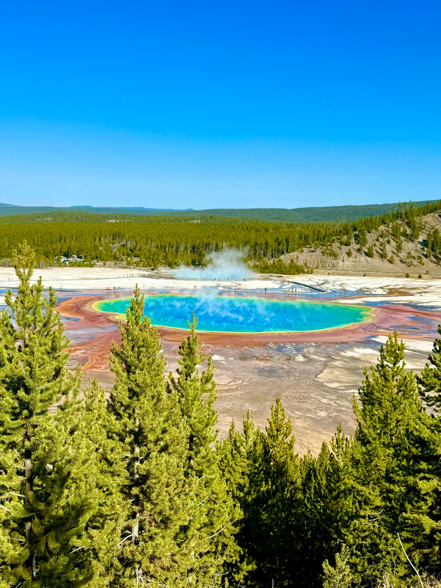
Yellowstone · Photo: David & Keri New
- 6.7 miDistance
- 3–5 hrTime
The numbers, with sources
Distance: 5.4 or 6.7 miles round trip, depending on approach Source
Gain: The NPS page doesn’t give this for the full hike Source
Time: 3-5 Hours Source
Difficulty: See the official route and surface descriptions; no separate rating added. Source
Trailhead: This trail is located in the western part of the park, with trailheads both north and south of Midway Geyser Basin. Source
Route type: out-and-back Source
Built from official sources (checked Nov 3, 2026). Confirm current conditions with the park.
Recreation.gov permits, entrances & campgrounds
Recreation.gov (RIDB). Booking records date not published. NPS guidance above takes precedence. A listing doesn’t mean you need a permit or that there’s space on your dates.
Park campground options (5)
These records belong to the park’s NPS recreation area. We haven’t checked how close these are to the trail, when they open or whether sites are free; check the map and the booking page.
Mammoth Campground (Yellowstone) — Campground; RIDB reservable: yes. Season: not published in structured RIDB data. Recreation.gov (RIDB) source · Booking details
NPS reservation guidance: Sites are reservation-only from early April to mid-October and first-come, first-served from mid-October to late March on Recreation.gov. Individual campsites at this campground can be reserved up to six months in advance. Reservations open on a rolling basis, meaning you can book your site exactly six months before the date of your stay, as long as reservations are available for that time. NPS source
Slough Creek Campground — Campground; RIDB reservable: yes. Season: not published in structured RIDB data. Recreation.gov (RIDB) source · Booking details
NPS reservation guidance: All sites are reservable on Recreation.gov. NPS source
Tower Fall Campground — Campground; RIDB reservable: yes. Season: not published in structured RIDB data. Recreation.gov (RIDB) source · Booking details
NPS reservation guidance: All sites are reservable on Recreation.gov. NPS source
Indian Creek Campground (WY) — Campground; RIDB reservable: yes. Season: not published in structured RIDB data. Recreation.gov (RIDB) source · Booking details
NPS reservation guidance: All sites are reservable on Recreation.gov. NPS source
Lewis Lake Campground — Campground; RIDB reservable: yes. Season: not published in structured RIDB data. Recreation.gov (RIDB) source · Booking details
NPS reservation guidance: All sites are reservable on Recreation.gov. Eighty percent of sites are reservable six months in advance, while the remaining 20% of sites are available two weeks in advance. NPS source
Route, junction by junction
Choose a Fairy Falls trailhead →
Fairy Falls Parking Lot or Fountain Flat Drive: 5.4 or 6.7 miles round trip, depending on which you pick. Source
Trailhead → Fairy Falls
Follow the Fairy Falls trail to the falls. The NPS doesn’t give junction-by-junction mileage. Source
Fairy Falls → back to your trailhead
Return the way you came. Spray and Imperial geysers are an optional add-on. Source
No elevation profile yet:
No elevation profile yet: we haven’t verified complete measurements for this route. Source
In-depth guide
Compiled from linked sources, checked Nov 3, 2026. Each paragraph links to its source.
Decisions & preparation
Distances are shown only where the NPS gives them. Source
Turnaround & return planning
Turn back at the falls, or sooner if the group is running low on energy, water or daylight. Planning basis
Parking & transport timing
Western part of the park, with trailheads north and south of Midway Geyser Basin. Parking is very limited and the NPS doesn’t say when it fills. Source
What to bring by season
All seasons: the NPS Ten Essentials (navigation, sun protection, extra clothing, a light, first aid, fire supplies where allowed, repair tools, extra food, water and emergency shelter), plus bear spray. Tell someone your route and when you’ll be back. Source
Warm weather: sun protection, plenty of water and extra food. Cold or wet weather: warm layers, rain gear and extra clothing in case you’re out longer than planned. Source
Children & mobility
The NPS doesn’t publish accessibility details for this trail. Source
Is this hike for you?
Fairy Falls is 200 feet (61 m) high, one of Yellowstone’s biggest waterfalls. It’s a there-and-back hike of either 5.4 miles (8.6 km) or 6.7 miles (10.7 km), depending on which trailhead you use. The NPS allows 3-5 hours and doesn’t give an elevation gain. Source · Source 2 · Source 3
The trail
The last 1.6 miles (2.6 km) to the falls go through a young lodgepole pine forest. You can continue 0.6 miles (0.97 km) to Spray and Imperial geysers, which adds 1.2 miles (1.9 km) to the hike. Come back the same way. Source
Getting to the trailhead
There are two trailheads, north and south of Midway Geyser Basin in the western part of the park. Park either at the end of Fountain Flat Drive or at the Fairy Falls Parking Lot, 1 mile (1.6 km) south of Midway Geyser Basin. Parking is very limited. Source
When we checked, a park alert said most park roads were closed to all vehicles ahead of the winter snowcoach and snowmobile season, which begins December 15 (weather depending). Only the road between the North and Northeast entrances stays open to regular vehicles all year. Check current alerts and road status before you go. Source
Bears and other animals
Grizzly and black bears live throughout Yellowstone. Hike in groups of 3 or more and stay together, make noise as you go, and carry bear spray where you can reach it, not inside your pack. Avoid dead animals and watch for scratches on trees, tracks, scat and dig sites. Stay 100 yards (91 m) from bears and wolves and 25 yards (23 m) from all other animals. Bison and elk have injured people. Source
Don’t hike after dark, carry a map and water, and tell someone where you’re going and when you’ll be back. Off-trail travel is prohibited in thermal areas. Source · Source 2
Permits and fees
The NPS says this hike doesn’t need a reservation. The private-vehicle entrance fee is $35.00, for unlimited entry over seven consecutive days in a private vehicle that seats 15 or less. Source · Source 2
Kids, dogs and wheelchairs
Pets aren’t allowed on this trail. The NPS doesn’t publish accessibility details for it. The NPS lists the hike for winter, summer and fall. Source · Source 2 · Source 3
Before you go
Before you start, decide if you’ll stop at the falls or go on to the geysers, and turn back early if the group is slower than expected. There’s no elevation profile yet. Source · Source 2
Sources & planning limits
Reviewed 2026-11-03. Check current conditions for your trip dates.
- Check access and services with the NPS for your travel date. Source
- NPS details are as of the date shown. Confirm access, services and reservations for your travel date. Source
- The NPS doesn’t say whether this trail suits kids or people with limited mobility. Source
- No elevation profile yet: we haven’t verified complete measurements for this route. Source
Getting there and back
This trail is located in the western part of the park, with trailheads both north and south of Midway Geyser Basin. Source
Return: Complete the return arrangement described for this route. The activity lists two complete return distances and a 1.6-mile forest segment. They measure different things. A separate NPS trailhead page describes a 4.5-mile walk there and back. Do not combine the forest segment and a road-location distance into a new total; verify the current map for the chosen start. Source
Water
Safety notes: Carry water and be aware of wildlife. Source
Hazards
Season
NPS activity season tags: Winter, Summer, Fall. Source
NPS activity season tags: Winter, Summer, Fall. Source
Gear & rules
The NPS activity marks pets permitted: false. Source
Filling a gap in your kit? Compare these packing essentials on Amazon. Choose gear for your route, conditions and the park’s guidance.
As an Amazon Associate we earn from qualifying purchases. How this works
Safety notes: Carry water and be aware of wildlife. Source
Questions
Which hike is this?
Choose between the Fountain Flat Drive approach and the Fairy Falls Parking Lot approach before departure. The destination is Fairy Falls; Spray and Imperial geysers are optional extensions. Source
Are the published figures fully consistent?
The activity lists two complete return distances and a 1.6-mile forest segment. They measure different things. A separate NPS trailhead page describes a 4.5-mile walk there and back. Do not combine the forest segment and a road-location distance into a new total; verify the current map for the chosen start. Source
Is there an elevation profile?
No elevation profile: the NPS gives two different distances for the full approach, and its trailhead page gives a third. The export contains numerous Fairy Falls segments, but a complete ordered line for a particular published approach has not been verified. Source
Alternatives
More Yellowstone trail guides
- Bunsen PeakStrenuous
- Grand Prismatic Overlook Trail1.2 mi · Easy
- Lone Star Geyser Trail4.8 mi · Easy
- Mount Washburn from Dunraven Pass6 mi · Strenuous
- Mystic FallsModerate
- Old Faithful to Morning Glory Pool2 mi · Easy
- Storm Point Trail2.3 mi · Easy
- Trout LakeEasy