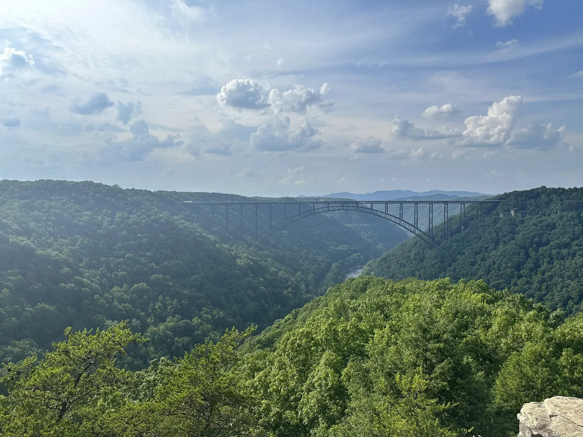
Endless Wall Trail
Labeled (3) on the Fayetteville - Lansing Area Trails map; LENGTH: 2.4 miles/3.86 km (One-way). DIFFICULTY: Moderate. TRAIL TYPE: Hiking only. The Endless Wall Trail is a 2.4 mile moderate walk that passes through rich forest, crosses Fern Creek, then zig-zags along the cliff edge. Many vistas can be seen along the trail.
New River Gorge · Photo: David & Keri New
- 2.4 mi one wayDistance
- ModerateDifficulty
The numbers, with sources
Distance: 2.4 miles one way; NPS also describes a 0.5-mile road return. Source
Gain: The NPS doesn’t publish the elevation gain. Source
Time: No official duration confirmed for this exact route. Source
Difficulty: Easy to moderate in detailed NPS text Source
Trailhead: Use the signed trailhead named on the NPS trail page. Source
Route type: point-to-point Source
Built from official sources (checked Nov 3, 2026). Confirm current conditions with the park.
Recreation.gov permits, entrances & campgrounds
Recreation.gov (RIDB). Booking records date not published. NPS guidance above takes precedence. A listing doesn’t mean you need a permit or that there’s space on your dates.
Nearby campground records
Within 10 straight-line miles of the trailhead. Distances are straight-line from map coordinates, not driving distances.
- Brooklyn Campground: approximately 5.3 miles straight line. RIDB coordinates · Mapped route source
Park campground options (6)
These records belong to the park’s NPS recreation area. We haven’t checked how close these are to the trail, when they open or whether sites are free; check the map and the booking page.
Grandview Playground Shelter — Campground; RIDB reservable: yes. Season: not published in structured RIDB data. Recreation.gov (RIDB) source · Booking details
Grandview Shelter 4 — Campground; RIDB reservable: yes. Season: not published in structured RIDB data. Recreation.gov (RIDB) source · Booking details
Grandview Shelter 2 — Campground; RIDB reservable: yes. Season: not published in structured RIDB data. Recreation.gov (RIDB) source · Booking details
Grandview Shelter 1 — Campground; RIDB reservable: yes. Season: not published in structured RIDB data. Recreation.gov (RIDB) source · Booking details
Grandview Shelter 3 — Campground; RIDB reservable: yes. Season: not published in structured RIDB data. Recreation.gov (RIDB) source · Booking details
Brooklyn Campground — Campground; RIDB reservable: no. Season: not published in structured RIDB data. Recreation.gov (RIDB) source
NPS reservation guidance: All sites are managed on a first-come, first-served basis and reservations are not accepted. NPS source
Route, junction by junction
Trailhead → Selected destination or loop
The trail passes through forest, crosses Fern Creek and follows the cliff edge to gorge viewpoints. Unprotected edges deserve attention even when the walking feels moderate. NPS gives a half-mile walk along the road to return after completing the trail. Include that road segment in the plan instead of assuming a closed walking loop. Source
No elevation profile: we only draw one from a mapped route we can verify. Route source
In-depth guide
Compiled from linked sources, checked Nov 2, 2026. Each paragraph links to its source.
Is this hike for you?
Endless Wall is 2.4 miles (3.86 km) one way through forest, across Fern Creek and then zig-zagging along the cliff edge above the gorge, with views of the New River almost 1000 feet below. The NPS rates it easy to moderate, lists it as hiking only and doesn’t give a hiking time. Most people turn around at the overlook at Diamond Point, which makes a popular two-mile out-and-back from the Fern Creek Trailhead. If you hike the whole thing, you finish at the other trailhead and walk 0.5 miles back along the road. Source
The trail
There are views all along the trail, and you can often hear whitewater rafters on the rapids of the lower New. You may also see some of the thousands of rock climbers who come for the park’s more than 1600 climbing routes on the sandstone walls. The area was the site of the Nuttallburg Mine, the largest mine in the New River Coalfields in the late 1800s. Be careful near the cliff edges. Stay on the trail and leave what you find. It’s trail (3) on the Fayetteville - Lansing Area Trails map. Source
Getting to the trailhead
Turn off Route 19 onto Lansing-Edmond Road, just north of the Canyon Rim Visitor Center. It’s a narrow road, so drive carefully. Fern Creek Trailhead is 1.3 miles down it, just before Fern Creek, and the Nuttall Trailhead at the other end of the trail is 1.8 miles from U.S. Route 19. The Fern Creek lot is small and often full. Don’t park on the road; cars on Lansing Edmond Road can be towed. Instead, try the Nuttall Trailhead 1/2 mile further up the road. Starting there reverses the hike, so agree on where you’re finishing before you split up. Source
Distance and elevation
The NPS lists 427 feet of total elevation gain and 545 feet of loss, with an average slope of 7.9%, but doesn’t say which direction those numbers are for. Source
There’s no elevation profile yet: the NPS trail map line comes from its trail data and USGS 3DEP terrain, but we haven’t verified complete measurements for this route. Source
Before you go
The NPS doesn’t give a season for this trail. Check the park’s current alerts and the forecast before you head out, and look at the signs at the trailhead. If the trail is closed, pick another hike. Source · Source 2
Decide where you’ll turn around, and how you’re getting back to your car, before you start. If the group is slower than you expected, turn back early and stay together. Source
Water and food
The NPS doesn’t list water or restrooms on the trail. Bring all the water you’ll need, plus snacks, a layer and any medication. Source
Kids, strollers and wheelchairs
The NPS doesn’t rate this trail for strollers or wheelchairs and doesn’t give a minimum age. The open cliff edges are worth thinking about with young kids. Source
Getting there and back
Check the official map for where the trail starts. Source
Return: Come back the way described above. Return along the same trail unless a separate transport plan has been confirmed. Source
Water
No complete route-specific drinking-water or restroom schedule confirmed. Carry water for the whole hike. Source
Hazards
Read the NPS trail page and current conditions before you go. Source
Season
Use current official conditions; activity season labels are not a guarantee of access. Source
Current trail conditions require a trip-date check. Source
Gear & rules
Follow current signs and closures, and treat any side trip as a separate decision. Source
Filling a gap in your kit? Compare these packing essentials on Amazon. Choose gear for your route, conditions and the park’s guidance.
As an Amazon Associate we earn from qualifying purchases. How this works
The NPS doesn’t publish a pet rule for this exact route. Confirm the applicable rule before bringing an animal. Source
Questions
Which route do these figures describe?
2.4 miles one way; NPS also describes a 0.5-mile road return. Choose between the complete one-way trail and the shorter Diamond Point return before leaving Fern Creek. NPS identifies Diamond Point as a useful turnaround for a popular two-mile out-and-back. The full 2.4-mile trail ends elsewhere and requires a separate return plan; its road return is not part of the forest trail mileage. Source
Is the trail open right now?
No. NPS details as of Nov 3, 2026. Confirm current conditions and closures with NPS. Source
Is there a measured elevation profile?
Official NPS trail geometry sampled with USGS 3DEP terrain; no mileage or gain scaling. NPS publishes 2.40 mi one way; the traced line measures 2.23 mi. The difference is unresolved. Source
Alternatives
Fern Creek parking is small and often full. The NPS says not to park on Lansing-Edmond Road because cars may be towed. Nuttall Trailhead is an alternative at the opposite end. Switching trailheads changes the order of the walk and where you get picked up, so agree on the finish before your group splits up. Source
More New River Gorge trail guides
- Long Point Trail1.6 mi one way · Moderate