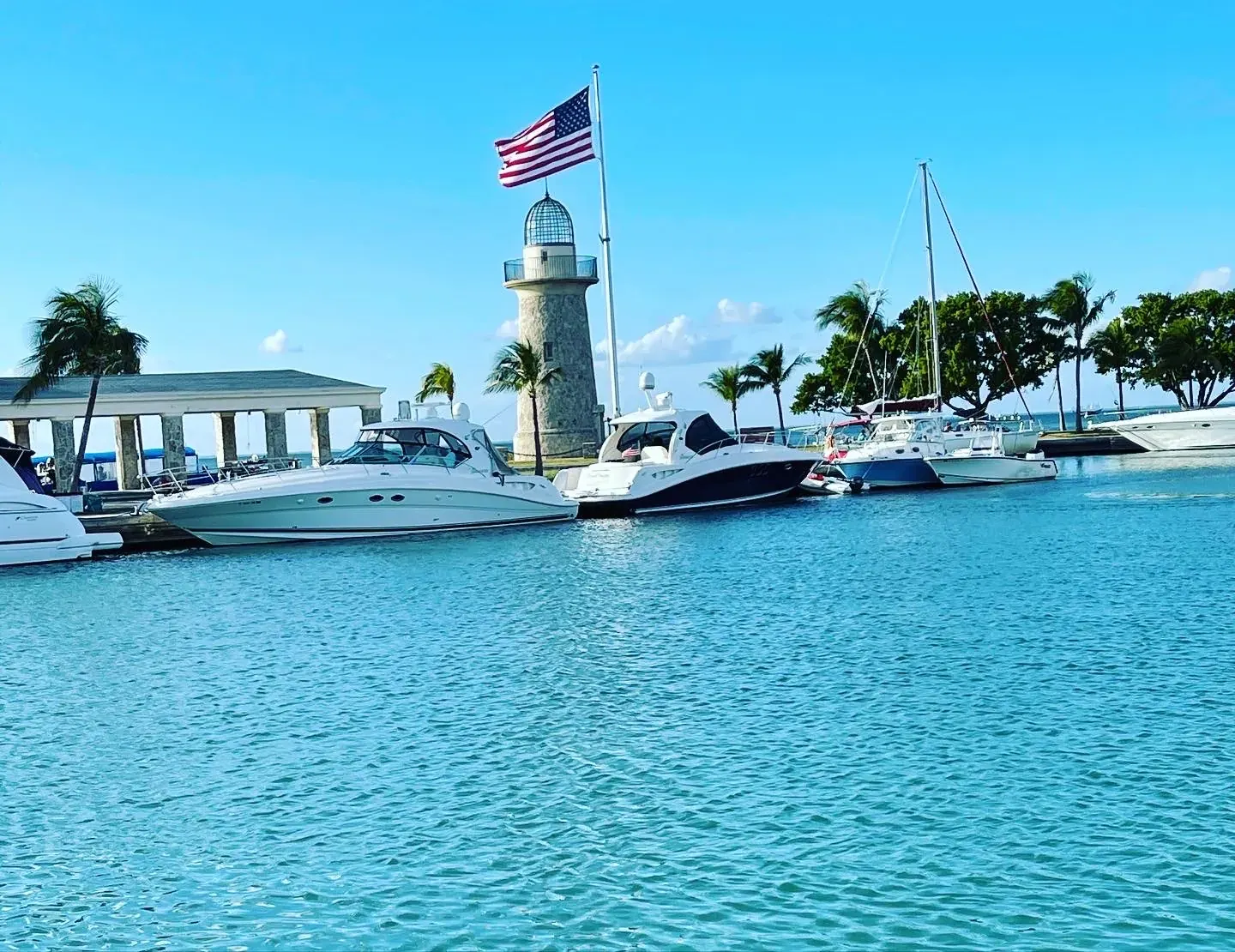
Convoy Point Jetty Walk
A mainland boardwalk-and-jetty walk with ten NPS interpretive stations, starting at the Dante Fascell Visitor Center.
Biscayne · Photo: David & Keri New
- 0.8 miDistance
- EasyDifficulty
The numbers, with sources
Distance: 0.8 mile round trip from the visitor center compass rose. Source
Gain: Not published for this walk. We don’t guess a total climb. Source
Time: Self-paced; no route-specific duration confirmed. Source
Difficulty: Wheelchair and mobility-device accessible according to NPS; mostly wooden boardwalk with a compact natural surface at stations 7–10. Puddles may form after rain and benches provide rest stops. Source
Trailhead: Compass rose, first floor of Dante Fascell Visitor Center Source
Route type: out-and-back Source
Built from official sources (checked Nov 2, 2026). Confirm current conditions with the park.
Recreation.gov permits, entrances & campgrounds
Recreation.gov (RIDB). Booking records date not published. NPS guidance above takes precedence. A listing doesn’t mean you need a permit or that there’s space on your dates.
Park campground options (2)
These records belong to the park’s NPS recreation area. We haven’t checked how close these are to the trail, when they open or whether sites are free; check the map and the booking page.
Elliot Key Campground — Campground; RIDB reservable: yes. Season: not published in structured RIDB data. Recreation.gov (RIDB) source · Booking details
Boca Chita Campground — Campground; RIDB reservable: yes. Season: not published in structured RIDB data. Recreation.gov (RIDB) source · Booking details
NPS reservation guidance: No reservations may be made in advance for the main campgrounds. The campgrounds are available on a first-come, first-served basis. NPS source
Route, junction by junction
Visitor center compass rose → Fish Wall
Walk southwest toward the Fish Wall and stop before the road. This is station 2; individual station distances are not published. Source
Fish Wall → canoe launch and flagpole crossroads
Do not cross the road. Follow the sidewalk right, generally northwest, to the canoe ramp and Jetty Walk start. Follow the waterfront east to the flagpole intersection. Source
Flagpole crossroads → jetty bend and bridge
Continue east to the nearly right-angle bend, then follow the trail south/southeast onto the bridge. Stop midway for the bay view. Source
Bridge → west-end benches
Continue to the south end of the bridge to see mangroves. Turn right at its end and follow the trail to the west-end benches. Source
West-end benches → east end and return
Head east along the jetty to its end. Walk back the same way to the visitor center for the published 0.8 miles. It’s not a loop. Source
No elevation profile yet:
No verified continuous NPS GIS line has been assembled for this exact selected walk and endpoints. No synthetic or flat elevation profile is substituted. Source
In-depth guide
Compiled from linked sources, checked Nov 3, 2026. Each paragraph links to its source.
Decisions & preparation
Distances are shown only where the NPS gives them. Source
Turnaround & return planning
Turn around at the end of the jetty, or anywhere earlier that suits your group. Planning basis
Parking & transport timing
Convoy Point grounds: 7 am–5:30 pm; visitor center: 9 am–5 pm. Four designated accessible parking spaces. The Homestead trolley is wheelchair accessible; check its timetable. The NPS doesn’t say when parking fills. Source
What to bring by season
Water, sun protection and clothes for changing weather, plus a light in case you’re out later than planned. Source
Check current conditions. The NPS doesn’t list seasonal closures. Source
Children & mobility
Wheelchair and mobility-device accessible, according to the NPS. Mostly wooden boardwalk, with a compact natural surface at stations 7–10 that can puddle after rain. Benches along the way. Source
Is this walk for you?
The Jetty Walk at Convoy Point is a 0.8 mile round trip on the mainland, starting and ending at the compass rose inside the Dante Fascell Visitor Center. It’s out-and-back, mostly on wooden boardwalk. The NPS self-guided walk has numbered stations, but there are no markers on the ground, so download or save the guide before you start. Source
The walk
Start at the compass rose on the first floor; the guide’s directions use north, south, east and west throughout. Walk southwest to the Fish Wall, which shows fish found in the park, and stop before the road. Don’t cross it. Follow the sidewalk around to the right (roughly northwest, along the grass) to the trailhead by the canoe ramp, the third station, then follow the Jetty Trail east along the water to the intersection by the American flagpole. Source
Keep going east beside the water to a nearly right-angle bend, then turn south/southeast onto the bridge. The middle is a quiet spot to look across Biscayne Bay, and from the south end you’ll see mangroves on both sides. Turn right at the end of the bridge to reach benches at the west end of the Jetty Trail, a place to listen to the park’s sounds. Then head east to the end of the jetty, where stations 9 and 10 are, and return the same way. You can turn around earlier at the benches or any station. Source
The islands across the bay aren’t connected by this trail; Boca Chita and Elliott Key are reachable only by boat, and the underwater Maritime Heritage Trail is a separate boat-and-water trip. Source
Hours, parking and the trolley
The Convoy Point grounds are open 7 am–5:30 pm and the visitor center 9 am–5 pm daily; the grounds close later than the visitor center. There are four designated accessible parking spaces. Homestead’s free trolley has a Biscayne stop and several pickup points; the NPS says its vehicles are wheelchair accessible and recommends reservations. It doesn’t give a timetable, so check the city’s service dates and return times. Source
Kids, strollers and wheelchairs
The NPS says the Jetty Walk is accessible by wheelchair and other mobility devices. It’s mostly boardwalk; around stations 7–10 the surface is compact natural material that can hold shallow puddles after rain. There are benches to rest on. Source
Inside, the visitor center has Junior Ranger booklets for different ages and abilities, ramp and elevator access, automatic doors and ADA-compliant restrooms. Films have wheelchair seating and open captions, and audio enhancement is available on request. It’s a good fallback if a child tires before the end of the jetty. Source
What to bring
Water, sun protection and clothes for changing weather. Add rain gear and a warm layer in rain or cooler weather. Source
Sources & planning limits
Reviewed Nov 3, 2026. Check current conditions for your trip dates.
- No elevation profile yet, and the NPS doesn’t say when parking fills.
Getting there and back
Convoy Point grounds: posted 7 am–5:30 pm; visitor center: 9 am–5 pm. Four designated accessible parking spaces. The Homestead trolley is wheelchair accessible; confirm its separate timetable. The NPS doesn’t say when parking fills. Source
Return: Walk back the same way to where you started. Longer paths and ticketed activities are separate. Source
Water
Bring drinking water. We can’t promise a refill along the way. Source
Hazards
Wheelchair and mobility-device accessible according to NPS; mostly wooden boardwalk with a compact natural surface at stations 7–10. Puddles may form after rain and benches provide rest stops. Source
Season
Check current conditions and operating hours before travel. Source
Check current conditions; we don’t have a closure calendar for this trail. Source
Gear & rules
Use open, designated paths and follow posted closures. Source
Filling a gap in your kit? Compare these packing essentials on Amazon. Choose gear for your route, conditions and the park’s guidance.
As an Amazon Associate we earn from qualifying purchases. How this works
Carry water, sun protection and clothing for changing weather. Keep navigation and a light available for an unexpected delay. Source
Questions
Is this a fixed-distance backcountry hike?
0.8 mile round trip from the visitor center compass rose. Source