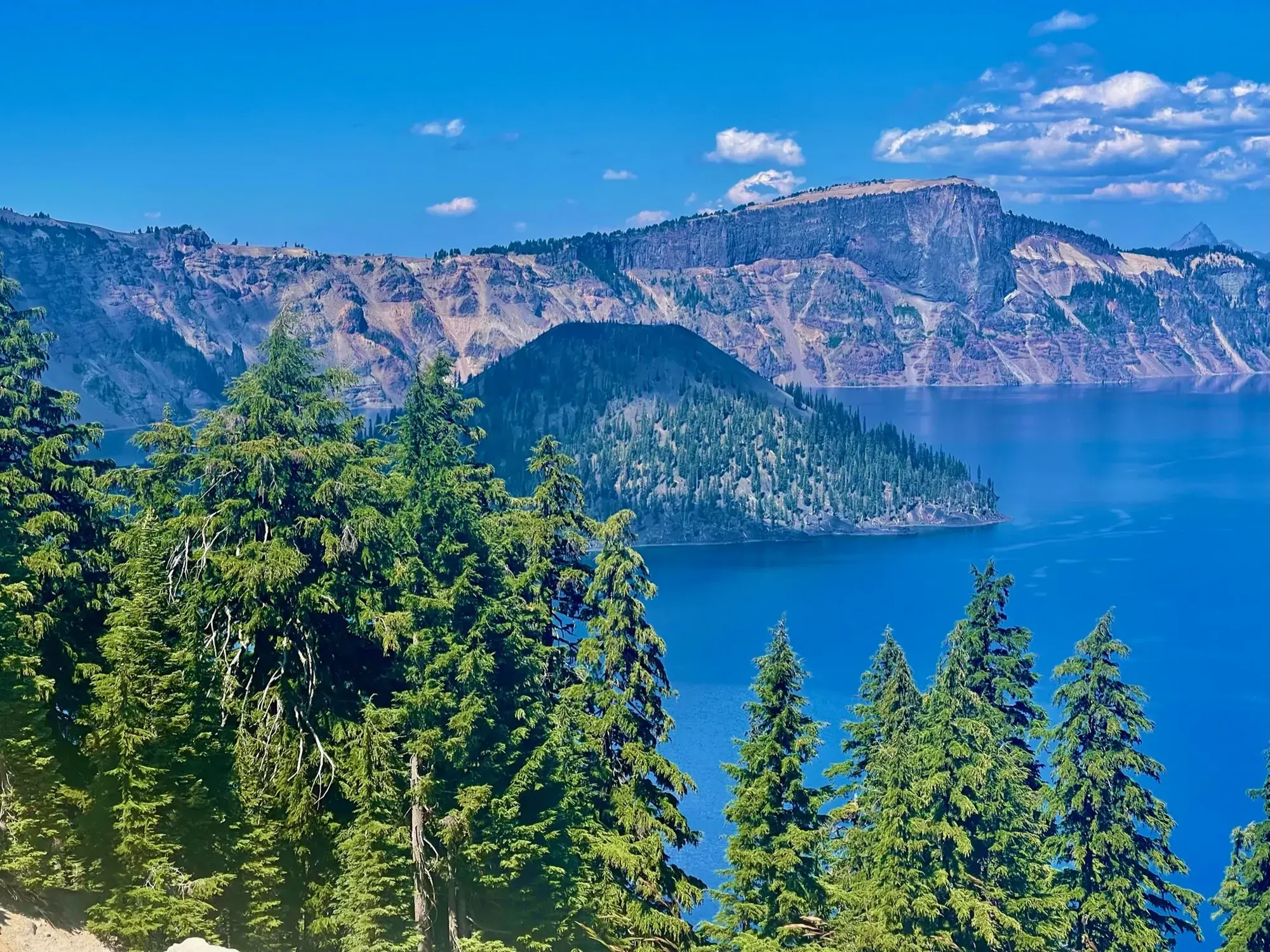
Cleetwood Cove Trail
The NPS listed it as closed for rehabilitation when we last checked. This page is for planning a future trip. It doesn’t mean the trail is open.
Crater Lake · Photo: David & Keri New
- 2.2 miDistance
- 700 ftElevation gain
- StrenuousDifficulty
The numbers, with sources
Distance: 2.2 miles round trip; 1.1-mile descent. Source
Gain: 700 feet down on the way in, then the climb back out. That’s not a measured total climb. Source
Time: The NPS doesn’t give a hiking time. Source
Difficulty: Steep and strenuous, with loose crushed-pumice footing when dry. Source
Trailhead: Cleetwood Cove Trailhead; current access is closed according to the NPS alert. Source
Route type: out-and-back Source
Built from official sources (checked Nov 3, 2026). Confirm current conditions with the park.
Recreation.gov permits, entrances & campgrounds
Recreation.gov (RIDB). Booking records date not published. NPS guidance above takes precedence. A listing doesn’t mean you need a permit or that there’s space on your dates.
Nearby campground records
Within 10 straight-line miles of the trailhead. Distances are straight-line from map coordinates, not driving distances.
- Lost Creek Campground: approximately 7.3 miles straight line. RIDB coordinates · Mapped route source
Park campground options (2)
These records belong to the park’s NPS recreation area. We haven’t checked how close these are to the trail, when they open or whether sites are free; check the map and the booking page.
Lost Creek Campground — Campground; RIDB reservable: no. Season: not published in structured RIDB data. Recreation.gov (RIDB) source
NPS reservation guidance: Lost Creek Campground has 16 sites for tents only. Registration is self-serve on the day of arrival. No advance registration is available. Payment can be made by check or exact cash. Credit cards are not accepted. Senior and Access pass holders are eligible for a 50% discount. The only means of knowing site availability is upon arrival at the campground. The campground typically fills up, so arrive early to secure a site. NPS source
Mazama Village Campground — Campground; RIDB reservable: yes. Season: not published in structured RIDB data. Recreation.gov (RIDB) source · Booking details
NPS reservation guidance: From the opening date (dependent on snow removal), all accessible sites are first come first serve through June 30. From July through September, all sites are available by reservation only, online (reservation button below). If no tent sites are available, tent campers may reserve an RV site at the posted fee for that site. Parking areas at tent sites cannot accommodate RVs, so RV campers may not rent tent sites. For complete details use the reservation button to go rec.gov or go to the ExplorUS website at https://explorecraterlake.com/stay-at-crater-lake/mazama-campground/. NPS source
Route, junction by junction
Trailhead → Cleetwood Cove Trail
For future planning only: follow long switchbacks down to the lakeshore and retrace them to the rim. Source
No elevation profile: we only draw one from a mapped route we can verify. Route source
In-depth guide
Compiled from linked sources, checked Nov 2, 2026. Each paragraph links to its source.
Is this hike for you?
The Cleetwood Cove Trail is closed for construction while the NPS rehabilitates the trail and marina. Check the park’s current information before you plan on it. Source
When it’s open, it’s a steep, strenuous hike down to the lake: the trail drops 700 feet (213 meters) in 1.1 miles (1.7 km) through long switchbacks, and the round trip is 2.2 miles. The shore is the halfway point, and all the climbing is on the way back. The NPS compares the walk up to climbing 65 flights of stairs. Source
The trail
The surface is crushed pumice, like fine sand, and it’s loose and slippery when dry. The trail is only partly shaded, and it ends at a boulder-strewn lakeshore with no shade and no beach. Stay on the switchbacks: cutting them damages fragile plants and can send rocks and loose soil onto people below. Source
Elevation, air temperature, trail dust and smoke from local fires can all make the climb back harder. The NPS suggests frequent rests, drinking water, eating a snack and knowing your limits. Source
Kids, strollers and wheelchairs
The NPS recommends good cardiovascular and physical fitness and doesn’t recommend this trail for people with mobility or health concerns. It doesn’t give a minimum age. Source
Before you go
We don’t list boat tours, fees, parking, hours or restrooms at the lake for this trail. Check current NPS information once it reopens. Source
Elevation
Our elevation chart uses the NPS trail line for Cleetwood Cove with USGS 3DEP terrain data, drawn from the rim down to the shore. That line measures 1.01 miles, with elevations from about 6,187 to 6,820 feet, about 14 feet of climbing and 635 feet of descent on the way down. The chart is smoothed over a fifty-meter window and skips rises under three meters, so short steps and small bumps may not show. Source · Source 2
Sources & planning limits
Reviewed 2026-11-03. Check current conditions for your trip dates.
- NPS details are as of the date shown. Confirm access, transport and services for your travel date. Source
- We haven’t confirmed current permit, reservation or fee terms. Check NPS for your travel date. Source
- We haven’t verified this point. Check the linked NPS page for anything your trip depends on. Source
- No elevation profile yet: we haven’t verified complete measurements for this route. Source
Getting there and back
Do not attempt while closed. The NPS reports construction rehabilitation of the trail and marina. Source
Return: The entire 700-foot descent must be climbed back to the rim; there is no easy return implied by reaching the shore. Source
Water
No amenity or refill claim is made from the web trail page; verify through current NPS facility information before a future visit. Source
No amenity or refill claim is made from the web trail page; verify through current NPS facility information before a future visit. Source
Hazards
Steep crushed pumice can be loose and slippery when dry. Source
Off-trail movement can dislodge rocks and soil onto visitors below. Source
The ascent remains after reaching the shoreline. Source
Season
Current closure overrides any general seasonal description. The NPS alert doesn’t give a reopening date. Source
Current closure overrides any general seasonal description. The NPS alert doesn’t give a reopening date. Source
Gear & rules
Respect the NPS closure. Source
Stay on the trail to protect fragile vegetation and avoid dislodging rocks. Source
Filling a gap in your kit? Compare these packing essentials on Amazon. Choose gear for your route, conditions and the park’s guidance.
As an Amazon Associate we earn from qualifying purchases. How this works
Respect the NPS closure. Source
Stay on the trail to protect fragile vegetation and avoid dislodging rocks. Source
Questions
Is the trail currently available?
No. The NPS listed it as closed for rehabilitation when we last checked. Check current status before you go. Source
Is the lake arrival the finish?
No. The return climbs back up the same steep switchbacks. Source
Alternatives
Camp near Cleetwood Cove Trail
Closest campgrounds by drive time to Cleetwood Cove Trailhead:
- 34 min Broken Arrow Campground ↗ (18.2 mi, USDA Forest Service)
- 37 min Mazama (17.2 mi, in the park)
- 38 min Diamond Lake ↗ (19.3 mi, USDA Forest Service)
- 44 min Thielsen View Campground ↗ (22.3 mi, USDA Forest Service)
- 52 min Clearwater Falls Campground ↗ (30.3 mi, USDA Forest Service)
Driving time with no traffic (OSRM, OpenStreetMap roads). Some park roads are shuttle-only in season. All camping near Crater Lake