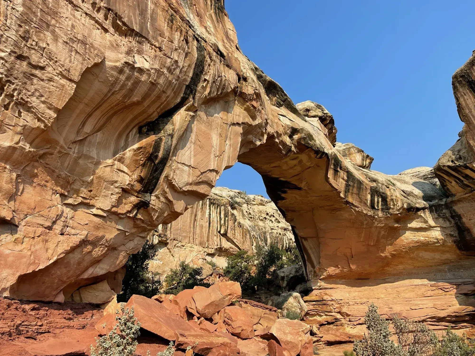
Cassidy Arch Trail
This page covers Cassidy Arch from the NPS list of strenuous trails. It does not include the Frying Pan connection or a longer combination with Cohab Canyon.
Capitol Reef · Photo: David & Keri New
- 1.7 mi one wayDistance
- 670 ftElevation gain
- StrenuousDifficulty
The numbers, with sources
Distance: 1.7 miles one way Source
Gain: 670 feet of elevation change Source
Time: The NPS does not publish a walking time for this route. Source
Difficulty: Hike a strenuous trail to view dramatic geologic formations and spectacular vistas. Source
Trailhead: The NPS listing doesn’t give driving directions or an exact trailhead. Source
Route type: out-and-back Source
Built from official sources (checked Nov 3, 2026). Confirm current conditions with the park.
Recreation.gov permits, entrances & campgrounds
Recreation.gov (RIDB). Booking records date not published. NPS guidance above takes precedence. A listing doesn’t mean you need a permit or that there’s space on your dates.
Nearby campground records
Within 10 straight-line miles of the trailhead. Distances are straight-line from map coordinates, not driving distances.
- FRUITA CAMPGROUND: approximately 2.2 miles straight line. RIDB coordinates · Mapped route source
- Capitol Reef Group Campground: approximately 2.3 miles straight line. RIDB coordinates · Mapped route source
Park campground options (4)
These records belong to the park’s NPS recreation area. We haven’t checked how close these are to the trail, when they open or whether sites are free; check the map and the booking page.
FRUITA CAMPGROUND — Campground; RIDB reservable: yes. Season: not published in structured RIDB data. Recreation.gov (RIDB) source · Booking details
NPS reservation guidance: The 71 site Fruita campground is the only developed campground in the park, offering picnic tables, fire rings, restrooms, water and a dump station. A $25 nightly fee is charged. It is open year-round. Campsites are reservable year-round; visit www.recreation.gov to make a reservation. Reservations are accepted 6 months ahead of time. The busy season is mid March through October when the campground is typically fully booked. In the winter, there is less demand and it is easy to secure a campsite. NPS source
Primitive campsites at Cedar Mesa Campground — Campground; RIDB reservable: no. Season: not published in structured RIDB data. Recreation.gov (RIDB) source
NPS reservation guidance: This primitive, no-fee campground has five (5) sites, each with a picnic table and fire grate. There is also a pit toilet, but no water is available. The campground is open year-round, but visitors should check with the Capitol Reef Visitor Center for road conditions prior to planning an overnight stay. No reservations; first-come, first-served. NPS source
Capitol Reef Group Campground — Campground; RIDB reservable: yes. Season: not published in structured RIDB data. Recreation.gov (RIDB) source · Booking details
NPS reservation guidance: The Group Campsite is a secluded site located near the Fruita Campground. It may be reserved through www.recreation.gov. The Group Campsite is reservable on a 12-month rolling basis starting the day of arrival. For example, on April 20, 2021 campsite availability will be released through April 20, 2022. This change is designed to allow the users greater flexibility with their bookings needs. NPS source
Primitive campsites at Cathedral Campground — Campground; RIDB reservable: no. Season: not published in structured RIDB data. Recreation.gov (RIDB) source
NPS reservation guidance: About 36 miles (57.9 km) from the visitor center, this primitive, no-fee campground has six (6) sites, each with a picnic table and fire grate. There is a pit toilet, but no water available. The campground is open year-round, but could be inaccessible due to weather. Visitors should check road conditions with the Capitol Reef Visitor Center (or call the information line) prior to planning an overnight stay. The campground is at approximately 7,000 feet (2,133 m) in elevation, in the Pinyon/Juniper-clad foothills of Thousand Lake Mountain. No reservations; first-come, first-served. NPS source
Route, junction by junction
Selected start → Selected destination
This page covers Cassidy Arch from the NPS list of strenuous trails. It does not include the Frying Pan connection or a longer combination with Cohab Canyon. Source
No elevation profile: we only draw one from a mapped route we can verify. Route source
In-depth guide
Compiled from linked sources, checked Nov 2, 2026. Each paragraph links to its source.
Is this hike for you?
Cassidy Arch Trail is 1.7 miles (2.8 km) one way, with an elevation change of 670 feet (204 m), to a natural arch and canyon views. The NPS lists it among the park’s strenuous trails and doesn’t give a hiking time. You come back the same way, so plan for the full round trip. Source
Distance and elevation
The 670 feet is the NPS’s elevation change, not a total climb, and the 1.7 miles is one way. Source
There’s no elevation profile yet: the NPS trail map line comes from its trail data and USGS 3DEP terrain, but we haven’t verified complete measurements for this route. Source
Getting to the trailhead
The NPS page for this hike doesn’t give driving directions or an exact trailhead location. Check the park map or ask at the visitor center before you go. Source
Kids, strollers and wheelchairs
The surface is a mix of slickrock, packed dirt, stone steps and loose gravel, and none of it is paved. The NPS doesn’t rate the trail for kids, strollers or wheelchairs. Service animals are allowed. Source · Source 2
Before you go
The NPS lists this hike for winter, spring, summer and fall. Check current alerts before you go. For the Reef Ride Bike Days special event in 2027, the Scenic Drive closes to vehicles from sunrise to 3pm and is open only to bikes and pedestrians; the alert gives the dates as September 19 and 25 in its title and Saturday, September 18 and Saturday, September 25 in the text. The Fruita area and the main road through the park (UT highway 24) stay open. Source · Source 2
Decide where you’ll turn around before you start. If the group is slower than you expected, turn back early and stay together. Source
Water and food
The NPS doesn’t list water or restrooms on the trail. Bring all the water you’ll need for the round trip, plus snacks and a layer. Source
Dogs, permits and fees
The NPS page sends you to the Capitol Reef National Park pets page for pet rules, so check it before you bring a dog. Stay on the trail and respect signs and closures. Source
No reservation is needed. The park charges an entrance fee per vehicle: $20.00 for a private vehicle. Source · Source 2
Sources & planning limits
Reviewed 2026-11-03. Check current conditions for your trip dates.
- The NPS gives an elevation change for this trail, not a total climb. Source
- NPS details are as of the date shown. Confirm access, services and reservations for your travel date. Source
- The NPS doesn’t say whether this trail suits kids or people with limited mobility. Check its accessibility page before you choose it. Source
- We haven’t confirmed access, transport or services for any given date. Check with the NPS before you rely on them. Source
- No elevation profile yet: we haven’t verified complete measurements for this route. Source
Getting there and back
The NPS listing doesn’t give driving directions or an exact trailhead. Source
Return: Complete the return arrangement described for this route. NPS explicitly introduces these mileages as one way unless stated otherwise. So the 1.7 miles is only the way out, not the round trip. The NPS calls its vertical number elevation change, and we use that wording rather than calling it the total climb. Source
Water
Hazards
Season
NPS activity season tags: Winter, Spring, Summer, Fall. Source
NPS activity season tags: Winter, Spring, Summer, Fall. Source
Gear & rules
Vist the Pets page for Capitol Reef National Park to learn more. Source
Filling a gap in your kit? Compare these packing essentials on Amazon. Choose gear for your route, conditions and the park’s guidance.
As an Amazon Associate we earn from qualifying purchases. How this works
Questions
Which hike is this?
This page covers Cassidy Arch from the NPS list of strenuous trails. It does not include the Frying Pan connection or a longer combination with Cohab Canyon. Source
Are the published figures fully consistent?
NPS explicitly introduces these mileages as one way unless stated otherwise. So the 1.7 miles is only the way out, not the round trip. The NPS calls its vertical number elevation change, and we use that wording rather than calling it the total climb. Source
Is there an elevation profile?
Official NPS trail geometry sampled with USGS 3DEP. Partial profile: the Cassidy Arch corridor is shown; the parking approach is excluded. NPS publishes 1.70 mi one way; the traced line measures 1.47 mi. The difference is unresolved. The chart shows the mapped Cassidy Arch trail only, not the walk from parking. Source
Alternatives
Camp near Cassidy Arch Trail
Closest campgrounds by drive time to Grad Wash / Cassidy Arch Trailhead:
- 34 min Fruita Group Campsite (3.4 mi, in the park)
- 34 min Fruita (3.5 mi, in the park)
- 1 hr 6 min Sunglow Campground ↗ (24.1 mi, USDA Forest Service)
- 1 hr 12 min Singletree ↗ (26.8 mi, USDA Forest Service)
- 1 hr 20 min Oak Creek Rec Site (Boulder, UT) ↗ (32.7 mi, USDA Forest Service)
Driving time with no traffic (OSRM, OpenStreetMap roads). Some park roads are shuttle-only in season. All camping near Capitol Reef
More Capitol Reef trail guides
- Hickman Bridge Trail0.9 mi one way · Moderate