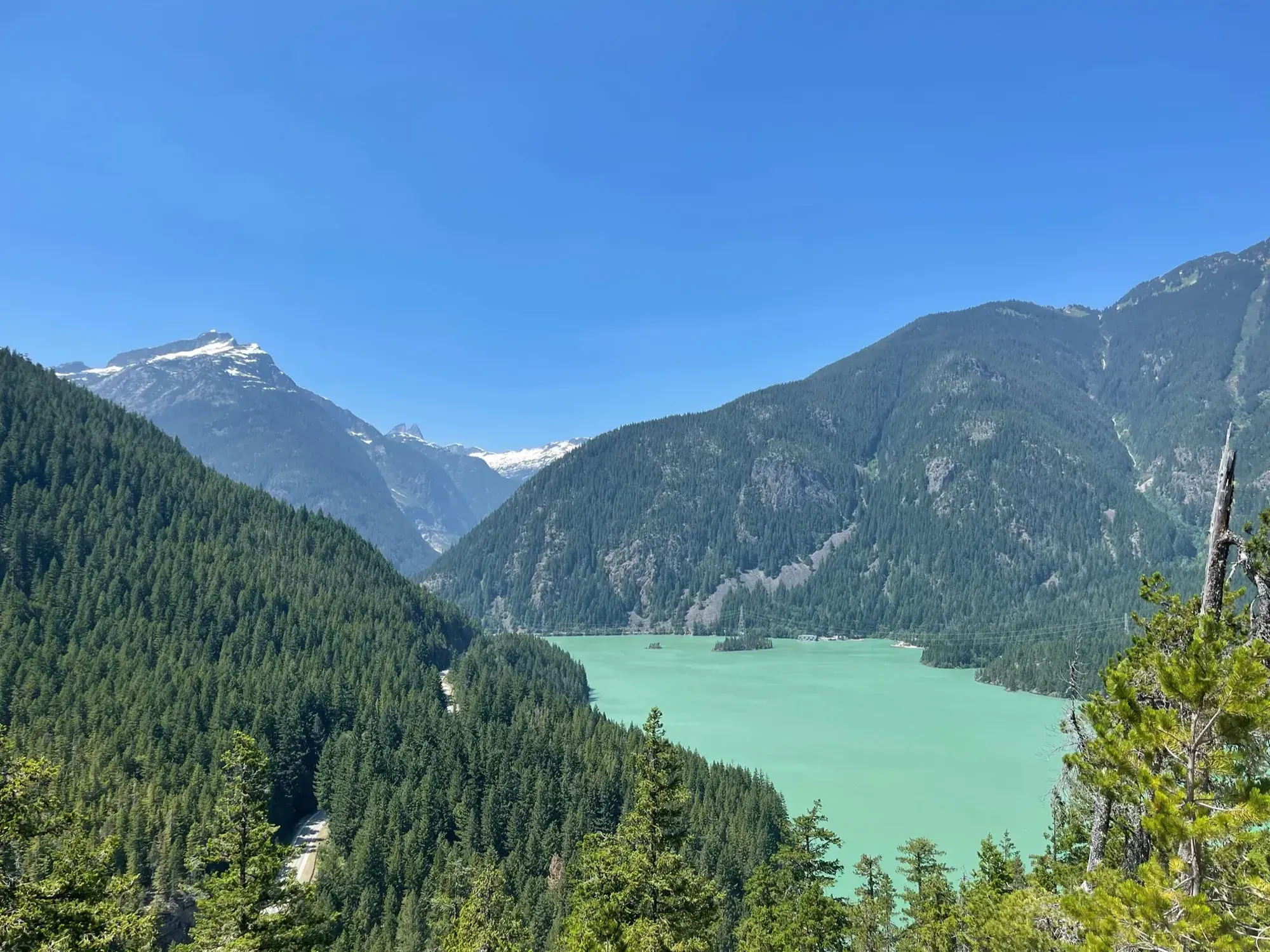
Cascade Pass Trail
Follow the forest switchbacks and meadow traverse to Cascade Pass, then return. The steep Sahale Arm continuation isn’t part of this hike.
North Cascades · Photo: David & Keri New
- 3.7 mi one wayDistance
- 1,700 ftElevation gain
- StrenuousDifficulty
The numbers, with sources
Distance: 3.7 miles one way to Cascade Pass Source
Gain: 1,700 feet of gain to Cascade Pass Source
Time: The NPS does not publish a walking time for this route. Source
Difficulty: Just to the east of the pass, the strenuous Sahale Arm Trail veers steeply north for another 2.2 miles (3.5 km) to the toe of the Sahale Glacier. Source
Trailhead: Cascade River Road from State Route 20 at Marblemount extends 23.1 miles to the trailhead; paved first third, then gravel with narrow and steep sections near the end. Source
Route type: out-and-back Source
Built from official sources (checked Nov 3, 2026). Confirm current conditions with the park.
Recreation.gov permits, entrances & campgrounds
Recreation.gov (RIDB). Booking records date not published. NPS guidance above takes precedence. A listing doesn’t mean you need a permit or that there’s space on your dates.
Park campground options (9)
These records belong to the park’s NPS recreation area. We haven’t checked how close these are to the trail, when they open or whether sites are free; check the map and the booking page.
Colonial Creek North Campground — Campground; RIDB reservable: yes. Season: not published in structured RIDB data. Recreation.gov (RIDB) source · Booking details
NPS reservation guidance: Reservations are required during the peak season for all campgrounds from late May through early September of each year. Campsite reservations are released in two different booking windows of 6 months in advance or 7 days in advance. Campsites can be reserved online or over the phone. To reserve campsites over the phone, call recreation.gov at (877) 444-6777. For changes to reservations contact the park at 360-854-7301. NPS source
LOWER GOODELL GROUP CAMPGROUND — Campground; RIDB reservable: yes. Season: not published in structured RIDB data. Recreation.gov (RIDB) source · Booking details
NPS reservation guidance: Reservations are required during the peak season for all campgrounds from late May through early September of each year. Group campsite reservations are released 12 months in advance. Campsites can be reserved online or over the phone. To reserve campsites over the phone, call recreation.gov at (877) 444-6777. For changes to reservations contact the park at 360-854-7301. NPS source
Hozomeen Campground — Campground; RIDB reservable: no. Season: not published in structured RIDB data. Recreation.gov (RIDB) source
NPS reservation guidance: Campsites are first-come, first-served. NPS source
Newhalem Creek Campground — Campground; RIDB reservable: yes. Season: not published in structured RIDB data. Recreation.gov (RIDB) source · Booking details
NPS reservation guidance: Reservations are required during the peak season for all campgrounds from late May through early September of each year. Individual campsite reservations are released in two different booking windows of 6 months in advance or 7 days in advance. Group campsite reservations are released 12 months in advance. Campsites can be reserved online or over the phone. To reserve campsites over the phone, call recreation.gov at (877) 444-6777. For changes to reservations contact the park at 360-854-7301. NPS source
Harlequin Campground — Campground; RIDB reservable: yes. Season: not published in structured RIDB data. Recreation.gov (RIDB) source · Booking details
NPS reservation guidance: Harlequin Campground sites are reservable 2-180 days in advance at www.recreation.gov or by calling 1-877-444-6777. NPS source
UPPER GOODELL GROUP CAMPGROUND — Campground; RIDB reservable: yes. Season: not published in structured RIDB data. Recreation.gov (RIDB) source · Booking details
Goodell Creek Campground — Campground; RIDB reservable: yes. Season: not published in structured RIDB data. Recreation.gov (RIDB) source · Booking details
NPS reservation guidance: Reservations are required during the peak season for all campgrounds from late May through early September of each year. Reservations are released in two different booking windows of 6 months in advance or 7 days in advance. Campsites can be reserved online or over the phone. To reserve campsites over the phone, call recreation.gov at (877) 444-6777. NPS source
Gorge Lake Campground — Campground; RIDB reservable: yes. Season: not published in structured RIDB data. Recreation.gov (RIDB) source · Booking details
NPS reservation guidance: Reservations are required during the peak season for all campgrounds from late May through early September of each year. Campsite reservations are available 6 months in advance. Campsites can be reserved online or over the phone. To reserve campsites over the phone, call recreation.gov at (877) 444-6777. For changes to reservations contact the park at 360-854-7301. NPS source
Colonial Creek South Campground — Campground; RIDB reservable: yes. Season: not published in structured RIDB data. Recreation.gov (RIDB) source · Booking details
NPS reservation guidance: Reservations are required during the peak season for all campgrounds from late May through early September of each year. Campsite reservations are released in two different booking windows of 6 months in advance or 7 days in advance. Campsites can be reserved online or over the phone. To reserve campsites over the phone, call recreation.gov at (877) 444-6777. For changes to reservations contact the park at 360-854-7301. NPS source
Route, junction by junction
Selected start → Selected destination
Follow the forest switchbacks and meadow traverse to Cascade Pass, then return. The steep Sahale Arm continuation isn’t part of this hike. Source
No elevation profile yet:
No elevation profile yet: we haven’t verified complete measurements for this route. Source
In-depth guide
Compiled from linked sources, checked Nov 2, 2026. Each paragraph links to its source.
Is this hike for you?
Cascade Pass is the most popular day hike in the national park. It’s 3.7 miles (6 km) one way with 1700 ft (550 m) of elevation gain, and the NPS rates it moderate. The trail switchbacks up through cool forest, crosses meadows and ends at a big viewpoint at the pass. It can be very crowded on summer weekends, at the trailhead and on the trail. The NPS doesn’t give a hiking time. Source
The trail and Sahale Arm
From the pass you can head back down or explore in several directions. Just east of the pass, the Sahale Arm Trail turns steeply north for another 2.2 miles (3.5 km) to the toe of the Sahale Glacier. That extension is strenuous: to the glacier it’s 5.9 miles (9.5 km) one way and 3940 ft (1200 m) of gain from the trailhead. Decide before you start if you’re going past the pass. Source
The plants up here are fragile. Walk and rest only on the trail, snow or rock. Source
Distance and elevation
The 3.7 miles and 1,700 feet are to Cascade Pass, one way. There’s no elevation profile yet: we haven’t verified complete measurements for this route. Source · Source 2 · Source 3
Getting to the trailhead
Take the Cascade River Road from State Route 20 at Marblemount. It’s 23.1 miles (37 km) to the trailhead, about an hour’s drive. The first third is paved, then it’s gravel, with some narrow, steep sections near the end. The road usually opens to the Cascade Pass parking lot by the end of June, or early July in heavy snow years. Source
In the latest NPS alert we saw, the road was closed to vehicles at milepost 21 (Johnson’s Cabin), two miles before the trailhead. You can walk or bike past the gate, but don’t block it. Check the park’s road conditions page before you drive up. Source
Kids, strollers and wheelchairs
The NPS doesn’t publish accessibility details for this trail or rate it for kids. Source
Dogs, permits and fees
Dogs aren’t allowed. Source
The NPS doesn’t say whether you need a reservation for this hike. Source
The NPS lists no entrance fee for the park. That doesn’t mean everything is free, so check any permit or booking you need for your date. Source · Source 2
Before you go
Bring the park map and decide where you’ll turn around. If the group is slower than you expected, turn back early. The pass is a fine place to stop. Source
Sources & planning limits
Reviewed 2026-11-03. Check current conditions for your trip dates.
- We haven’t confirmed current permits, reservations or fees. Check with the NPS for your travel date. Source
- NPS details are as of the date shown. Confirm access, services and reservations for your travel date. Source
- The NPS doesn’t rate this trail for kids or wheelchairs. Read its accessibility notes before you go. Source
- We haven’t confirmed access, transport or services for your date. Check with the NPS before you rely on them. Source
- No elevation profile yet: we haven’t verified complete measurements for this route. Source
Getting there and back
Cascade River Road from State Route 20 at Marblemount extends 23.1 miles to the trailhead; paved first third, then gravel with narrow and steep sections near the end. Source
Return: Complete the return arrangement described for this route. The source separately gives 5.9 miles one way and 3,940 feet of gain to Sahale Glacier. Those figures belong to the longer continuation. The 3.7-mile pass distance is one way, so the return remains a second traversal rather than an included mileage allowance. Source
Water
Hazards
Just to the east of the pass, the strenuous Sahale Arm Trail veers steeply north for another 2.2 miles (3.5 km) to the toe of the Sahale Glacier. Source
The road is paved for the first third and then becomes gravel, with some narrow and steep sections near the end. Source
Season
The NPS does not publish a seasonal opening window for this route. Source
The NPS does not publish a seasonal opening window for this route. Source
Gear & rules
The NPS does not publish pet rules for this exact route. Source
Filling a gap in your kit? Compare these packing essentials on Amazon. Choose gear for your route, conditions and the park’s guidance.
As an Amazon Associate we earn from qualifying purchases. How this works
Questions
Which hike is this?
Follow the forest switchbacks and meadow traverse to Cascade Pass, then return. The steep Sahale Arm continuation isn’t part of this hike. Source
Are the published figures fully consistent?
The source separately gives 5.9 miles one way and 3,940 feet of gain to Sahale Glacier. Those figures belong to the longer continuation. The 3.7-mile pass distance is one way, so the return remains a second traversal rather than an included mileage allowance. Source
Is there an elevation profile?
Elevation profile omitted: The export contains numerous Cascade Pass segments extending beyond the day-hike destination. A verified pass endpoint and complete trailhead-to-pass ordered line have not been isolated; longer valley travel is not substituted. Source
Alternatives
More North Cascades trail guides
- Thunder Knob Trail3.6 mi · Moderate