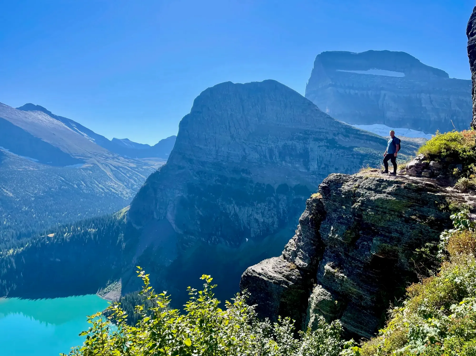
Avalanche Lake Trail
Use the Avalanche Lake trail with its Trail of the Cedars approach, and return along the same connection. Decide whether the destination is the first lake view or a farther lakeshore point.
Glacier · Photo: David & Keri New
- 2.3 mi one wayDistance
- 741 ftElevation gain
The numbers, with sources
Distance: 2.3 miles one way Source
Gain: 741 feet of gain and 275 feet of loss in the NPS route description Source
Time: The NPS does not publish a walking time for this route. Source
Difficulty: See the official route and surface descriptions; no separate rating added. Source
Trailhead: Avalanche Picnic Area, with access to Avalanche Lake Trail off Trail of the Cedars. Source
Route type: out-and-back Source
Built from official sources (checked Nov 3, 2026). Confirm current conditions with the park.
Recreation.gov permits, entrances & campgrounds
Recreation.gov (RIDB). Booking records date not published. NPS guidance above takes precedence. A listing doesn’t mean you need a permit or that there’s space on your dates.
Nearby campground records
Within 10 straight-line miles of the trailhead. Distances are straight-line from map coordinates, not driving distances.
- Avalanche Campground: approximately 0.2 miles straight line. RIDB coordinates · Mapped route source
- Sprague Creek Campground: approximately 5.8 miles straight line. RIDB coordinates · Mapped route source
Park campground options (9)
These records belong to the park’s NPS recreation area. We haven’t checked how close these are to the trail, when they open or whether sites are free; check the map and the booking page.
APGAR GROUP SITES — Campground; RIDB reservable: yes. Season: not published in structured RIDB data. Recreation.gov (RIDB) source · Booking details
Apgar Campground — Campground; RIDB reservable: yes. Season: not published in structured RIDB data. Recreation.gov (RIDB) source · Booking details
NPS reservation guidance: Reservations are required throughout the spring, summer, and fall at Apgar Campground. A reservation is not required during the winter months. Reservations must be made through Recreation.gov. Five group sites are available for parties of 9-24 people. Reservations are also required for group campsites. NPS source
FISH CREEK CAMPGROUND — Campground; RIDB reservable: yes. Season: not published in structured RIDB data. Recreation.gov (RIDB) source · Booking details
NPS reservation guidance: Campsites become reservable on a rolling basis, 6 months in advance from the date you want to book your stay. Reservations must be made through Recreation.gov and must be made in advance. A certain number of sites will be reservable up to 4 days before the desired date. NPS source
Avalanche Campground — Campground; RIDB reservable: yes. Season: not published in structured RIDB data. Recreation.gov (RIDB) source · Booking details
NPS reservation guidance: Campsites become reservable on a rolling basis, 6 months in advance from the date you want to book your stay. A certain number of sites will be reservable up to 4 days before the desired date. NPS source
Rising Sun Campground — Campground; RIDB reservable: yes. Season: not published in structured RIDB data. Recreation.gov (RIDB) source · Booking details
NPS reservation guidance: Rising Sun Campground requires a reservation to book a site. Reservations have a 0-day booking window, meaning they need to be reserved the day of your desired stay. Reservations can only be made on Recreation.gov. Cell service is limited within the park boundary. It is recommended to make a Rising Sun Campground reservation before coming to the park or at St. Mary and Apgar Visitor Centers, where public wifi is available. NPS source
Two Medicine Campground — Campground; RIDB reservable: yes. Season: not published in structured RIDB data. Recreation.gov (RIDB) source · Booking details
NPS reservation guidance: Campsites become reservable on a rolling basis, 6 months in advance from the date you want to book your stay. A certain number of sites will be reservable up to 4 days before the desired date. Two Medicine Campground will be closed in 2026 due to construction. NPS source
Sprague Creek Campground — Campground; RIDB reservable: yes. Season: not published in structured RIDB data. Recreation.gov (RIDB) source · Booking details
NPS reservation guidance: Reservations are required to camp at Sprague Creek Campground. Campsites become reservable on a rolling basis, 6 months in advance from the date you want to book your stay. Reservations must be made through Recreation.gov. A certain number of sites will be reservable up to 4 days before the desired date. NPS source
MANY GLACIER CAMPGROUND — Campground; RIDB reservable: yes. Season: not published in structured RIDB data. Recreation.gov (RIDB) source · Booking details
NPS reservation guidance: Campsites become reservable on a rolling basis, 6 months in advance from the date you want to book your stay. A certain number of sites will be reservable up to 4 days before the desired date. NPS source
ST. MARY CAMPGROUND — Campground; RIDB reservable: yes. Season: not published in structured RIDB data. Recreation.gov (RIDB) source · Booking details
NPS reservation guidance: Campground sites can be reserved April 18 through October 31, 2026. Reservations are NOT required during the winter months. Reservations must be made through Recreation.gov. Individual campsites may be reserved up to 6 months in advance. The two group sites can be reserved up to six months in advance. NPS source
Route, junction by junction
Avalanche Picnic Area → Trail of the Cedars
Take the Trail of the Cedars to the start of the Avalanche Lake Trail. Source
Avalanche Lake Trail → lake
Follow the trail to the lake. The NPS lists 2.3 miles one way and doesn’t say whether that includes the Cedars stretch. Source
Lake → original approach
Come back the same way. Source
No elevation profile: we only draw one from a mapped route we can verify. Route source
In-depth guide
Compiled from linked sources, checked Nov 3, 2026. Each paragraph links to its source.
Decisions & preparation
The NPS gives distances only for the points listed above, so we don’t split the total into legs. Source
Turnaround & return planning
Turn back sooner if the group is running low on energy, water or daylight. Planning basis
Parking & transport timing
Avalanche Picnic Area, off the Trail of the Cedars. The NPS doesn’t say when parking fills. Source
What to bring by season
Pack the Ten Essentials: navigation, sun protection, extra clothing, a light, first aid, fire supplies where allowed, repair tools, extra food, water and emergency shelter. Tell someone your plan. Source
In warm weather bring sun protection, plenty of water and extra food. In cold or wet weather add warm layers and rain gear. Source
Children & mobility
The NPS doesn’t publish an accessibility rating for this trail. Source
Is this hike for you?
Avalanche Lake is 2.3 miles (3.7 km) one way. The trail climbs steadily through old-growth forest to an alpine lake with waterfalls. The NPS lists 741 feet (226 m) of elevation gain and 275 feet (84 m) of loss, and doesn’t give a hiking time. Source · Source 2
The trail
You start at Avalanche Picnic Area and pick up the Avalanche Lake Trail off the Trail of the Cedars, then come back the same way. The 2.3 miles is one way, and the NPS doesn’t say whether it includes the Cedars stretch. The park asks you to stay alert around water, steep dropoffs and wildlife; you’re responsible for your own safety. Source · Source 2
There’s no elevation profile yet: the NPS trail map line comes from its trail data and USGS 3DEP terrain, but we haven’t verified complete measurements for this route. Source
Getting to the trailhead
The trailhead is at Avalanche Picnic Area, off the Trail of the Cedars. The NPS doesn’t say when parking fills. Source
Before you go
The NPS doesn’t give a season for this trail. A posted park alert said Going-to-the-Sun Road was closed for the season at Avalanche Creek on the west side and at Jackson Glacier Overlook on the east side, and that open sections can change at any time in winter weather. Check road conditions and current alerts before you go, and be ready for winter weather. Source · Source 2
Decide where you’ll turn around before you start. Stay together, and turn back early if the group is slower than you expected. Source
Kids, strollers and wheelchairs
The NPS doesn’t publish an accessibility rating for this trail or say what ages it suits. Keep the steady climb and the water and dropoffs in mind with young kids. Source · Source 2
Dogs, permits and fees
The NPS doesn’t publish a pet rule for this trail, so check the park’s pet rules before you bring a dog. Stay on the trail and respect any closures. The NPS doesn’t say whether this hike needs a reservation. Source · Source 2
Park entry is $35.00 per private, non-commercial vehicle (car, truck or van), or $25.00 at the winter rate from November 1 to April 30. The pass is good for seven days and can’t be transferred. If the entrance station isn’t staffed, you can buy a 7-day pass at the self-registration area. Source
Sources & planning limits
Reviewed 2026-11-03. Check current conditions for your trip dates.
- The NPS gives one distance for this hike, and we haven’t measured it ourselves. Check where it starts and ends. Source
- NPS details are as of the date shown. Confirm access, services and reservations for your travel date. Source
- The NPS doesn’t say whether this trail suits kids or people with limited mobility. Check its accessibility page before you choose it. Source
- We haven’t confirmed access, transport or services for any given date. Check with the NPS before you rely on them. Source
- No elevation profile yet: we haven’t verified complete measurements for this route. Source
Getting there and back
Avalanche Picnic Area, with access to Avalanche Lake Trail off Trail of the Cedars. Source
Return: Complete the return arrangement described for this route. The lake approach and any further lakeshore walking must remain distinct when comparing published distances. The source is used for the complete route wording rather than supplying a number from a trailhead location or from memory. Source
Water
Avalanche Lake 2.3 mi (3.7 km), one way Elevation gain: 741 ft (226 m) Elevation loss: 275 ft (84 m) Trailhead: Avalanche Picnic Area While in Glacier National Park, please maintain extra awareness around water, steep dropoffs, and wildlife. Source
Hazards
Avalanche Lake 2.3 mi (3.7 km), one way Elevation gain: 741 ft (226 m) Elevation loss: 275 ft (84 m) Trailhead: Avalanche Picnic Area While in Glacier National Park, please maintain extra awareness around water, steep dropoffs, and wildlife. Source
Season
The NPS does not publish a seasonal opening window for this route. Source
The NPS does not publish a seasonal opening window for this route. Source
Gear & rules
The NPS does not publish pet rules for this exact route. Source
Filling a gap in your kit? Compare these packing essentials on Amazon. Choose gear for your route, conditions and the park’s guidance.
As an Amazon Associate we earn from qualifying purchases. How this works
Questions
Which hike is this?
Use the Avalanche Lake trail with its Trail of the Cedars approach, and return along the same connection. Decide whether the destination is the first lake view or a farther lakeshore point. Source
Are the published figures fully consistent?
The lake approach and any further lakeshore walking must remain distinct when comparing published distances. The source is used for the complete route wording rather than supplying a number from a trailhead location or from memory. Source
Is there an elevation profile?
Official NPS trail geometry sampled with USGS 3DEP. Partial profile: mapped Avalanche Lake trail features are shown; the Trail of the Cedars approach is excluded. NPS publishes 2.30 mi one way; the traced line measures 2.53 mi. The difference is unresolved. The chart shows the mapped Avalanche Lake trail only, not the Trail of the Cedars approach. Source
Alternatives
Camp near Avalanche Lake Trail
Closest campgrounds by drive time to Avalanche Trailhead:
- 2 min Avalanche (0.4 mi, in the park)
- 14 min Sprague Creek (6.6 mi, in the park)
- 31 min Apgar (14.5 mi, in the park)
- 35 min Fish Creek (17.1 mi, in the park)
- 58 min Big Creek Campground (Flathead National Forest, MT) ↗ (29.1 mi, USDA Forest Service)
Driving time with no traffic (OSRM, OpenStreetMap roads). Some park roads are shuttle-only in season. All camping near Glacier
More Glacier trail guides
- Grinnell Glacier Viewpoint5.3 mi one way · Strenuous
- Hidden Lake Overlook Trail1.3 mi one way
- Highline Trail to Granite Park Chalet7.6 mi one way · Strenuous
- Iceberg Lake9.6 mi · Strenuous
- Running Eagle Falls Nature Trail0.7 mi
- Trail of the Cedars0.9 mi · Easy