Our favorite hike
Boardwalk Loop
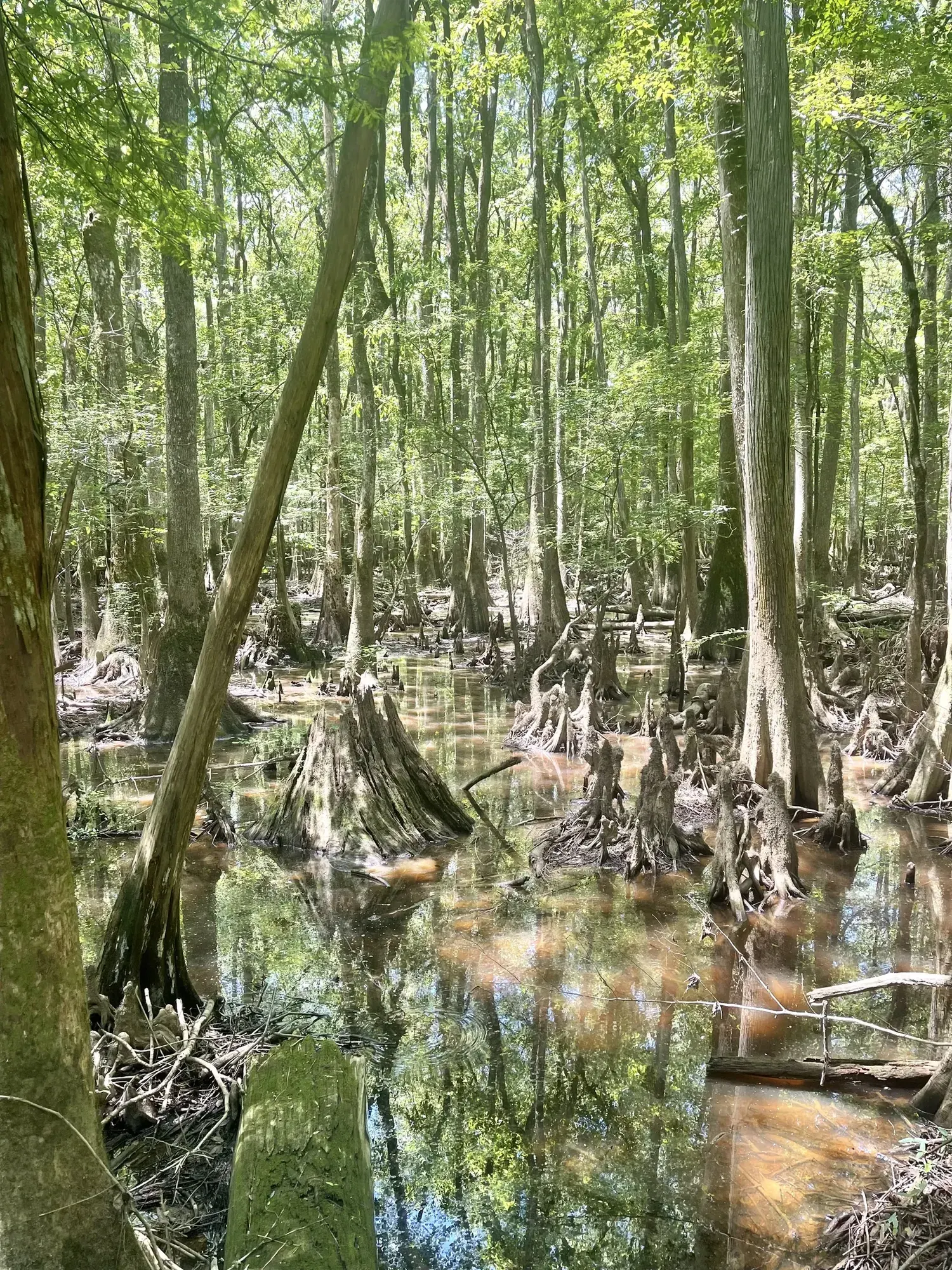
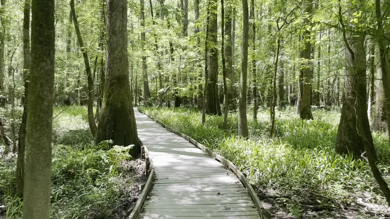
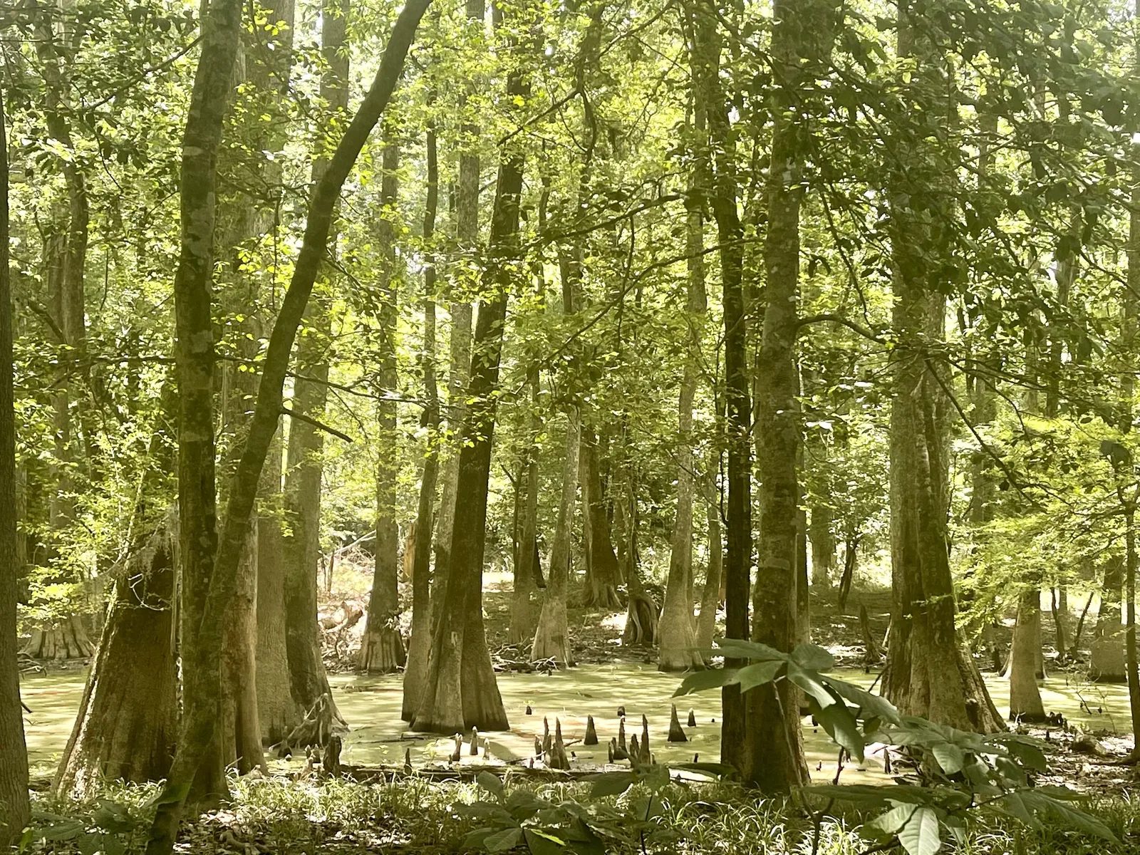
The boardwalk is an easy 2.6 miles through old-growth bottomland forest, past huge bald cypress and their knees standing in dark water. You get to see the big trees without getting your feet wet.

South Carolina
The largest remaining stretch of old-growth bottomland hardwood forest in the United States: champion trees, cypress knees and Cedar Creek paddling, just outside Columbia.
By David & Keri New, who have visited 63 of the 64 U.S. national parksUpdated
41Park 41 of our 63Visited May 2022
Saves this park and its trail guides on this device. Alerts and conditions are as of when you save; live maps and bookings need a connection.
NPS alertsAs of 6:03 AM ET, Nov 20
1 day is our starting point.
Use one day for the Boardwalk Loop and add a longer forest walk when trails are open. Add a Cedar Creek paddle only when water, obstacles and launch access suit your group.
Open the 1-day itineraryOpen the 2-day itineraryNPS park conditionsCedar Creek paddling conditions
For a few hours, walk only the Boardwalk Trail from the Harry Hampton Visitor Center: 2.6 miles round trip, rated easy. It has benches and is wheelchair and stroller accessible. Check alerts first, because floods can close parts of it.
Add the Bates Ferry Trail in the park's eastern section, starting from Route 601. It follows a 1920s ferry road to the Congaree River, 2.2 miles round trip. The riverbank is steep and can be slippery, so stay on the marked path.
If flooding closes the boardwalk, use the visitor center and Bluff Trail only when the approach and trail are open and dry. If the paddle is canceled but the boardwalk is open, use the one-day walking plan. If safe access is unavailable, reschedule.
Open the backup itineraryOpen the 1-day itineraryNPS park conditionsNPS trail information
Columbia for lodging or a confirmed campsite inside the park
Stay in Columbia for a flexible day trip. If camping, choose your campsite and verify access before setting your hiking or paddling plans.
Lodging and gateway townsNational Park News guideNPS park conditions
For a Cedar Creek day, arrange a boat or outfitter and confirm where you launch, how you return, and what happens if conditions change. Check current conditions and the water-level guidance before committing. Reserve a campsite separately if you are staying in the park.
Cedar Creek paddling conditionsNPS park conditionsNational Park News guide
Set GPS to 100 National Park Road, Hopkins, SC 29061, because searching the park name can misroute you. COMET bus Route 47 stops at the visitor center. Ride shares may not pick up at the park, so arrange your return ride.
From David & Keri’s visit: The boardwalk and one longer trail like Weston Lake will give you a good feel for the park. Read our trip notes
Our visit
May 2022
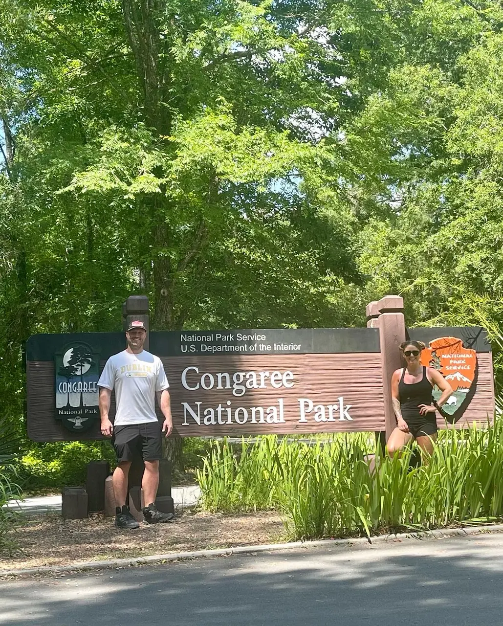
Why it’s on our list
Congaree protects one of the most impressive remaining old-growth bottomland hardwood forests in the United States, with enormous trees and a fascinating floodplain ecosystem. Walking the boardwalk or paddling through the waterways offers a peaceful and unusual experience. However, the flat, swampy landscape, heavy mosquito presence, and lack of dramatic scenery make it one of the less memorable national parks from a sightseeing perspective.
Our favorite moment
Walking the Boardwalk Loop among the enormous bald cypress trees.
Photos by David & Keri New.
Firsthand · David & Keri New
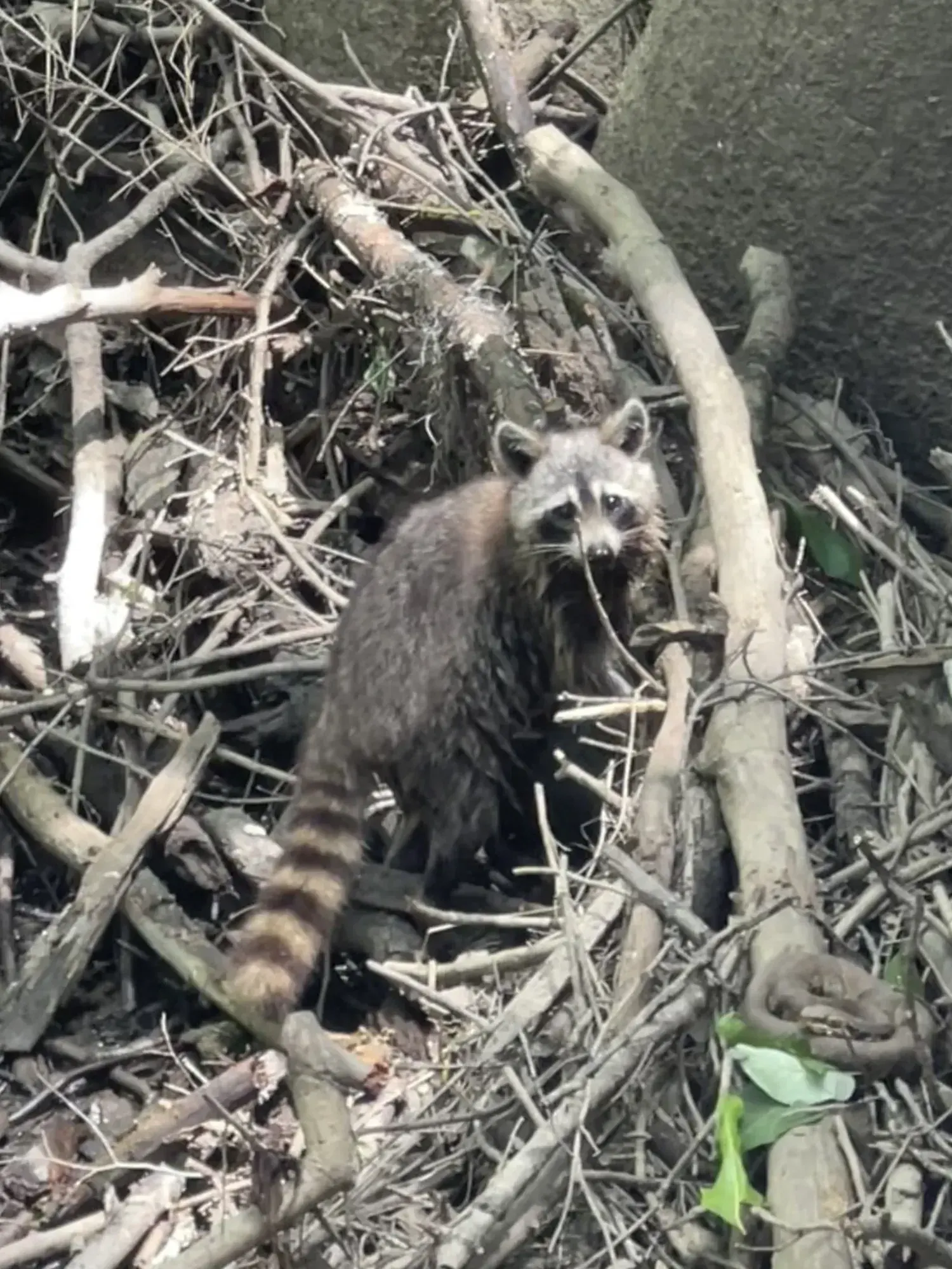
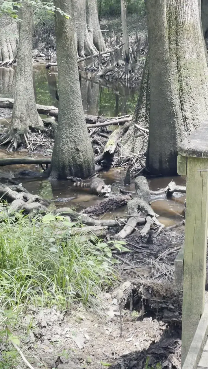
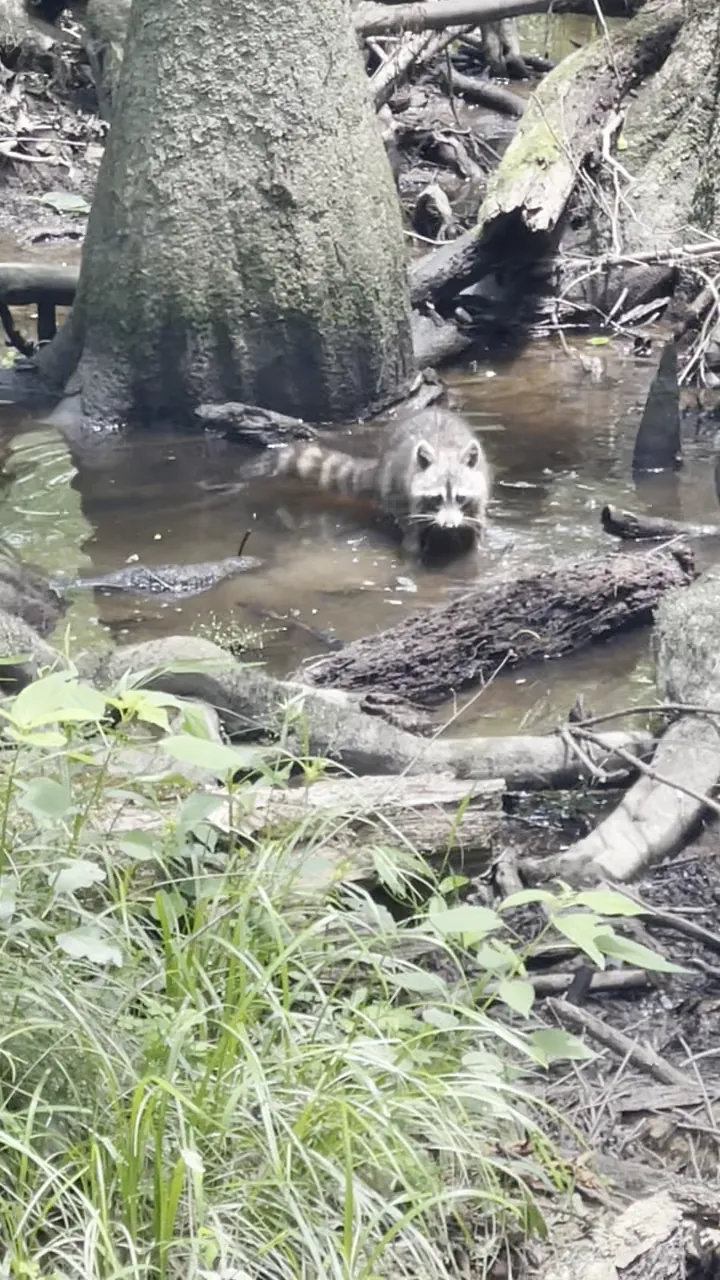
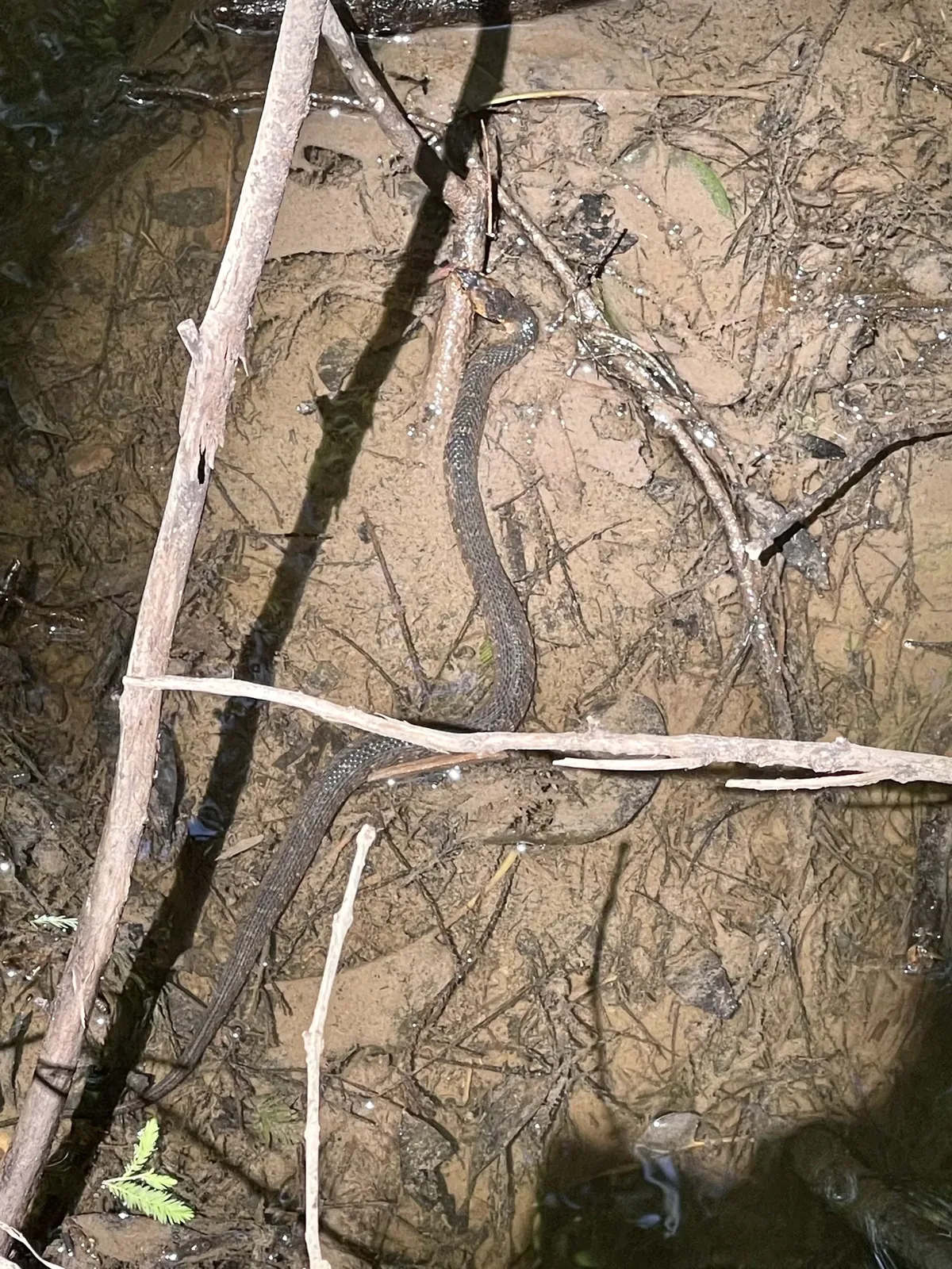
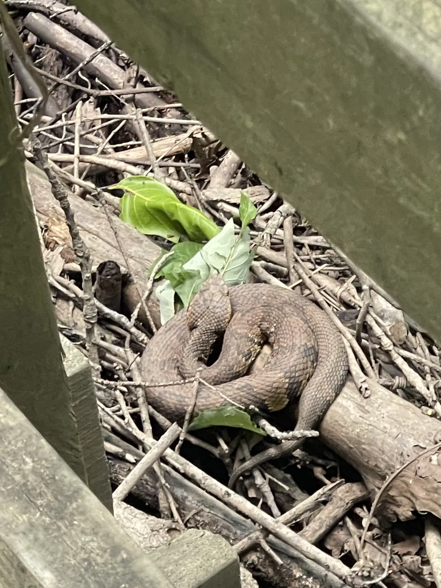
Congaree is one of the tallest old-growth hardwood forests in the country, and it floods regularly. We saw a raccoon wading through the swamp and a snake coiled right next to the boardwalk. It’s quiet and a little wild, and it deserves more than a quick stop.
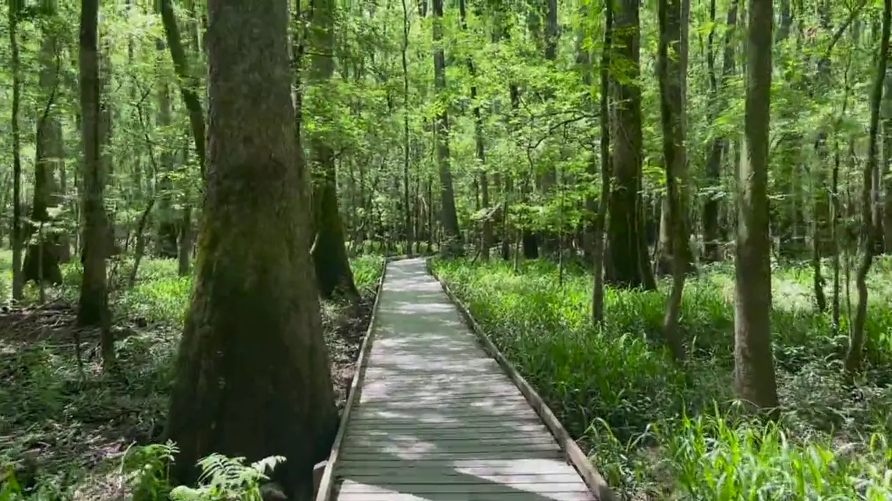
Boardwalk Loop
The boardwalk is an easy 2.6 miles through old-growth bottomland forest, past huge bald cypress and their knees standing in dark water. You get to see the big trees without getting your feet wet.
Read the mosquito meter at the visitor center before you head out, and bring repellent from late spring through summer. If you want to see the synchronous fireflies in late May or early June, enter the lottery ahead of time.
We never got on the water, and paddling Cedar Creek is at the top of our list for a return. Seeing the swamp from a kayak or canoe is supposed to be the best way to experience it.
We didn’t feel like we needed one. The boardwalk and one longer trail like Weston Lake will give you a good feel for the park.
Memorial Day was not a problem, because Congaree doesn’t get huge crowds even on a holiday. Late May is warm and humid, and the mosquitoes are out. The sun was filtering down through a very green forest.
Columbia is just 20 miles away. Lizard’s Thicket is a Southern meat-and-three, and the Soda City Market on Main Street is great on a Saturday morning.
Best time
April, October, November
Spring and fall best. July-August hot, wet, mosquito-heavy. Firefly lottery event mid-May. Winter mild but flood-prone. March and May busiest.
Month by monthItineraries
1 dayOur pick
Optional day 2 · Cedar Creek paddle
Compare the 1-day plans, day by day →
Map
1 visitor center and 3 campgrounds on a map you can zoom and drag. Map data loads from OpenStreetMap when you tap.
Visitor centerCampground Roads and trails are community-mapped; check closures with the park.
Locations from the NPS visitor-center listing, checked Nov 13, 2026. Hours and what each one has
Locations from Recreation.gov, checked Nov 7, 2026. Compare the campgrounds
Trails
1.8 mi
Upland loop through young loblolly and longleaf pine, linking to the boardwalk; it doesn’t flood.
Loop
Start: Connects to the elevated boardwalk north of the visitor center.
2.2 mi
Off US 601 on the east side, following a 1920s ferry road to the Congaree River.
Out and back
Start: Bates Ferry trailhead off Route 601 in the eastern park.
2.6 mi
Elevated and accessible, it drops from the visitor center bluff into old-growth bald cypress and tupelo forest. Self-guided brochure with numbered stops.
Loop · About 1-2 hours
Start: Harry Hampton Visitor Center.
3.2 mi
Old gravel road from the Bluff Trail to Cedar Creek, crossing the boardwalk twice.
Start: Harry Hampton Visitor Center.
4.5 mi
Cedar Creek views where otters and wading birds are often seen, plus a cypress-tupelo slough full of knees.
Start: Harry Hampton Visitor Center.
7.1 mi
Old-growth oaks along a subtle ridge, with deer and wild turkey. Can be hard to follow; carry GPS.
Start: Harry Hampton Visitor Center.
11.1 mi
Out to the Congaree River, with a large sandbar at low water. Many trees down; GPS needed.
Start: Harry Hampton Visitor Center.
12 mi
The NPS trail guide explicitly defines this distance as round trip from the visitor center. The Trail Information page still lists Bridge K as out; check current conditions before hiking.
Start: Harry Hampton Visitor Center.
Distances, gains and difficulty as NPS publishes them; the bar shows the published distance, dashed where a longer option exists.
Camping
Fees, permits & rules
Last verified · nps.gov All Congaree fees, permits and booking deadlines →
NPS Trail Information, updated Oct 30, 2026, still lists Bridge K as out and warns of the slough crossing. No replacement date is posted; check with the visitor center before hiking.
Last verified · Trail Information (NPS)Oakridge, Boggy Gut (formerly River) and Kingsnake may be hard to follow. Boggy Gut has many trees down from recent storms.
Last verified · Trail Information (NPS)Downed trees between Bannister’s Bridge and South Cedar Creek may mean big portages, depending on water level.
Last verified · NPS alert / Canoe Trail ConditionsAbout 10 floods a year. All trails except the elevated boardwalk, Bluff, Firefly and Longleaf are subject to flooding. Check the Cedar Creek gauge (flood stage about 8 ft) before you go.
Last verified · Conditions (NPS)2027 event dates, lottery dates and access rules are not announced yet (NPS, checked Nov 1, 2026). In 2026, the event ran May 13-20; evening entry required a Recreation.gov lottery pass. The lottery ran April 7-14, with one entry per household, a $1 application fee and $24 more for winners. Day visitors had to leave by 4:30 pm; pass holders entered 7-8:30 pm. These are past 2026 arrangements.
Last verified · Firefly Viewing Event (NPS)Email me this guide Get a link to the Congaree guide in your inbox, to open again when you plan or before you go.
One email with the link. We don’t add you to any list unless you tick the box.
Historical recreation visits · 2021–2025 · as of Nov 3, 2026. Visits count entries, not unique people, parking spaces or trail crowding.
Busiest by average count: May. Quietest: Aug. Each bar is that month’s average visits across 5 years; unusual years and reported zeros are included. Past visits can’t tell you the best time of day to arrive.
Every month’s visits and NOAA weather, with the counts for each year →
NPS Visitor Use Statistics: monthly report · NPS monthly data · checked Nov 3, 2026; latest included year 2025.
Plan your visit
For any park: passes and free entrance days · what to pack · visiting with kids · stargazing
Getting there and park logistics →
Find a place to stay near Congaree → See camping and backup options for this park.
How this page is made. The section “What we’d tell a friend” is ours. Our recorded visits to Congaree include May 2022.Planning information, including any fees, permits, closures, weather and crowd figures shown here, is compiled from the National Park Service, Recreation.gov and other public sources, and each fact shows the date we last checked it. If something is wrong, tell us and we’ll log the fix on our corrections page.