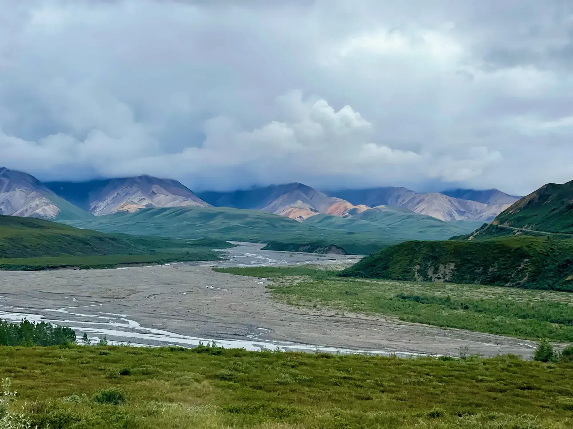
Savage River Loop Trail
Choose the short Savage River Loop, following the river to the small bridge and returning along the opposite side. The strenuous Savage Alpine Trail is a separate route.
Denali · Photo: David & Keri New
- 2 miDistance
The numbers, with sources
Distance: About 2 miles round trip Source
Gain: No complete-loop gain stated in the NPS listing Source
Time: No standalone loop walking time supplied; the activity duration includes area access. Source
Difficulty: While hiking is a main attraction at the Savage River area, there is plenty of scenery to enjoy even from the picnic areas or parking lots. There are decent chances to see wildlife in the area, too, from small critters (squirrels, gulls) to large animals (Dall sheep, bears, moose). Source
Trailhead: The parking area can get full each day in summer. Source
Route type: loop Source
Built from official sources (checked Nov 3, 2026). Confirm current conditions with the park.
Recreation.gov permits, entrances & campgrounds
Recreation.gov (RIDB). Booking records date not published. NPS guidance above takes precedence. A listing doesn’t mean you need a permit or that there’s space on your dates.
Route, junction by junction
Selected start → Selected destination
Choose the short Savage River Loop, following the river to the small bridge and returning along the opposite side. The strenuous Savage Alpine Trail is a separate route. Source
No elevation profile: we only draw one from a mapped route we can verify. Route source
In-depth guide
Compiled from linked sources, checked Nov 2, 2026. Each paragraph links to its source.
Is this hike for you?
The Savage River Loop Trail is about 2 miles round trip. It follows the Savage River for about a mile, crosses it on a small bridge, and winds back to the parking area. The NPS doesn’t give an elevation gain for the loop or a walking time for the trail alone. Source
How much time to plan
Counting the drive or the free Savage River Shuttle, the NPS suggests at least two hours total, which leaves only a little time in the Savage River area. If you want to hike, take in the scenery or look for wildlife, plan at least six hours total, counting travel both ways. You can explore off trail, so there’s no real maximum. Overnight stays are limited to the nearby Savage River Campground or backpacking with a permit. Source
Getting to the trailhead
The parking area can fill every day in summer. Vehicle access is limited in fall, winter and spring; depending on snow, you may be able to drive here as early as April and as late as October, and access is more reliable from May through September. The park is open in winter, but you’d need to ski, hike or otherwise travel under your own power for about 10 miles from Park Headquarters to get here. Ask park staff if you’re unsure where the trailhead is. Source
NPS alert as of 2026-11-03: the Denali Park Road is open only to Mile 3 (Park Headquarters). Snow beyond that point stops vehicles, though you can travel on foot. Check current alerts before you go. Source
Kids, strollers and wheelchairs
The first quarter-mile of the loop is compacted gravel, 48” wide, with almost no elevation change. After that the trail gets very narrow. The nearby Savage Alpine Trail is long and fairly narrow. The free Savage River Shuttle is wheelchair accessible, and so are the restrooms at Mountain Vista Rest Area and the Savage River Rest Area. The NPS doesn’t give an age or stroller rating for the loop. Source
Dogs, permits and fees
Pets aren’t allowed on this trail; check the park’s rules for service animals. The NPS says no reservation is needed for this hike. Stay on the trail and respect signs and closures. Source
Denali charges an entrance fee year-round: $15.00 per person, which buys a 7-day entrance permit for anyone 16 or older. Kids 15 and younger are free. Be ready to show your receipt or pass (digital or paper) if staff ask. Camping, guided programs and commercial transport have their own rules. Check prices for your dates. Source
Before you go
Bring the current park map and read the signs at the trailhead. If conditions or your group’s needs change, turn back early; you don’t have to finish the loop. Source
Map and elevation profile
The NPS trail map line comes from its trail data and USGS 3DEP terrain, but we haven’t verified complete measurements for this route, so there’s no elevation profile yet. Source
Sources & planning limits
Reviewed 2026-11-03. Check current conditions for your trip dates.
- The NPS gives about 2 miles round trip for the loop but no single measured distance or time for it. Source
- NPS details are as of the date shown. Confirm access, services and reservations for your travel date. Source
- The NPS doesn’t say whether the loop suits kids or mobility devices beyond the first quarter-mile. Check its accessibility page. Source
- Confirm road access, the shuttle and services for your date with the NPS and any transport provider. Source
- No elevation profile yet: we haven’t verified complete measurements for this route. Source
Getting there and back
The parking area can get full each day in summer. Source
Return: Complete the return arrangement described for this route. The NPS activity covers an entire area and several trails. Its suggested two-hour and six-hour visits include travel and sightseeing rather than measuring the river loop alone. Do not reuse the area-visit duration as a precise walking time. Source
Water
Hazards
Season
Vehicle access is limited in the fall, winter and spring. Depending on snow conditions, you may be able to drive here as early as April and as late as October. Access is more reliable in summer (May through September). The park is open in winter, but you would need to be ready to ski, hike or otherwise travel under your own power for about 10 miles from Park Headquarters to reach this area. Source
Vehicle access is limited in the fall, winter and spring. Depending on snow conditions, you may be able to drive here as early as April and as late as October. Access is more reliable in summer (May through September). The park is open in winter, but you would need to be ready to ski, hike or otherwise travel under your own power for about 10 miles from Park Headquarters to reach this area. Source
Gear & rules
The NPS activity marks pets permitted: false. Source
Filling a gap in your kit? Compare these packing essentials on Amazon. Choose gear for your route, conditions and the park’s guidance.
As an Amazon Associate we earn from qualifying purchases. How this works
Questions
Which hike is this?
Choose the short Savage River Loop, following the river to the small bridge and returning along the opposite side. The strenuous Savage Alpine Trail is a separate route. Source
Are the published figures fully consistent?
The NPS activity covers an entire area and several trails. Its suggested two-hour and six-hour visits include travel and sightseeing rather than measuring the river loop alone. Do not reuse the area-visit duration as a precise walking time. Source
Is there an elevation profile?
Official NPS trail geometry sampled with USGS 3DEP. Partial profile: the mapped river circuit is shown between parking-side trail ends; the road-side connection closing the loop is excluded. NPS gives 2.00 mi for the whole loop; the line we traced measures 1.71 mi. The difference is unresolved. The chart follows the mapped river loop from one parking-side trail end to the other, not the stretch along the road that closes the loop. Source