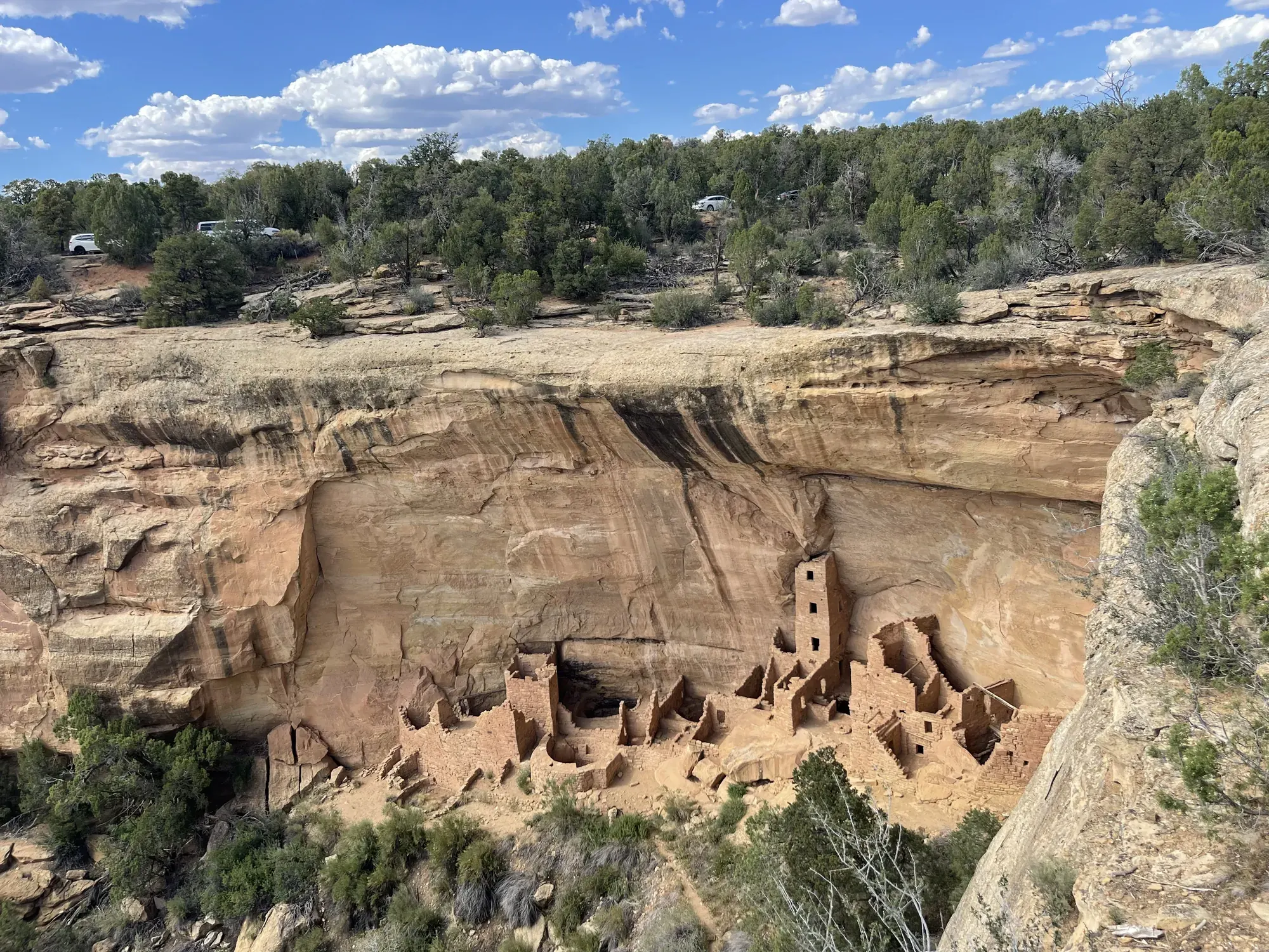
Petroglyph Point Trail
A rugged 2.4-mile loop along canyon walls to a large petroglyph panel, followed by a hands-and-feet stone-staircase climb to the rim.
Mesa Verde · Photo: David & Keri New
- 2.4 miDistance
- 174 ftElevation gain
- 2 hrTime
- StrenuousDifficulty
The numbers, with sources
Distance: 2.4-mile loop. Source
Gain: 174 feet of elevation change. That’s not necessarily the total climb. Source
Time: Allow about 2 hours. Source
Difficulty: Moderately strenuous to strenuous; narrow rocky route, steep drop-offs and scrambling. Source
Trailhead: Petroglyph Point trailhead in the Spruce Canyon area. Source
Route type: loop Source
Built from official sources (checked Nov 3, 2026). Confirm current conditions with the park.
Recreation.gov permits, entrances & campgrounds
Recreation.gov (RIDB). Booking records date not published. NPS guidance above takes precedence. A listing doesn’t mean you need a permit or that there’s space on your dates.
Park campground options (1)
These records belong to the park’s NPS recreation area. We haven’t checked how close these are to the trail, when they open or whether sites are free; check the map and the booking page.
Morefield Campground — Campground; RIDB reservable: no. Season: not published in structured RIDB data. Recreation.gov (RIDB) source · Booking details
NPS reservation guidance: Morefield Campground is managed by park concessionaire, Aramark. Reservations are accepted but not required. Reservations are highly recommended for one of the 15, RV full hook-up sites. Reservations can be made online at www.visitmesaverde.com, by calling 1-800-449-2288, or at the Morefield Campground Store. NPS source
Route, junction by junction
Trailhead → Petroglyph Point Trail
Follow the canyon-wall route to the petroglyph panel 1.4 miles south of the trailhead, climb the large stone staircase, and return through forest on the rim. Source
No elevation profile yet:
No elevation profile yet: we haven’t verified complete measurements for this route. Source
In-depth guide
Compiled from linked sources, checked Nov 2, 2026. Each paragraph links to its source.
Is this hike for you?
Petroglyph Point is a 2.4-mile (3.9 km) loop with 174 ft (53 m) of elevation change, and it takes about 2 hours. The NPS rates it moderately strenuous to strenuous. The short distance is misleading: the trail is narrow, rugged and rocky, with steep drop-offs along the canyon wall, and after the panel you scramble up a large stone staircase using your hands and feet. Source
The trail
The trail follows a foot-worn path of the Ancestral Pueblo people into forested Spruce Canyon, with views of Spruce and Navajo Canyons. This path once linked the community at Spruce Tree House with other sites in the canyon and the rest of the Pueblo world. Source
The big petroglyph panel is 1.4 miles (2.3 km) south of the trailhead, partway around the loop. After it comes the staircase scramble to the rim, then an easy walk back through the forest. Source
The petroglyph panel
The panel has more than thirty human and animal figures, spirals and handprints across an area over 35 feet wide, and it represents the written language of the people who lived in and traveled through this canyon. Don’t touch it: oils from your skin can stain and permanently damage the images, and once damaged they can’t be repaired. Source
Heat, altitude and the rim
Dehydration and altitude sickness are common at Mesa Verde. Drink water, rest often and avoid hiking in the hottest part of the day. The NPS doesn’t list water on the trail, so bring your own. Stay on the trail and away from unstable cliff edges. Source
Rules
Access into Spruce Tree House is strictly prohibited right now because of rock fall danger. Source
Pets and bicycles aren’t allowed, and trails are day-use only. Leave archeological sites, artifacts, plants and animals as you find them, and watch wildlife from a distance. The NPS doesn’t give a minimum age or rate the trail for strollers or wheelchairs. Source
Check the NPS fees page for the park entrance fee; we haven’t confirmed current fees. Source
Sources & planning limits
Reviewed 2026-11-03. Check current conditions for your trip dates.
- We haven’t confirmed current permit, reservation and fee terms. Check the NPS page for your travel date. Source
- We haven’t confirmed access, transport or services for your trip date. Check with the NPS and any transport provider. Source
- The NPS doesn’t say whether this hike suits kids or people with limited mobility. Read its accessibility notes before you pick it. Source
- There’s no elevation profile yet: we haven’t verified complete measurements for this route. Source
Getting there and back
Plan a day-use walk in the Spruce Canyon area. The activity doesn’t confirm a parking inventory. Source
Return: After the panel, scramble to the rim using the stone staircase and complete the forest return. Source
Water
NPS advises drinking water and resting often. It doesn’t list a refill along the way. Source
NPS advises drinking water and resting often. It doesn’t list a refill along the way. Source
Hazards
Steep drop-offs, rocky ground and the hands-and-feet staircase require care. Source
NPS highlights dehydration and altitude sickness. Source
Stay away from unstable cliff edges. Source
Season
Avoid the hottest part of the day. Confirm current access; the NPS listing prohibits access into Spruce Tree House because of rockfall danger. Source
Avoid the hottest part of the day. Confirm current access; the NPS listing prohibits access into Spruce Tree House because of rockfall danger. Source
Gear & rules
Do not touch the petroglyph panel or disturb archeological sites or artifacts. Source
Pets and bicycles are prohibited. Source
Trails are day-use only. Source
Filling a gap in your kit? Compare these packing essentials on Amazon. Choose gear for your route, conditions and the park’s guidance.
As an Amazon Associate we earn from qualifying purchases. How this works
Do not touch the petroglyph panel or disturb archeological sites or artifacts. Source
Pets and bicycles are prohibited. Source
Trails are day-use only. Source
Questions
Is 174 feet the total climb?
The NPS calls it elevation change, and we don’t relabel it as total climbing. Source
May visitors touch the panel?
No. NPS says skin oils can stain and permanently damage the images. Source
Alternatives
Camp near Petroglyph Point Trail
Closest campgrounds by drive time to Petroglyph Point Trailhead:
- 1 hr 8 min Target Tree Campground ↗ (35.6 mi, USDA Forest Service)
- 1 hr 28 min Snowslide ↗ (50.5 mi, USDA Forest Service)
- 1 hr 29 min Kroeger ↗ (50.8 mi, USDA Forest Service)
- 1 hr 32 min Mcphee Recreation Complex ↗ (47.3 mi, USDA Forest Service)
- 1 hr 33 min Transfer Campground ↗ (38.9 mi, USDA Forest Service)
Driving time with no traffic (OSRM, OpenStreetMap roads). Some park roads are shuttle-only in season. All camping near Mesa Verde
More Mesa Verde trail guides
- Spruce Canyon Trail2.4 mi · Strenuous