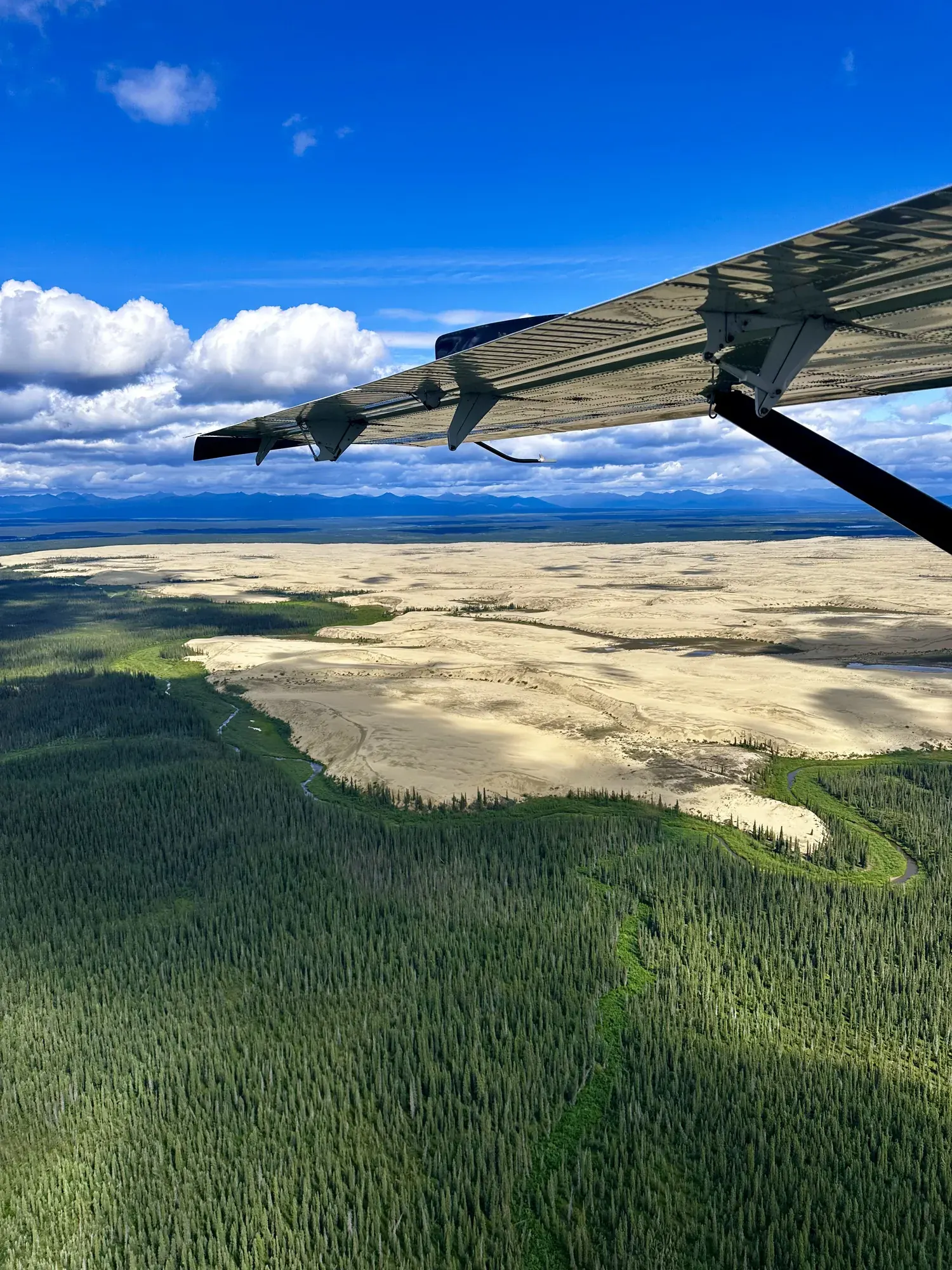
Great Kobuk Sand Dunes — off-trail planning
This is an off-trail planning guide. NPS identifies no trails or facilities in the park. A dunes map pin is a destination reference, not a trailhead or an air-taxi landing instruction. Distance, junction directions and a dependable walking duration are unavailable because the activity does not prescribe a route.
Kobuk Valley · Photo: David & Keri New
The numbers, with sources
Distance: Not available: there’s no built trail or set loop. Source
Gain: Not available: no confirmed total climb. Source
Time: 1–5 days is the activity allowance, not a walking time. Source
Difficulty: Off-trail wilderness; no developed trail. Source
Trailhead: The NPS doesn’t publish this for the whole route. Consult the official route description and park map for the start. Source
Route type: Off-trail; no fixed route Source
Built from official sources (checked Nov 3, 2026). Confirm current conditions with the park.
Recreation.gov permits, entrances & campgrounds
Recreation.gov (RIDB). Booking records date not published. NPS guidance above takes precedence. A listing doesn’t mean you need a permit or that there’s space on your dates.
Route, junction by junction
Route selection → Described destination
This is an off-trail planning guide. NPS identifies no trails or facilities in the park. A dunes map pin is a destination reference, not a trailhead or an air-taxi landing instruction. Distance, junction directions and a dependable walking duration are unavailable because the activity does not prescribe a route. Source
No elevation profile yet:
No elevation profile yet: we haven’t verified a complete line for this route. No partial line, invented connector, scaled mileage or flat profile is substituted. Source
In-depth guide
Compiled from linked sources, checked Nov 3, 2026. Each paragraph links to its source.
Is this trip for you?
There are no trails or facilities in Kobuk Valley National Park, so the Great Kobuk Sand Dunes are an off-trail trip with no set route, distance or hiking time. The NPS allows 1–5 days for the activity; that’s the trip, not a walking time. Grizzly, caribou and wolf tracks cross the dunes, where boreal forest, tundra and brush meet glacially ground sand. Source · Source 2 · Source 3
Getting there and what to bring
Most people fly in. Weather in northwest Alaska is unpredictable, so build in a cushion for flight delays. Bring sunscreen and a rain jacket (you may use both in one day), a head net for summer bugs, and layers, since the dunes are very exposed and can be windy. Source
Getting there and back
The NPS doesn’t publish this for the whole route. Consult the official route description and park map for the start. Source
Return: Use the return described in the official route account. Don’t count on a shuttle, boat, flight or pickup unless you have confirmed it yourself. Source
Water
The NPS doesn’t publish a full list of water and restrooms along this route. Use only the facilities explicitly identified in the NPS account; confirm current operations. Source
Hazards
Flight delays belong in the itinerary. NPS recommends a weather cushion, layers, rain protection, sunscreen and a summer head net. The one-to-five-day activity allowance doesn’t confirm the time needed for a particular dune crossing or confirm that a flight can land on a chosen date. Source
Season
This page can’t tell you current access. Check NPS conditions before departure. Source
Check current conditions and seasonal access with the park before you go. Check the park before departure. Source
Gear & rules
Respect current closures, signs and barriers. A mapped path is not proof that travel is permitted. Source
Filling a gap in your kit? Compare these packing essentials on Amazon. Choose gear for your route, conditions and the park’s guidance.
As an Amazon Associate we earn from qualifying purchases. How this works
The NPS doesn’t publish a pet rule for this exact route; confirm with the park before bringing an animal. Source
Questions
Which hike is this?
This is an off-trail planning guide. NPS identifies no trails or facilities in the park. A dunes map pin is a destination reference, not a trailhead or an air-taxi landing instruction. Distance, junction directions and a dependable walking duration are unavailable because the activity does not prescribe a route. Not available: there’s no built trail or set loop. Source
Is a measured elevation profile available?
No elevation profile yet: we haven’t verified a complete line for this route. No partial line, invented connector, scaled mileage or flat profile is substituted. Source
Alternatives
Alternative-route distances and durations are unavailable unless separately described in the source. Side trails aren’t included. Source