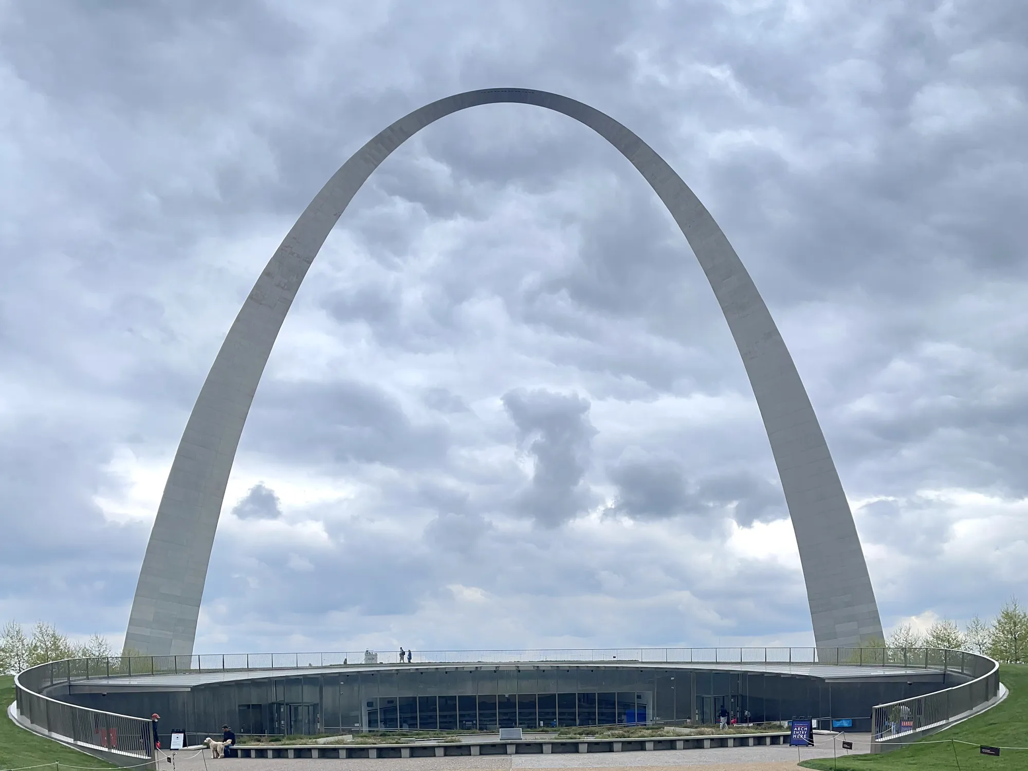
Gateway Arch accessible grounds walk
A self-selected walk on the maintained paved grounds, with accessible riverfront ramps as an optional extension.
Gateway Arch · Photo: David & Keri New
- EasyDifficulty
The numbers, with sources
Distance: Variable route; NPS does not publish a fixed distance for this selected grounds-and-ramps walk. Source
Gain: Not published for this walk. We don’t guess a total climb. Source
Time: Self-paced; no route-specific duration confirmed. Source
Difficulty: NPS says the paved paths crossing the grounds are fully accessible. Use either of the two riverfront ramps instead of the approximately 65-step Grand Staircase. The tram/top-of-Arch visit has separate requirements. Source
Trailhead: West entrance facing Fourth Street and the Old Courthouse Source
Route type: out-and-back Source
Built from official sources (checked Nov 2, 2026). Confirm current conditions with the park.
Recreation.gov permits, entrances & campgrounds
Recreation.gov (RIDB). Booking records date not published. NPS guidance above takes precedence. A listing doesn’t mean you need a permit or that there’s space on your dates.
Route, junction by junction
West entrance → paved Arch grounds
Begin on the west side facing Fourth Street and the Old Courthouse. Use the paved paths across the grounds; the Arch legs are exit-only for the interior visitor route. Source
Arch grounds → riverfront ramp decision
For a riverfront extension, choose one of the two accessible ramps to Leonor K. Sullivan Boulevard. The Grand Staircase has around 65 steps; it is a different option, not an accessible shortcut. Source
Riverfront ramp → original west-side start
Retrace the chosen ramp and paved grounds path to your starting point. No total distance is assigned: path choices and your parking approach change the walk. Source
No elevation profile yet:
No verified continuous NPS GIS line has been assembled for this exact selected walk and endpoints. No synthetic or flat elevation profile is substituted. Source
In-depth guide
Compiled from linked sources, checked Nov 3, 2026. Each paragraph links to its source.
Decisions & preparation
Distances are shown only where the NPS gives them. Source
Turnaround & return planning
Turn around wherever suits your group. Planning basis
Parking & transport timing
No designated visitor parking: use city garages or street parking and plan ahead. Drop-off spots are for loading only. The NPS doesn’t say when parking fills. Source
What to bring by season
Water, sun protection and clothes for changing weather, plus a light in case you’re out later than planned. Source
Check current conditions. The NPS doesn’t list seasonal closures. Source
Children & mobility
The NPS says the paved paths across the grounds are fully accessible. Use one of the two riverfront ramps instead of the roughly 65-step Grand Staircase. The top of the Arch has its own requirements. Source
Is this walk for you?
This is a walk on the Arch’s paved grounds, which the NPS describes as fully accessible. It isn’t a named trail with a set distance; walk as far as suits your group, with an optional extension down to the riverfront. The NPS doesn’t give a distance or elevation gain. Source
The walk
Start at the west entrance, facing Fourth Street and the Old Courthouse, and pick a meeting spot there. (The Arch legs are exits from the inside visit, not entrances.) To reach the river, the Grand Staircase down to Leonor K. Sullivan Boulevard has around 65 steps; two ramps give a step-free route instead. The cobblestone levee parking isn’t accessible because of its slope. Come back the same way. Source
Parking, drop-off and MetroLink
The park has no designated visitor parking. Use city garages or street parking nearby and plan ahead; the walk from the garage is extra. Pickup and drop-off spots are on Memorial Drive by the Old Cathedral lot, Market Street between Luther Ely Smith Square and Gateway Tower, Chestnut Street between the square and the Hyatt, and Fourth Street between the square and the Old Courthouse. Cars can idle there to load and unload but can’t park. Source · Source 2
By MetroLink, get off at 8th and Pine or Laclede’s Landing and follow signs about ten minutes to the park. The NPS directions page gives 28 minutes from the airport, with trains every 15–20 minutes; check the current schedule. Source
Kids, strollers and wheelchairs
The paved paths are fully accessible, according to the NPS; use the ramps rather than the staircase. Free wheelchairs are first-come, first-served, with a state ID held as collateral. Inside, the museum has tactile exhibits and a replica of the Arch’s final piece with livestream screens. Source
The top of the Arch is a separate ticketed trip and isn’t wheelchair accessible. You have to manage at least 96 steps in six flights and may stand for 30–60 minutes or longer in the busy summer season, with no benches or restrooms at the top. Source
Going inside
Inside there’s airport-style security, and weapons are prohibited, including fixed-blade knives, pepper spray and electronic weapons. If you have tram tickets, arrive at least 30 minutes before your ticketed time. Source
What to bring
Water, sun protection and clothes for the weather; add rain gear and warm layers when it’s cold or wet. Source
Sources & planning limits
Reviewed Nov 3, 2026. Check current conditions for your trip dates.
- No elevation profile yet, and the NPS doesn’t say when parking fills.
Getting there and back
No designated visitor parking: use city garages or street parking and plan in advance. Drop-off locations are loading areas, not parking. No guaranteed parking-fill time is published. Source
Return: Walk back the same way to where you started. Longer paths and ticketed activities are separate. Source
Water
Bring drinking water. We can’t promise a refill along the way. Source
Hazards
NPS says the paved paths crossing the grounds are fully accessible. Use either of the two riverfront ramps instead of the approximately 65-step Grand Staircase. The tram/top-of-Arch visit has separate requirements. Source
Season
Check current conditions and operating hours before travel. Source
Check current conditions; we don’t have a closure calendar for this trail. Source
Gear & rules
Use open, designated paths and follow posted closures. Source
Filling a gap in your kit? Compare these packing essentials on Amazon. Choose gear for your route, conditions and the park’s guidance.
As an Amazon Associate we earn from qualifying purchases. How this works
Carry water, sun protection and clothing for changing weather. Keep navigation and a light available for an unexpected delay. Source
Questions
Is this a fixed-distance backcountry hike?
Variable route; NPS does not publish a fixed distance for this selected grounds-and-ramps walk. Source