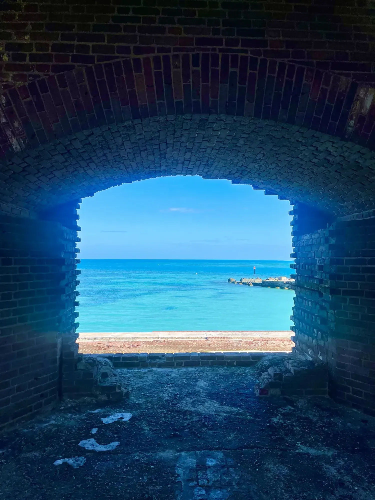
Fort Jefferson walking visit
Choose a fort visit rather than a promised moat circuit. The NPS covers the fort’s history but doesn’t describe a full walking loop, its length, or how much of the moat wall you can walk on now. A map outline around the fort does not demonstrate that the entire perimeter is open. Respect current barriers and confirm which areas can be visited.
Dry Tortugas · Photo: David & Keri New
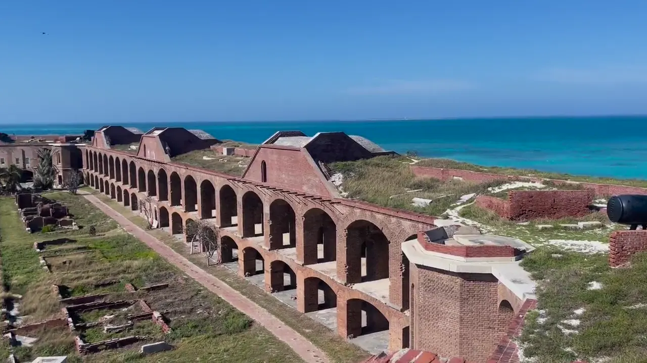
The numbers, with sources
Distance: Not available: the NPS doesn’t describe a set loop. Source
Gain: Unavailable: no measured walking gain. Source
Time: Unavailable: no walking duration. Source
Difficulty: Historic-site visit. No trail survey is available. Source
Trailhead: The NPS doesn’t publish this for the whole route. Consult the official route description and park map for the start. Source
Route type: Walking visit; no fixed circuit Source
Built from official sources (checked Nov 3, 2026). Confirm current conditions with the park.
Recreation.gov permits, entrances & campgrounds
Recreation.gov (RIDB). Booking records date not published. NPS guidance above takes precedence. A listing doesn’t mean you need a permit or that there’s space on your dates.
Park campground options (2)
These records belong to the park’s NPS recreation area. We haven’t checked how close these are to the trail, when they open or whether sites are free; check the map and the booking page.
Garden Key Campground — Campground; RIDB reservable: yes. Season: not published in structured RIDB data. Recreation.gov (RIDB) source · Booking details
NPS reservation guidance: You may reserve a group camp site that holes 10-20 campers. Call 305-242-7700 to reserve. NPS source
Garden Key Campground — Campground; RIDB reservable: no. Season: not published in structured RIDB data. Recreation.gov (RIDB) source
NPS reservation guidance: You may reserve a group camp site that holes 10-20 campers. Call 305-242-7700 to reserve. NPS source
Route, junction by junction
Route selection → Described destination
Choose a fort visit rather than a promised moat circuit. The NPS covers the fort’s history but doesn’t describe a full walking loop, its length, or how much of the moat wall you can walk on now. A map outline around the fort does not demonstrate that the entire perimeter is open. Respect current barriers and confirm which areas can be visited. Source
No elevation profile yet:
No elevation profile yet: we haven’t verified a complete line for this route. No partial line, invented connector, scaled mileage or flat profile is substituted. Source
In-depth guide
Compiled from linked sources, checked Nov 3, 2026. Each paragraph links to its source.
Is this walk for you?
This is a visit to Fort Jefferson, not a set loop. The NPS doesn’t publish a walking circuit, a distance, an elevation gain or a time, and it doesn’t say how much of the moat wall is open. Respect any barriers and ask which areas you can visit. Source
The fort and its harbor
The fort was built to guard one of the most strategic deepwater anchorages in North America. Ships patrolling the Gulf of America and the Straits of Florida used the harbor among the islands and shoals of the Dry Tortugas to resupply, refit or wait out storms. The Tortugas sit on one of the world’s busiest shipping lanes. Passing ships could steer clear of the fort’s biggest guns but not the warships based in its harbor, and in enemy hands the islands could have threatened traffic between the Gulf Coast (New Orleans, Mobile and Pensacola) and the eastern seaboard, or served as a staging area for an attack anywhere along the Gulf Coast. Source
It’s one of the largest forts ever built. Work went on for nearly thirty years (1846-1875) and it was never finished or fully armed. It was the most sophisticated link in a chain of coastal forts from Maine to California, and it was never attacked. Source
In the Civil War, Union warships used the harbor to blockade Southern shipping, and the fort held prisoners, mostly Union deserters. The best known was Dr. Samuel Mudd, who set John Wilkes Booth’s broken leg. The Army left in 1874, and the fort later served as a coaling station. In 1898 the USS Maine left the Tortugas for Havana, Cuba. The fort saw brief use in both world wars. Source
Maps and elevation
The NPS trail map lists a Fort Jefferson Pathway, and we found no matching route on OpenStreetMap. Neither gives a measured walk. Source · Source 2
There’s no elevation profile, and the NPS doesn’t publish leg times, parking or shuttle details, or services for this walk. Source · Source 2
Getting there and back
The NPS doesn’t publish this for the whole route. Consult the official route description and park map for the start. Source
Return: Use the return described in the official route account. Don’t count on a shuttle, boat, flight or pickup unless you have confirmed it yourself. Source
Water
The NPS doesn’t publish a full list of water and restrooms along this route. Use only the facilities explicitly identified in the NPS account; confirm current operations. Source
Hazards
The harbor is central to understanding the fort: it provided ships with resupply and shelter. Use that context when looking at the structure. This page gives history and planning limits. It doesn’t send you onto a closed wall or suggest every level is accessible. Source
Season
This page can’t tell you current access. Check NPS conditions before departure. Source
Check current conditions and seasonal access with the park before you go. Check the park before departure. Source
Gear & rules
Respect current closures, signs and barriers. A mapped path is not proof that travel is permitted. Source
Filling a gap in your kit? Compare these packing essentials on Amazon. Choose gear for your route, conditions and the park’s guidance.
As an Amazon Associate we earn from qualifying purchases. How this works
The NPS doesn’t publish a pet rule for this exact route; confirm with the park before bringing an animal. Source
Questions
Which hike is this?
Choose a fort visit rather than a promised moat circuit. The NPS covers the fort’s history but doesn’t describe a full walking loop, its length, or how much of the moat wall you can walk on now. A map outline around the fort does not demonstrate that the entire perimeter is open. Respect current barriers and confirm which areas can be visited. Not available: the NPS doesn’t describe a set loop. Source
Is a measured elevation profile available?
No elevation profile yet: we haven’t verified a complete line for this route. No partial line, invented connector, scaled mileage or flat profile is substituted. Source
Alternatives
Alternative-route distances and durations are unavailable unless separately described in the source. Side trails aren’t included. Source