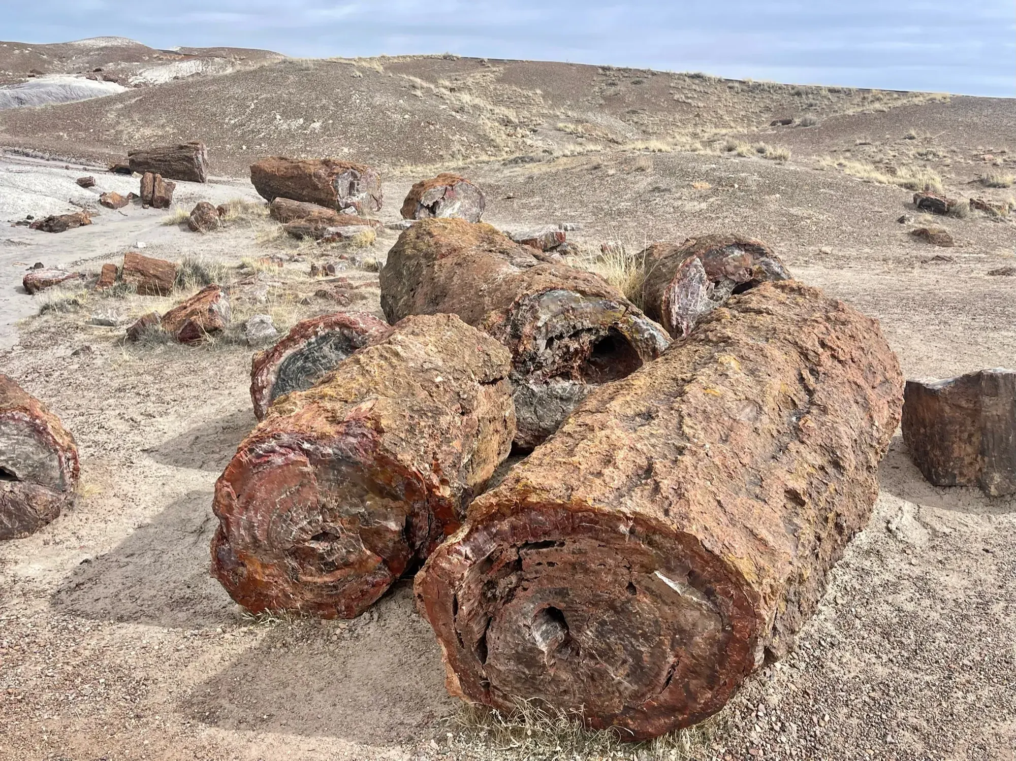
Blue Mesa Trail
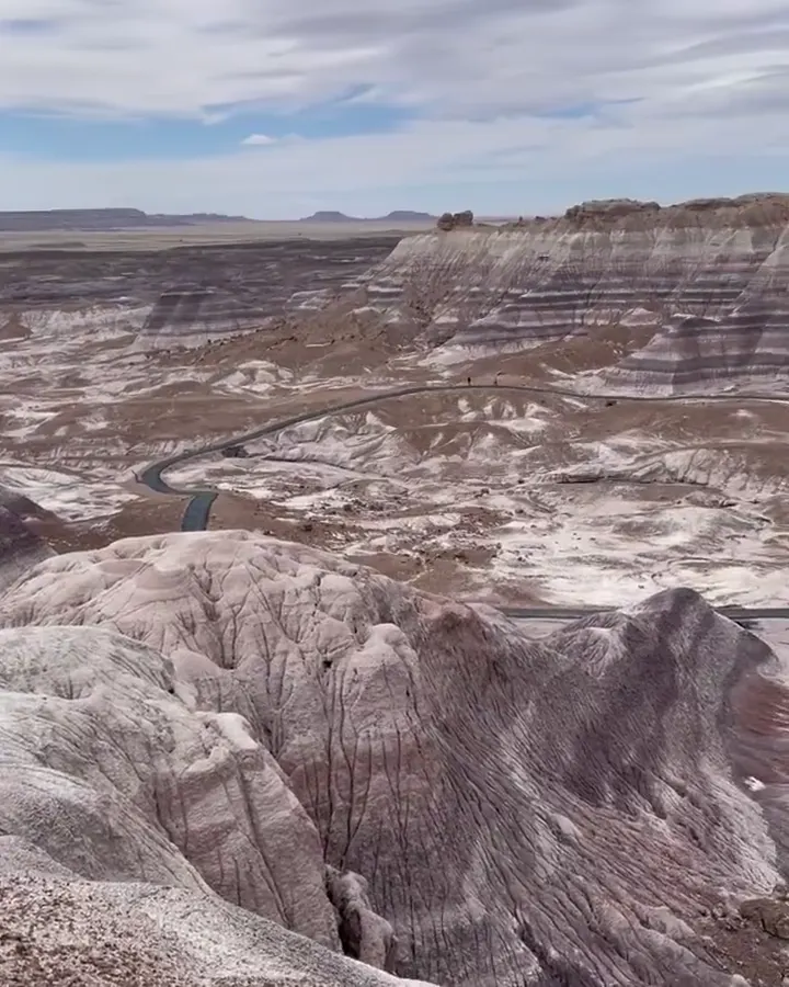
A one-mile paved-and-gravel loop descending steeply among colored bentonite badlands and petrified wood.
Petrified Forest · Photo: David & Keri New
- 1 miDistance
- 30–120 minTime
- EasyDifficulty
The numbers, with sources
Distance: 1-mile loop. Source
Gain: The NPS doesn’t give a number for the climb, but says the first descent is steep. Source
Time: 30–120 minutes, depending on pace and wayside stops. Source
Difficulty: Most of the trail is relatively easy in the duration description, with a short steep section. Source
Trailhead: Halfway around the Blue Mesa Road loop, next to a sun shelter. Source
Route type: loop Source
Built from official sources (checked Nov 3, 2026). Confirm current conditions with the park.
Recreation.gov permits, entrances & campgrounds
Recreation.gov (RIDB). Booking records date not published. NPS guidance above takes precedence. A listing doesn’t mean you need a permit or that there’s space on your dates.
Route, junction by junction
Trailhead → Blue Mesa Trail
Descend from the mesa top and follow the alternately paved-and-gravel loop among the banded badlands. Source
No elevation profile yet:
No elevation profile yet: we haven’t verified complete measurements for this route. Source
In-depth guide
Compiled from linked sources, checked Nov 2, 2026. Each paragraph links to its source.
Is this hike for you?
Blue Mesa is a 1-mile loop that drops steeply from the mesa top into badland hills of bentonite clay banded blue, purple, peach and gray, with petrified wood along the way. Paleontologists have found many plant and animal fossils in the sedimentary layers here. The NPS says most of it is relatively easy, with one short steep section, and allows 30 to 120 minutes depending on your pace and how many wayside exhibits you read. Source
The trail
The surface alternates between pavement and gravel, but hard ground doesn’t mean gentle: the steep grade is near the beginning, so you’ll climb it again at the end. Save energy for the walk back up to the mesa top. Source
Getting to the trailhead
The trailhead is halfway around the Blue Mesa Road loop, next to a sun shelter. The NPS doesn’t say how much parking there is or when it fills. Source
Winter
There can be ice in winter, which matters most on the steep descent. If the footing isn’t secure, pick something else. Source
Kids, strollers and wheelchairs
The NPS says most of the trail isn’t accessible for mobility devices because of the steep grade near the start. Exhibits have good contrast for people with low vision. It doesn’t say anything about strollers or kids’ ages. Source
Dogs
The park’s BARK Ranger rules apply: bag your pet’s poop, keep it on a leash, respect wildlife, and know where you can go. Source
Water and elevation
The NPS mentions the sun shelter but doesn’t list water or restrooms on the loop, so bring what you need. It doesn’t give an elevation gain, and we haven’t checked one, so there’s no elevation profile yet. Source
Sources & planning limits
Reviewed 2026-11-03. Check current conditions for your trip dates.
- The NPS doesn’t give an elevation gain for this loop, and we haven’t worked one out. Source
- We don’t judge whether the trail suits kids or mobility devices beyond what the NPS says; read its accessibility notes before you go. Source
- No elevation profile yet: we haven’t verified a complete line and measurements for this route. Source
Getting there and back
Use the Blue Mesa Trailhead on the Blue Mesa Road loop. Do not substitute a general badlands viewpoint for the trailhead. Source
Return: Complete the loop and climb back to the mesa-top trailhead; the steep access section remains part of the return. Source
Water
The activity identifies a sun shelter near the trailhead but doesn’t confirm water or restroom service on the route. Source
The activity identifies a sun shelter near the trailhead but doesn’t confirm water or restroom service on the route. Source
Hazards
Steep initial grade; winter ice can change footing. Source
Season
NPS says ice can occur in winter. Check actual footing before the steep section. Source
NPS says ice can occur in winter. Check actual footing before the steep section. Source
Gear & rules
BARK Ranger guidance: bag pet waste, keep pets leashed, respect wildlife and know permitted areas. Source
Filling a gap in your kit? Compare these packing essentials on Amazon. Choose gear for your route, conditions and the park’s guidance.
As an Amazon Associate we earn from qualifying purchases. How this works
BARK Ranger guidance: bag pet waste, keep pets leashed, respect wildlife and know permitted areas. Source
Questions
Does a hard surface make this an accessible trail?
No. NPS says most of it is not accessible for mobility devices because of the steep beginning. Source
Is winter ice possible?
Yes. The official season description explicitly says there can be ice in winter. Source