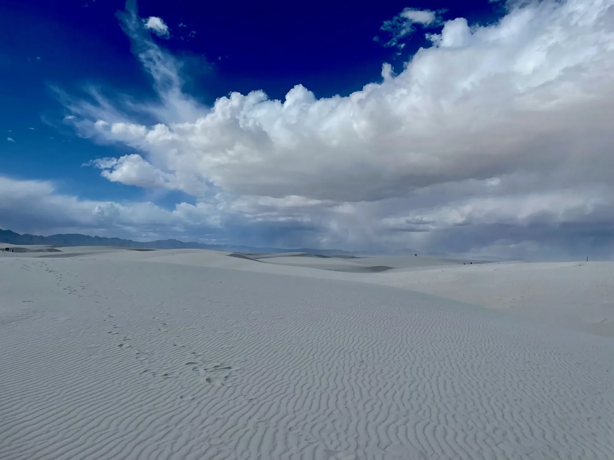
Alkali Flat Trail
Imagine yourself surrounded by the spectacular views of endless dunes with few footprints. The Alkali Flat Trail takes you through the heart of the sands, up and over steep dunes to the edge of Alkali Flat.
White Sands · Photo: David & Keri New
- 5 miDistance
- 60 ftElevation gain
- 3–5 hrTime
- StrenuousDifficulty
The numbers, with sources
Distance: 5 miles round trip; activity describes 2.5 miles outbound and return. Source
Gain: Repeated dunes up to 60 feet high. The NPS doesn’t publish a total climb. Source
Time: 3–5 hours on the NPS activity page, which also says 4 hours on average; the place page says 3 hours on average. Source
Difficulty: Strenuous Source
Trailhead: Trailhead parking lot is at the end of the loop portion of Dunes Drive, 7.4 miles (12 km) from the visitor center. Source
Route type: out-and-back Source
Built from official sources (checked Nov 3, 2026). Confirm current conditions with the park.
Recreation.gov permits, entrances & campgrounds
Recreation.gov (RIDB). Booking records date not published. NPS guidance above takes precedence. A listing doesn’t mean you need a permit or that there’s space on your dates.
Route, junction by junction
Trailhead → Selected destination or loop
Follow red posts bearing a diamond. NPS says to turn around when the next marker cannot be seen, including when wind reduces visibility or a marker is down. Footprints do not replace that rule. The activity and place records also differ on average completion time and the distance from the visitor center; those conflicts remain visible here. Source
No elevation profile yet:
No elevation profile yet: we haven’t verified complete measurements for this route. Source
In-depth guide
Compiled from linked sources, checked Nov 2, 2026. Each paragraph links to its source.
Is this hike for you?
Despite the name, Alkali Flat is not flat. It’s a strenuous 5-mile (8 km) out-and-back across the dunes: 2.5 miles (4 km) to the edge of Alkali Flat, the salty bed of an ancient lake, and back the same way, climbing dunes up to 60 ft (18.3 m) high over and over. The NPS gives 3–5 hours; one NPS page says it averages 4 hours and another says 3. There’s no published elevation gain. Source · Source 2
The trail
Follow the red posts with a diamond on them. If you can’t see the next marker, because of blowing sand or because a marker is knocked down, don’t go on; turn around and go back to the trailhead. Strong winds can cut visibility to a few feet, and it’s easy to get lost. Footprints aren’t a substitute for the markers. Stay on the trail to avoid damaging the delicate biocrust. Source
Getting to the trailhead
The trailhead parking lot is at the end of the loop part of Dunes Drive, 7.4 miles (12 km) from the visitor center. (Another NPS page says 7 miles (11.2 km).) There are two vault toilets at the trailhead. Source
Shade and water
There’s no shade, no water and no toilet on the trail. Bring plenty of water for everyone, including dogs, and good sun protection. Read the park’s Hiking Safety page before you go. Source
Kids, dogs and wheelchairs
The trail isn’t ADA accessible; it goes up and down dunes of loose gypsum sand, and the NPS doesn’t recommend it for small children. The park’s only accessible trail is the Interdune Boardwalk. Dogs are allowed on a leash no longer than 6 feet; clean up after them. Source
Permits and fees
The NPS says this hike doesn’t need a reservation. Check the park’s entrance fee for your date. Source · Source 2
Before you go
The NPS lists this hike for every season. Check current alerts, the forecast (especially wind) and the signs at the trailhead. Agree on a turnaround before you start and turn back early if the group is slower than expected. Source · Source 2
There’s no elevation profile yet: we haven’t verified complete measurements for this route. Source · Source 2
Sources & planning limits
Reviewed 2026-11-03. Check current conditions for your trip dates.
Getting there and back
Trailhead parking lot is at the end of the loop portion of Dunes Drive, 7.4 miles (12 km) from the visitor center. Source
Return: Come back the way described above. Return along the same trail unless a separate transport plan has been confirmed. Source
Water
There is no shade, no water, and no toilet facility along this trail. Length: 5 miles (8 km), round-trip Trail Marker Color: Red Trail Marker Symbol: Diamond Average Completion Time: 3 hours Difficulty: Strenuous Distance from Visitor Center: 7 miles (11.2 km) Restroom: Two vault toilets at the trailhead Before setting out on foot at White Sands National Park, please view the park’s Hiking Safety Tips . Source
Hazards
This trail is not ADA accessible. This hike includes walking up and down sand dunes of up to sixty feet in loose gypsum sand. The park’s only accessible trail is the Interdune Boardwalk . Source
Season
Use current official conditions; activity season labels are not a guarantee of access. Source
Current trail conditions require a trip-date check. Source
Gear & rules
Follow current signs and closures, and treat any side trip as a separate decision. Source
Filling a gap in your kit? Compare these packing essentials on Amazon. Choose gear for your route, conditions and the park’s guidance.
As an Amazon Associate we earn from qualifying purchases. How this works
Pets are allowed on a leash of maximum 6 feet length. Please remember to clean up after your pet. Pets need plenty of water! Learn more about bringing your pet to White Sands National Park Source
Questions
Which route do these figures describe?
5 miles round trip; activity describes 2.5 miles outbound and return. Despite its name, Alkali Flat is a strenuous dune hike. The NPS activity page calls it a five-mile out-and-back: 2.5 miles to the edge of the flat, with repeated climbs over dunes as high as 60 feet. Another NPS place description uses round-trip wording without the same route-shape explanation. Source
Is the trail open right now?
No. NPS details as of Nov 3, 2026. Confirm current conditions and closures with NPS. Source
Is there a measured elevation profile?
No elevation profile yet: we haven’t verified a complete line for this route. Source
Alternatives
The NPS place page says there’s no shade, water or toilet along the trail, though there are vault toilets at the trailhead. That distinction matters before setting out into the dunes. The NPS doesn’t publish a total climb, and you can’t get one by multiplying a sixty-foot dune height. Source
Camp near Alkali Flat Trail
Closest campgrounds by drive time to Alkali Flat Trail Trailhead:
- 1 hr 19 min Deerhead Campground ↗ (43.5 mi, USDA Forest Service)
- 1 hr 21 min Sleepy Grass ↗ (44.3 mi, USDA Forest Service)
Driving time with no traffic (OSRM, OpenStreetMap roads). Some park roads are shuttle-only in season. All camping near White Sands
More White Sands trail guides
- Dune Life Nature Trail1 mi · Moderate